Ivy Creek Campground Campground
Community Reviews
Been here? Share the conditions.
Reviews, ratings & photos are added in the free Snoflo iOS app — rate a spot, tag the conditions, and your visit is verified by location. Add or manage your reviews from the app.
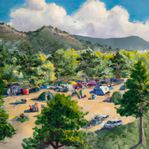
Ivy Creek Campground
Reservations are accepted at Ivy Creek Campground, allowing campers to secure their spot in advance. It is recommended to make reservations, especially during peak seasons, to guarantee availability. The best time to visit this campground is during the summer months, typically from June to August, when the weather is pleasant and favorable for outdoor activities such as hiking, fishing, and wildlife viewing.
While camping at Ivy Creek Campground, visitors should be cautious of the local wildlife, including bears and mountain lions. It is important to store food properly and follow all safety guidelines to avoid encounters with these animals. Moreover, it is advised to be mindful of weather conditions, as Colorado's weather can be unpredictable, with sudden thunderstorms and temperature changes. Being prepared with appropriate clothing and equipment is essential for a safe and enjoyable camping experience at Ivy Creek Campground.
What's on-site at Ivy Creek Campground
Key facilities Snoflo tracks for this campground. Confirm with the operator before booking -- amenities can change seasonally.
Plan your trip down to the hour
Same weather feed Snoflo's iOS app uses -- updated continuously from NOAA / yr.no.
Next 5 days, hour by hour
Temperature line with weather symbols on top, snow + rain accumulation as columns, humidity as a dotted line.
5-day forecast table
Every 3 hours, broken out across temperature, snow, rain, humidity, and wind. Each cell is colour-coded relative to the column min/max so trends jump out at a glance.
| Time | Condition | Temp (°F) | Snow (in) | Rain (in) | Humidity (%) | Wind (mps) | Wind dir |
|---|---|---|---|---|---|---|---|
| Loading detailed forecast… | |||||||
15-day temperature & precipitation
Daily temperatures, snow, and rain projected over the next two weeks. Hover any point for the full breakdown.
Other campgrounds in the area
Snoflo-tracked campsites within driving distance of Ivy Creek Campground, with reservations status.
| Campground | Reservations | Toilets | View |
|---|---|---|---|
| Ivy Creek | ✗ | ✓ | → |
| Rio Grande Campground | ✓ | ✗ | → |
| Rio Grande | ✗ | ✗ | → |
| Marshall Park | ✓ | ✓ | → |
| Marshall Park Campground | ✓ | ✗ | → |
Nearby streamflow
USGS streamgauges within reach of Ivy Creek Campground -- pulled live from the National Water Information System.
| Streamgauge | Discharge | View |
|---|---|---|
| Goose Creek At Wagonwheel Gap | 10 cfs | → |
| Rio Grande At Wagon Wheel Gap | 182 cfs | → |
| Rio Grande At Thirtymile Bridge | 66 cfs | → |
| North Clear Creek Bl Continental Reservoir | 6 cfs | → |
| South Fork Rio Grande At South Fork | 59 cfs | → |
| East Fork San Juan River Nr Pagosa Springs | -888 cfs | → |
Nearby snow depths
NRCS SNOTEL stations within reach of Ivy Creek Campground -- relevant when planning a shoulder-season or alpine trip.
| SNOTEL station | Snowpack | 24h Snowfall | View |
|---|---|---|---|
| Middle Creek | 1.0 in | 1.0 in | → |
| Middle Creek | 0.0 in | 0.0 in | → |
| Creede 0.2 Wsw | 0.0 in | 0.0 in | → |
| Upper Rio Grande | 0.0 in | 0.0 in | → |
| Nohrsc Upper Rio Grande | 0.0 in | 0.0 in | → |
| Upper San Juan | 0.0 in | 0.0 in | → |
Plan a longer trip
The closest parks, lakes, boat launches, and paddle runs so a camping night can grow into a full weekend.
Parks
- Wilderness La Garita
- Wilderness Weminuche
- Wilderness Powderhorn
- Town Park
- Gunnison National Forest
- Wilderness Uncompahgre
Boat launches
- Creede State Wildlife Area
- Road Canyon Reservoir State Wildlife Area
- Brown Lakes State Wildlife Area
- Cr 10 Hinsdale County
- Big Meadows Reservoir State Wildlife Area
- Coller State Wildlife Area
Fishing spots
- Love Lake Picnic Site
- Road Canyon Reservoir Number 1
- Road Canyon Reservoir
- Road Canyon Dam Fishing Site
- Shaw Lake
- Brown Lakes Swa
Points of interest
- Creede Fork
- Creede Underground Mining Museum
- North Clear Creek Falls Observation Site
- San Juan Overlook
- Treasure Falls Observation Site
- Treasure Falls
Paddle runs
- Below Rio Grande Reservoir (Sec 13, T40n, R4w) To Spring Creek (Sec 31, T41n, R2w)
- East Fork--Unnamed Ponds Approx 1/4 Mile Below Continental Divide To Weminuche Wilderness Boundary
- Sec 10, T42n, R1e To Sec 13, T41n, R1e
- Middle Fork--Headwaters To Weminuche Wilderness Boundary
- Headwaters (Sec 21, T38n, R1e) To 1/4 Mile Above Big Meadows Reservoir
- Snowslide Canyon Creek--Headwaters To Confluence With Los Pinos
Camping essentials & Leave No Trace
- Pack it in, pack it out
- Take all trash, food scraps, and gear back with you to keep campsites clean and protect wildlife.
- Respect wildlife
- Observe animals from a distance, store food securely, and never feed wildlife to maintain natural behavior and safety.
- Know before you go
- Check weather, fire restrictions, trail conditions, and permit requirements to ensure a safe and well-planned trip.
- Minimize campfire impact
- Use established fire rings, keep fires small, fully extinguish them, or opt for a camp stove when fires are restricted.
- Leave what you find
- Preserve natural and cultural features by avoiding removal of plants, rocks, artifacts, or other elements of the environment.
Set push alerts in the Snoflo app
Save Ivy Creek Campground as a favorite, set a custom threshold (precipitation, snowpack, freezing temperatures), and the iOS app will push the moment conditions cross.
About Ivy Creek Campground
Can I make reservations at Ivy Creek Campground?
Yes -- this campground accepts reservations. Snoflo recommends booking early for peak season; check the operator (Recreation.gov / state park system / private operator) for the booking window and cancellation policy.
How fresh is the weather data on this page?
The hourly forecast updates throughout the day from the NOAA / yr.no public feeds. Streamflow data is pulled live from USGS streamgauges and snowpack from the NRCS SNOTEL network.
What's the best time of year to visit?
Use the 15-day temperature & precipitation outlook on this page to plan -- pick a window with comfortable temperatures and low precipitation. For longer trips, the 5-day hourly meteogram shows snow + rain accumulation hour-by-hour.
How do I get to Ivy Creek Campground?
Tap Directions in the hero above to open driving directions in Google Maps, or Open in map to center the Snoflo interactive map on the campground.
Can I get alerts when conditions change?
Yes -- alerts are managed through the Snoflo iOS app. Favorite this campground, set a threshold (temperature, snowpack, precipitation), and you'll get a push the moment it crosses.
Other campgrounds near here
Snoflo-tracked campgrounds within driving distance of Ivy Creek Campground.