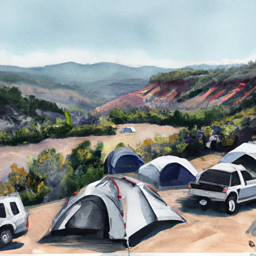
Low Gap Rec Site Campground
Community Reviews
Been here? Share the conditions.
Reviews, ratings & photos are added in the free Snoflo iOS app — rate a spot, tag the conditions, and your visit is verified by location. Add or manage your reviews from the app.
Low Gap Rec Site
Some nearby points of interest include the Colorado River, the Arapaho National Forest, and the Hot Sulphur Springs Resort and Spa. Campground amenities are limited to vault toilets and fire rings, so visitors must bring their own water and supplies.
Interesting facts about the area include its history as a popular camping and hunting spot for Native American tribes and early pioneers. The best time of year to visit is from June to September, with average temperatures ranging from the mid-70s to low 80s during the day and dropping to the low 40s at night.
Overall, the Low Gap Rec Site Campsite offers a unique opportunity to experience the natural beauty of the Colorado headwaters-Plateau watershed and enjoy a peaceful camping experience in a remote and scenic location.
What's on-site at Low Gap Rec Site
Key facilities Snoflo tracks for this campground. Confirm with the operator before booking -- amenities can change seasonally.
Plan your trip down to the hour
Same weather feed Snoflo's iOS app uses -- updated continuously from NOAA / yr.no.
Next 5 days, hour by hour
Temperature line with weather symbols on top, snow + rain accumulation as columns, humidity as a dotted line.
5-day forecast table
Every 3 hours, broken out across temperature, snow, rain, humidity, and wind. Each cell is colour-coded relative to the column min/max so trends jump out at a glance.
| Time | Condition | Temp (°F) | Snow (in) | Rain (in) | Humidity (%) | Wind (mps) | Wind dir |
|---|---|---|---|---|---|---|---|
| Loading detailed forecast… | |||||||
15-day temperature & precipitation
Daily temperatures, snow, and rain projected over the next two weeks. Hover any point for the full breakdown.
Other campgrounds in the area
Snoflo-tracked campsites within driving distance of Low Gap Rec Site, with reservations status.
| Campground | Reservations | Toilets | View |
|---|---|---|---|
| Island Acres - James M. Robb - Colorado River State Park | ✓ | ✗ | → |
| Canyon View Rv Resort | ✗ | ✗ | → |
| Camp Eddy | ✗ | ✗ | → |
| North Fruita Desert Lower Campground H3 | ✗ | ✗ | → |
| North Fruita Desert Lower Campground H4 | ✗ | ✗ | → |
Nearby streamflow
USGS streamgauges within reach of Low Gap Rec Site -- pulled live from the National Water Information System.
| Streamgauge | Discharge | View |
|---|---|---|
| Colorado River Near Cameo | 1,760 cfs | → |
| Colo River Blw Grd Valley Div Nr Palisade Co | 310 cfs | → |
| Plateau Creek Near Cameo | 19 cfs | → |
| Gunnison River Near Grand Junction | 650 cfs | → |
| Big Creek At Upper Station | 3 cfs | → |
| Colorado River Near Colorado-Utah State Line | 1,740 cfs | → |
Nearby snow depths
NRCS SNOTEL stations within reach of Low Gap Rec Site -- relevant when planning a shoulder-season or alpine trip.
| SNOTEL station | Snowpack | 24h Snowfall | View |
|---|---|---|---|
| Grand Junction | 0.0 in | 0.0 in | → |
| Wfo Grand Junction | 0.0 in | 0.0 in | → |
| Grand Junction 4.4 E | 0.0 in | 0.0 in | → |
| Grand Junction 1.0 E | 0.0 in | 0.0 in | → |
| East Junction Ham | 0.0 in | 0.0 in | → |
| Grand Junction 4.0 W | 0.0 in | 0.0 in | → |
Plan a longer trip
The closest parks, lakes, boat launches, and paddle runs so a camping night can grow into a full weekend.
Parks
- Peach Valley Park
- Columbine Park
- James M Robb Colorado River State Park
- Colorado National Monument
- Highline Lake State Park
- Grand Mesa National Forest
Boat launches
- Corn Lake Boat Ramp
- Eagle Rim Trail Grand Junction
- James M. Robb - Colorado River State Park
- Redlands Dam River Access
- Mesa County
Fishing spots
- Lewis Wash
- Corn Lake
- West Lake (Gj)
- Connected Lakes
- Fruita Reservoir Number 2
- Jerry Creek Reservoirs
Camping essentials & Leave No Trace
- Pack it in, pack it out
- Take all trash, food scraps, and gear back with you to keep campsites clean and protect wildlife.
- Respect wildlife
- Observe animals from a distance, store food securely, and never feed wildlife to maintain natural behavior and safety.
- Know before you go
- Check weather, fire restrictions, trail conditions, and permit requirements to ensure a safe and well-planned trip.
- Minimize campfire impact
- Use established fire rings, keep fires small, fully extinguish them, or opt for a camp stove when fires are restricted.
- Leave what you find
- Preserve natural and cultural features by avoiding removal of plants, rocks, artifacts, or other elements of the environment.
Set push alerts in the Snoflo app
Save Low Gap Rec Site as a favorite, set a custom threshold (precipitation, snowpack, freezing temperatures), and the iOS app will push the moment conditions cross.
About Low Gap Rec Site
Can I make reservations at Low Gap Rec Site?
This campground does not appear to accept reservations -- it's typically first-come, first-served. Arrive early on summer weekends.
How fresh is the weather data on this page?
The hourly forecast updates throughout the day from the NOAA / yr.no public feeds. Streamflow data is pulled live from USGS streamgauges and snowpack from the NRCS SNOTEL network.
What's the best time of year to visit?
Use the 15-day temperature & precipitation outlook on this page to plan -- pick a window with comfortable temperatures and low precipitation. For longer trips, the 5-day hourly meteogram shows snow + rain accumulation hour-by-hour.
How do I get to Low Gap Rec Site?
Tap Directions in the hero above to open driving directions in Google Maps, or Open in map to center the Snoflo interactive map on the campground.
Can I get alerts when conditions change?
Yes -- alerts are managed through the Snoflo iOS app. Favorite this campground, set a threshold (temperature, snowpack, precipitation), and you'll get a push the moment it crosses.
Other campgrounds near here
Snoflo-tracked campgrounds within driving distance of Low Gap Rec Site.