Olive Ridge Campground
Community Reviews
Been here? Share the conditions.
Reviews, ratings & photos are added in the free Snoflo iOS app — rate a spot, tag the conditions, and your visit is verified by location. Add or manage your reviews from the app.
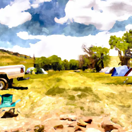
Olive Ridge
Reservations are accepted at this campground, providing campers with the convenience of securing a spot in advance. However, it is essential to note that availability may vary, especially during peak seasons. Therefore, it is advisable to make reservations as early as possible to ensure a spot at this popular camping destination.
The best time of year to visit Olive Ridge camping area is during the summer months, from June to August, when the weather is generally pleasant with mild temperatures. This allows visitors to fully enjoy the outdoor activities and explore the nearby hiking trails. However, it is important to be prepared for sudden weather changes, as the area is known for afternoon thunderstorms during this time of year.
While camping at Olive Ridge, campers should be cautious of potential wildlife encounters, as the area is home to various species. It is recommended to store food and dispose of waste properly to avoid attracting animals. Additionally, respecting the natural surroundings and following Leave No Trace principles is crucial to preserve the beauty of this camping area for future visitors.
What's on-site at Olive Ridge
Key facilities Snoflo tracks for this campground. Confirm with the operator before booking -- amenities can change seasonally.
Plan your trip down to the hour
Same weather feed Snoflo's iOS app uses -- updated continuously from NOAA / yr.no.
Next 5 days, hour by hour
Temperature line with weather symbols on top, snow + rain accumulation as columns, humidity as a dotted line.
5-day forecast table
Every 3 hours, broken out across temperature, snow, rain, humidity, and wind. Each cell is colour-coded relative to the column min/max so trends jump out at a glance.
| Time | Condition | Temp (°F) | Snow (in) | Rain (in) | Humidity (%) | Wind (mps) | Wind dir |
|---|---|---|---|---|---|---|---|
| Loading detailed forecast… | |||||||
15-day temperature & precipitation
Daily temperatures, snow, and rain projected over the next two weeks. Hover any point for the full breakdown.
Other campgrounds in the area
Snoflo-tracked campsites within driving distance of Olive Ridge, with reservations status.
| Campground | Reservations | Toilets | View |
|---|---|---|---|
| Olive Ridge Campground | ✗ | ✗ | → |
| Meadow Mountain Ranch | ✗ | ✗ | → |
| Hole In The Wall | ✗ | ✗ | → |
| Allenspark Dispersed Camping | ✗ | ✗ | → |
| Campers Creek | ✗ | ✗ | → |
Nearby streamflow
USGS streamgauges within reach of Olive Ridge -- pulled live from the National Water Information System.
| Streamgauge | Discharge | View |
|---|---|---|
| South St. Vrain Creek Near Ward | 17 cfs | → |
| Left Hand Creek Near Boulder | 16 cfs | → |
| St. Vrain Creek At Lyons | 61 cfs | → |
| Grand Lake Outlet Blw Chipmunk Ln At Grand Lk | 193 cfs | → |
| Colorado River Bl Shadow Mountain Reservoir | 51 cfs | → |
| Fourmile Creek At Orodell | 0 cfs | → |
Nearby snow depths
NRCS SNOTEL stations within reach of Olive Ridge -- relevant when planning a shoulder-season or alpine trip.
| SNOTEL station | Snowpack | 24h Snowfall | View |
|---|---|---|---|
| Allens Park 1.5 Ese | 0.0 in | 0.0 in | → |
| Copeland Lake | 0.0 in | 0.0 in | → |
| Nohrsc Copeland Lake | 0.0 in | 0.0 in | → |
| Wild Basin | 0.0 in | 0.0 in | → |
| Nohrsc Wild Basin | 0.0 in | 0.0 in | → |
| Sawtooth | 0.0 in | -1.0 in | → |
Plan a longer trip
The closest parks, lakes, boat launches, and paddle runs so a camping night can grow into a full weekend.
Parks
- Rocky Mountain National Park
- Protection Area (National) Bowen Gulch Protection Area (National)
- Comanche Peak Wilderness
- North Boulder Community Park
- Wonderland Lake Park
- North Central Boulder Park
Boat launches
- Boat Launch Grand Lake
- Hilltop Boating Site
- Grand County
- Lagerman Trail Boulder County
- Cr 6 Grand County
- Us 34 Grand County
Fishing spots
- Copeland Lake - Rmnp
- Sandbeach Lake - Rmnp
- Peacock Pool - Rmnp
- Ouzel Lake - Rmnp
- Pear Lake & Creek - Rmnp
- Pony Lake - Ipwa
Points of interest
Paddle runs
- Begins 0.5 Miles Upstream From End Of County Hwy 115 To Eastern Boundary Of Rocky Mountain National Park
- Nsv
- Headwaters To Ends 0.5 Miles Upstream From End Of County Hwy 115
- Ssv - Confluence To Picnic Grounds
- Begins 0.5 Miles Upstream From End Of Fern Lake Road To Eastern Boundary Of Rocky Mountain National Park
- Black Bear Hole & A-Hole
Camping essentials & Leave No Trace
- Pack it in, pack it out
- Take all trash, food scraps, and gear back with you to keep campsites clean and protect wildlife.
- Respect wildlife
- Observe animals from a distance, store food securely, and never feed wildlife to maintain natural behavior and safety.
- Know before you go
- Check weather, fire restrictions, trail conditions, and permit requirements to ensure a safe and well-planned trip.
- Minimize campfire impact
- Use established fire rings, keep fires small, fully extinguish them, or opt for a camp stove when fires are restricted.
- Leave what you find
- Preserve natural and cultural features by avoiding removal of plants, rocks, artifacts, or other elements of the environment.
Set push alerts in the Snoflo app
Save Olive Ridge as a favorite, set a custom threshold (precipitation, snowpack, freezing temperatures), and the iOS app will push the moment conditions cross.
About Olive Ridge
Can I make reservations at Olive Ridge?
Yes -- this campground accepts reservations. Snoflo recommends booking early for peak season; check the operator (Recreation.gov / state park system / private operator) for the booking window and cancellation policy.
How fresh is the weather data on this page?
The hourly forecast updates throughout the day from the NOAA / yr.no public feeds. Streamflow data is pulled live from USGS streamgauges and snowpack from the NRCS SNOTEL network.
What's the best time of year to visit?
Use the 15-day temperature & precipitation outlook on this page to plan -- pick a window with comfortable temperatures and low precipitation. For longer trips, the 5-day hourly meteogram shows snow + rain accumulation hour-by-hour.
How do I get to Olive Ridge?
Tap Directions in the hero above to open driving directions in Google Maps, or Open in map to center the Snoflo interactive map on the campground.
Can I get alerts when conditions change?
Yes -- alerts are managed through the Snoflo iOS app. Favorite this campground, set a threshold (temperature, snowpack, precipitation), and you'll get a push the moment it crosses.
Other campgrounds near here
Snoflo-tracked campgrounds within driving distance of Olive Ridge.