Wolf Creek Campground
Community Reviews
Been here? Share the conditions.
Reviews, ratings & photos are added in the free Snoflo iOS app — rate a spot, tag the conditions, and your visit is verified by location. Add or manage your reviews from the app.
Wolf Creek
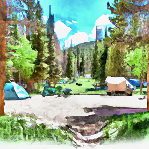
Reservations are accepted at Wolf Creek camping area, allowing campers to secure their spot in advance. This is particularly convenient during peak seasons when the campground can get crowded. It is advisable to make reservations early, especially if planning a visit during the weekends or summer months.
The best time to visit Wolf Creek camping area is during the summer months when the weather is warmer, making it ideal for outdoor activities such as hiking, fishing, and exploring the surrounding nature. However, it's important to note that the campground is located at a higher elevation, so visitors should be prepared for cooler temperatures, even during the summer. Furthermore, it is advisable to carry bug repellent as mosquitoes and other insects can be prevalent in the area.
In summary, Wolf Creek camping area in Colorado offers a range of amenities including restrooms, showers, picnic tables, fire pits, and a playground. Reservations are accepted, and it is recommended to make them in advance, especially during peak seasons. The best time to visit is during the summer months, but visitors should be prepared for cooler temperatures and bring bug repellent.
What's on-site at Wolf Creek
Key facilities Snoflo tracks for this campground. Confirm with the operator before booking -- amenities can change seasonally.
Plan your trip down to the hour
Same weather feed Snoflo's iOS app uses -- updated continuously from NOAA / yr.no.
Next 5 days, hour by hour
Temperature line with weather symbols on top, snow + rain accumulation as columns, humidity as a dotted line.
5-day forecast table
Every 3 hours, broken out across temperature, snow, rain, humidity, and wind. Each cell is colour-coded relative to the column min/max so trends jump out at a glance.
| Time | Condition | Temp (°F) | Snow (in) | Rain (in) | Humidity (%) | Wind (mps) | Wind dir |
|---|---|---|---|---|---|---|---|
| Loading detailed forecast… | |||||||
15-day temperature & precipitation
Daily temperatures, snow, and rain projected over the next two weeks. Hover any point for the full breakdown.
Other campgrounds in the area
Snoflo-tracked campsites within driving distance of Wolf Creek, with reservations status.
| Campground | Reservations | Toilets | View |
|---|---|---|---|
| West Fork | ✗ | ✓ | → |
| West Fork Campground | ✗ | ✗ | → |
| East Fork | ✗ | ✓ | → |
| Tucker Ponds | ✗ | ✓ | → |
| Tucker Ponds Campground | ✓ | ✗ | → |
Nearby streamflow
USGS streamgauges within reach of Wolf Creek -- pulled live from the National Water Information System.
| Streamgauge | Discharge | View |
|---|---|---|
| East Fork San Juan River Nr Pagosa Springs | -888 cfs | → |
| San Juan River At Pagosa Springs | 31 cfs | → |
| Wightman Fork Bel Cropsy Creek At Summitville | 1 cfs | → |
| Rio Blanco Bl Blanco Div Dam | 25 cfs | → |
| Conejos River Below Platoro Reservoir | 19 cfs | → |
| South Fork Rio Grande At South Fork | 59 cfs | → |
Nearby snow depths
NRCS SNOTEL stations within reach of Wolf Creek -- relevant when planning a shoulder-season or alpine trip.
| SNOTEL station | Snowpack | 24h Snowfall | View |
|---|---|---|---|
| Upper San Juan | 0.0 in | 0.0 in | → |
| Upper San Juan | 0.0 in | 0.0 in | → |
| Wolf Creek Snotel | 0.0 in | 0.0 in | → |
| Wolf Creek Summit | 1.0 in | 1.0 in | → |
| Pagosa Springs 9.1 Nnw | 0.0 in | 0.0 in | → |
| Nohrsc Pagosa Springs 4.7 E | 0.0 in | 0.0 in | → |
Plan a longer trip
The closest parks, lakes, boat launches, and paddle runs so a camping night can grow into a full weekend.
Parks
- Wilderness Weminuche
- Town Park
- Wilderness La Garita
- San Juan National Forest
- Wilderness South San Juan
Boat launches
- Alberta Park Reservoir State Wildlife Area
- Alberta Lake Fishing Site
- Big Meadows Reservoir State Wildlife Area
- Beaver Creek Reservoir State Wildlife Area
- Echo Canyon Reservoir State Wildlife Area
- Williams Creek Reservoir State Wildlife Area
Fishing spots
- Alberta Park Reservoir
- Tucker Ponds Fishing Site
- Big Meadows Reservoir
- Pass Creek Lake Fishing Site
- Shaw Lake
- Poage Lake Fishing Site
Points of interest
- Treasure Falls Observation Site
- San Juan Overlook
- Treasure Falls
- Pagosa Springs History Museum
- Mix Lake Observation
- Creede Fork
Paddle runs
- Headwaters (Sec 21, T38n, R1e) To 1/4 Mile Above Big Meadows Reservoir
- East Fork--Unnamed Ponds Approx 1/4 Mile Below Continental Divide To Weminuche Wilderness Boundary
- Middle Fork--Headwaters To Weminuche Wilderness Boundary
- Ef/Middle Fork At Weminuche Wilderness Boundary To Forest Development Road 631
- El Rito Azul--Blue Lake (Sec 26, T35n, R3e) And Portion Of Conejos Above Platoro Reservoir To Upper Reach Of Platoro Reservoir--Sec 6, T35n, R4e
- North Fork--Sec 8, T35n, R2e To Confluence With Middle Fork
Camping essentials & Leave No Trace
- Pack it in, pack it out
- Take all trash, food scraps, and gear back with you to keep campsites clean and protect wildlife.
- Respect wildlife
- Observe animals from a distance, store food securely, and never feed wildlife to maintain natural behavior and safety.
- Know before you go
- Check weather, fire restrictions, trail conditions, and permit requirements to ensure a safe and well-planned trip.
- Minimize campfire impact
- Use established fire rings, keep fires small, fully extinguish them, or opt for a camp stove when fires are restricted.
- Leave what you find
- Preserve natural and cultural features by avoiding removal of plants, rocks, artifacts, or other elements of the environment.
Set push alerts in the Snoflo app
Save Wolf Creek as a favorite, set a custom threshold (precipitation, snowpack, freezing temperatures), and the iOS app will push the moment conditions cross.
About Wolf Creek
Can I make reservations at Wolf Creek?
This campground does not appear to accept reservations -- it's typically first-come, first-served. Arrive early on summer weekends.
How fresh is the weather data on this page?
The hourly forecast updates throughout the day from the NOAA / yr.no public feeds. Streamflow data is pulled live from USGS streamgauges and snowpack from the NRCS SNOTEL network.
What's the best time of year to visit?
Use the 15-day temperature & precipitation outlook on this page to plan -- pick a window with comfortable temperatures and low precipitation. For longer trips, the 5-day hourly meteogram shows snow + rain accumulation hour-by-hour.
How do I get to Wolf Creek?
Tap Directions in the hero above to open driving directions in Google Maps, or Open in map to center the Snoflo interactive map on the campground.
Can I get alerts when conditions change?
Yes -- alerts are managed through the Snoflo iOS app. Favorite this campground, set a threshold (temperature, snowpack, precipitation), and you'll get a push the moment it crosses.
Other campgrounds near here
Snoflo-tracked campgrounds within driving distance of Wolf Creek.