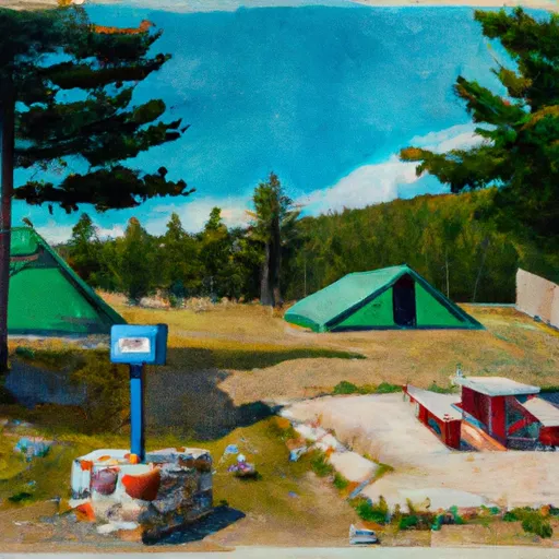
Fairview Ranger Station Campground
Community Reviews
Been here? Share the conditions.
Reviews, ratings & photos are added in the free Snoflo iOS app — rate a spot, tag the conditions, and your visit is verified by location. Add or manage your reviews from the app.
Fairview Ranger Station
What's on-site at Fairview Ranger Station
Key facilities Snoflo tracks for this campground. Confirm with the operator before booking -- amenities can change seasonally.
Plan your trip down to the hour
Same weather feed Snoflo's iOS app uses -- updated continuously from NOAA / yr.no.
Next 5 days, hour by hour
Temperature line with weather symbols on top, snow + rain accumulation as columns, humidity as a dotted line.
5-day forecast table
Every 3 hours, broken out across temperature, snow, rain, humidity, and wind. Each cell is colour-coded relative to the column min/max so trends jump out at a glance.
| Time | Condition | Temp (°F) | Snow (in) | Rain (in) | Humidity (%) | Wind (mps) | Wind dir |
|---|---|---|---|---|---|---|---|
| Loading detailed forecast… | |||||||
15-day temperature & precipitation
Daily temperatures, snow, and rain projected over the next two weeks. Hover any point for the full breakdown.
Other campgrounds in the area
Snoflo-tracked campsites within driving distance of Fairview Ranger Station, with reservations status.
| Campground | Reservations | Toilets | View |
|---|---|---|---|
| Island Lake Fas | ✗ | ✗ | → |
| Sylvia Lake Campground | ✗ | ✗ | → |
| Dunn Creek Flats | ✗ | ✗ | → |
| Blackwell Flats Campground | ✗ | ✓ | → |
| Blackwell Flats | ✗ | ✗ | → |
Nearby streamflow
USGS streamgauges within reach of Fairview Ranger Station -- pulled live from the National Water Information System.
| Streamgauge | Discharge | View |
|---|---|---|
| Fisher River Near Libby Mt | 94 cfs | → |
| Kootenai River Bl Libby Dam Nr Libby Mt | 9,070 cfs | → |
| Tobacco River Near Eureka Mt | 388 cfs | → |
| Flathead River At Columbia Falls Mt | 7,430 cfs | → |
| Mill Cr Ab Bassoo Cr Nr Niarada Mt | 2 cfs | → |
| N F Flathead River Nr Columbia Falls Mt | 2,020 cfs | → |
Nearby snow depths
NRCS SNOTEL stations within reach of Fairview Ranger Station -- relevant when planning a shoulder-season or alpine trip.
| SNOTEL station | Snowpack | 24h Snowfall | View |
|---|---|---|---|
| Hand Creek | 0.0 in | 0.0 in | → |
| Hand Creek | 0.0 in | 0.0 in | → |
| Nohrsc Banfield Mountain | 0.0 in | 0.0 in | → |
| Banfield Mountain | 0.0 in | 0.0 in | → |
| Libby | 0.0 in | 0.0 in | → |
| Marion 1.1 Se | 0.0 in | 0.0 in | → |
Plan a longer trip
The closest parks, lakes, boat launches, and paddle runs so a camping night can grow into a full weekend.
Parks
- Lost Trail National Wildlife Refuge
- Logan State Park
- Whitefish Lake State Park
- Les Mason State Park
- Depot Park Whitefish
- Lone Pine State Park
Boat launches
- Dunn Creek
- Lincoln County
- National Forest Development Road 333 Lincoln County
- Osprey Landing
- Little Bitterroot Lake-Northwest
- Bitterroot Lions Youth Camp
Fishing spots
Paddle runs
- Junction Of The Fisher River (Three Miles Sownstream Of Libby Dam) To Tub Gulch, Approximately Four Miles Upstream From The Town Of Libby, Montana
- 10 Miles From Tub Gulch To Quartz Creek To 10 Miles From Tub Gulch To Quartz Creek
- Big Creek Bridge Adjacent To Lake Koocanusa, Sec. 33, T35n, R29w To North And South Fork Of Big Creek
- Little North Fork And Big Creek, Sec. 32, T35n, R29w To Upstream 2 Miles
- Lookout Creek And South Fork, Sec. 21, T34n, R30w To Upstream For 6 Miles
- From The Junction Of Hennesey Creek Downstream For Nine Miles To The Confluence With The Kootenai River To
Camping essentials & Leave No Trace
- Pack it in, pack it out
- Take all trash, food scraps, and gear back with you to keep campsites clean and protect wildlife.
- Respect wildlife
- Observe animals from a distance, store food securely, and never feed wildlife to maintain natural behavior and safety.
- Know before you go
- Check weather, fire restrictions, trail conditions, and permit requirements to ensure a safe and well-planned trip.
- Minimize campfire impact
- Use established fire rings, keep fires small, fully extinguish them, or opt for a camp stove when fires are restricted.
- Leave what you find
- Preserve natural and cultural features by avoiding removal of plants, rocks, artifacts, or other elements of the environment.
Set push alerts in the Snoflo app
Save Fairview Ranger Station as a favorite, set a custom threshold (precipitation, snowpack, freezing temperatures), and the iOS app will push the moment conditions cross.
About Fairview Ranger Station
Can I make reservations at Fairview Ranger Station?
Yes -- this campground accepts reservations. Snoflo recommends booking early for peak season; check the operator (Recreation.gov / state park system / private operator) for the booking window and cancellation policy.
How fresh is the weather data on this page?
The hourly forecast updates throughout the day from the NOAA / yr.no public feeds. Streamflow data is pulled live from USGS streamgauges and snowpack from the NRCS SNOTEL network.
What's the best time of year to visit?
Use the 15-day temperature & precipitation outlook on this page to plan -- pick a window with comfortable temperatures and low precipitation. For longer trips, the 5-day hourly meteogram shows snow + rain accumulation hour-by-hour.
How do I get to Fairview Ranger Station?
Tap Directions in the hero above to open driving directions in Google Maps, or Open in map to center the Snoflo interactive map on the campground.
Can I get alerts when conditions change?
Yes -- alerts are managed through the Snoflo iOS app. Favorite this campground, set a threshold (temperature, snowpack, precipitation), and you'll get a push the moment it crosses.
Other campgrounds near here
Snoflo-tracked campgrounds within driving distance of Fairview Ranger Station.