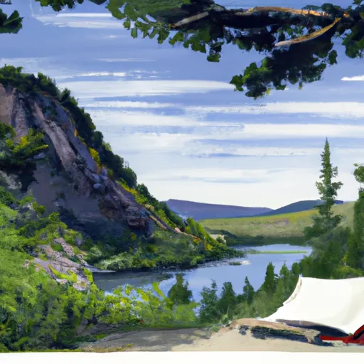
High Lake Outlet Campground
Community Reviews
Been here? Share the conditions.
Reviews, ratings & photos are added in the free Snoflo iOS app — rate a spot, tag the conditions, and your visit is verified by location. Add or manage your reviews from the app.
High Lake Outlet
Reservations are not accepted at High Lake Outlet camping area, and campsites are available on a first-come, first-served basis. It is advised to arrive early in the day, especially during peak camping seasons, to secure a spot. The best time to visit this camping area is during the summer months when the weather is generally pleasant and the lake is ideal for swimming and fishing.
This camping area is surrounded by breathtaking natural beauty, offering opportunities for hiking, wildlife viewing, and photography. Campers should be cautious of bears in the area and take appropriate precautions, such as storing food in bear-resistant containers and adhering to proper food storage guidelines. Additionally, it is recommended to bring bug spray, as mosquitoes and other insects can be prevalent in the area. Overall, High Lake Outlet camping area provides a serene and scenic setting for nature enthusiasts to enjoy the great outdoors in Montana.
What's on-site at High Lake Outlet
Key facilities Snoflo tracks for this campground. Confirm with the operator before booking -- amenities can change seasonally.
Plan your trip down to the hour
Same weather feed Snoflo's iOS app uses -- updated continuously from NOAA / yr.no.
Next 5 days, hour by hour
Temperature line with weather symbols on top, snow + rain accumulation as columns, humidity as a dotted line.
5-day forecast table
Every 3 hours, broken out across temperature, snow, rain, humidity, and wind. Each cell is colour-coded relative to the column min/max so trends jump out at a glance.
| Time | Condition | Temp (°F) | Snow (in) | Rain (in) | Humidity (%) | Wind (mps) | Wind dir |
|---|---|---|---|---|---|---|---|
| Loading detailed forecast… | |||||||
15-day temperature & precipitation
Daily temperatures, snow, and rain projected over the next two weeks. Hover any point for the full breakdown.
Nearby streamflow
USGS streamgauges within reach of High Lake Outlet -- pulled live from the National Water Information System.
| Streamgauge | Discharge | View |
|---|---|---|
| Yellowstone River At Corwin Springs Mt | 3,760 cfs | → |
| Gardner River Near Mammoth Ynp | 181 cfs | → |
| Boiling River At Mammoth | 22 cfs | → |
| Tantalus Creek At Norris Junction | 3 cfs | → |
| Madison River Bl Hebgen Lake Nr Grayling Mt | 1,200 cfs | → |
| Lamar River Nr Tower Falls Ranger Station Ynp | 498 cfs | → |
Nearby snow depths
NRCS SNOTEL stations within reach of High Lake Outlet -- relevant when planning a shoulder-season or alpine trip.
| SNOTEL station | Snowpack | 24h Snowfall | View |
|---|---|---|---|
| Carrot Basin | 0.0 in | 0.0 in | → |
| Carrot Basin | 0.0 in | 0.0 in | → |
| Beaver Creek | 0.0 in | 0.0 in | → |
| Nohrsc Beaver Creek | 0.0 in | 0.0 in | → |
| Nohrsc Shower Falls | 0.0 in | 0.0 in | → |
| Shower Falls | 0.0 in | 0.0 in | → |
Plan a longer trip
The closest parks, lakes, boat launches, and paddle runs so a camping night can grow into a full weekend.
Boat launches
- Brogan's Landing
- Carbella Boat Ramp
- Old Yellowstone Trail Park County
- Dailey Lake
- Daily Lake Road Park County
Fishing spots
- Dailey Lake
- Cottonwood Creek
- Axolotl Lake
- Blue Paradise Lake
- Blue Danube Lake
- East Fork Hyalite Creek
Points of interest
- Yellowstone Hot Springs
- Yellowstone Gateway Garden
- North Entrance Webcam
- Electric Peak Webcam
- Mammoth Hot Springs Terraces
- Officer's Row Webcam
Paddle runs
- The Headwaters, In The Gallatin Range To Ends Downstream Of Osprey Falls
- Yankee Jim Canyon (Joe Brown To Miner)
- Gallatin Forest Boundary, Sec. 32, T7s, R7e To Yellowstone National Park, Sec. 23, T9s, R8e
- Begins Where The River Parallels A Two-Lane Highway To The Western Boundary Of Yellowstone National Park
- Gallatin Canyon, Sec. 19, T4s, R4e To Yellowstone National Park, Sec. 27, T9s, R5e
- Gardiner Town Run
Camping essentials & Leave No Trace
- Pack it in, pack it out
- Take all trash, food scraps, and gear back with you to keep campsites clean and protect wildlife.
- Respect wildlife
- Observe animals from a distance, store food securely, and never feed wildlife to maintain natural behavior and safety.
- Know before you go
- Check weather, fire restrictions, trail conditions, and permit requirements to ensure a safe and well-planned trip.
- Minimize campfire impact
- Use established fire rings, keep fires small, fully extinguish them, or opt for a camp stove when fires are restricted.
- Leave what you find
- Preserve natural and cultural features by avoiding removal of plants, rocks, artifacts, or other elements of the environment.
Set push alerts in the Snoflo app
Save High Lake Outlet as a favorite, set a custom threshold (precipitation, snowpack, freezing temperatures), and the iOS app will push the moment conditions cross.
About High Lake Outlet
Can I make reservations at High Lake Outlet?
Yes -- this campground accepts reservations. Snoflo recommends booking early for peak season; check the operator (Recreation.gov / state park system / private operator) for the booking window and cancellation policy.
How fresh is the weather data on this page?
The hourly forecast updates throughout the day from the NOAA / yr.no public feeds. Streamflow data is pulled live from USGS streamgauges and snowpack from the NRCS SNOTEL network.
What's the best time of year to visit?
Use the 15-day temperature & precipitation outlook on this page to plan -- pick a window with comfortable temperatures and low precipitation. For longer trips, the 5-day hourly meteogram shows snow + rain accumulation hour-by-hour.
How do I get to High Lake Outlet?
Tap Directions in the hero above to open driving directions in Google Maps, or Open in map to center the Snoflo interactive map on the campground.
Can I get alerts when conditions change?
Yes -- alerts are managed through the Snoflo iOS app. Favorite this campground, set a threshold (temperature, snowpack, precipitation), and you'll get a push the moment it crosses.
Other campgrounds near here
Snoflo-tracked campgrounds within driving distance of High Lake Outlet.