Lolo Creek Campground And Picnic Area campground
Community Reviews
Been here? Share the conditions.
Reviews, ratings & photos are added in the free Snoflo iOS app — rate a spot, tag the conditions, and your visit is verified by location. Add or manage your reviews from the app.
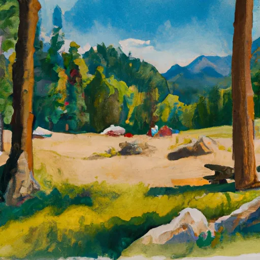
Lolo Creek Campground And Picnic Area
What's on-site at Lolo Creek Campground And Picnic Area
Key facilities Snoflo tracks for this campground. Confirm with the operator before booking -- amenities can change seasonally.
Plan your trip down to the hour
Same weather feed Snoflo's iOS app uses -- updated continuously from NOAA / yr.no.
Next 5 days, hour by hour
Temperature line with weather symbols on top, snow + rain accumulation as columns, humidity as a dotted line.
5-day forecast table
Every 3 hours, broken out across temperature, snow, rain, humidity, and wind. Each cell is colour-coded relative to the column min/max so trends jump out at a glance.
| Time | Condition | Temp (°F) | Snow (in) | Rain (in) | Humidity (%) | Wind (mps) | Wind dir |
|---|---|---|---|---|---|---|---|
| Loading detailed forecast… | |||||||
15-day temperature & precipitation
Daily temperatures, snow, and rain projected over the next two weeks. Hover any point for the full breakdown.
Other campgrounds in the area
Snoflo-tracked campsites within driving distance of Lolo Creek Campground And Picnic Area, with reservations status.
| Campground | Reservations | Toilets | View |
|---|---|---|---|
| Lolo Creek | ✗ | ✓ | → |
| Lewis And Clark | ✗ | ✗ | → |
| Earl Tennant | ✗ | ✓ | → |
| West Fork Butte Lookout | ✗ | ✗ | → |
| Lee Creek | ✗ | ✓ | → |
Nearby streamflow
USGS streamgauges within reach of Lolo Creek Campground And Picnic Area -- pulled live from the National Water Information System.
| Streamgauge | Discharge | View |
|---|---|---|
| Clark Fork Below Missoula Mt | 4,230 cfs | → |
| Bitterroot River Near Missoula Mt | 1,690 cfs | → |
| Clark Fork Above Missoula Mt | 2,570 cfs | → |
| Bitterroot River At Bell Crossing Nr Victor Mt | 814 cfs | → |
| Clark Fork At Turah Bridge Nr Bonner Mt | 1,180 cfs | → |
| Blackfoot River Near Bonner Mt | 1,380 cfs | → |
Nearby snow depths
NRCS SNOTEL stations within reach of Lolo Creek Campground And Picnic Area -- relevant when planning a shoulder-season or alpine trip.
| SNOTEL station | Snowpack | 24h Snowfall | View |
|---|---|---|---|
| Lolo Pass | 0.0 in | 0.0 in | → |
| Nohrsc Lolo Pass | 0.0 in | 0.0 in | → |
| Missoula 4.4 W | 0.0 in | 0.0 in | → |
| Alberton | 0.0 in | 0.0 in | → |
| Missoula | 0.0 in | 0.0 in | → |
| Missoula 6 Nw Wfo | 0.0 in | 0.0 in | → |
Plan a longer trip
The closest parks, lakes, boat launches, and paddle runs so a camping night can grow into a full weekend.
Parks
- Council Grove State Park
- Travelers' Rest State Park
- Playfair Park
- Frenchtown Pond State Park
- Fish Creek State Park
- Missoula Memorial Rose Garden
Boat launches
Fishing spots
- Deep Creek Fishing Access
- Bitterroot River
- Petty Creek Fishing Access
- St. John's Fishing Access Site
- Bass Creek
- Tarkio Fishing Access
Points of interest
- Petty Creek Bighorn Sheep Viewing Site
- Historical Museum At Fort Missoula
- National Museum Of Forest Service History
- Studio Greytak
- E3 Convergance Gallery
- The Artists' Shop
Paddle runs
- Mainstem Headwaters, Sec. 35, T10n, R22w To South Fork Lolo Creek Trailhead, Sec. 12, T11n, R22w
- No Name Creek Headwaters, Sec. 30, T10n, R22w To Mainstem, Sec. 24, T10n, R22w
- Montana Creek, Sec. 18, T11n, R24w To Fish Creek, Sec. 8, T12n, R24w
- Mainstem Headwaters, Sec. 21, T11n, R25w To Montana Creek, Sec. 18, T12n, R24w
- White Creek Headwaters, Sec. 33, T12n, R24w To Mainstem, Sec. 18, T12n, R24w
- Pebble Creek Headwaters, Sec. 10, T11n, R25w To Mainstem, Sec. 28, T12n, R25w
Camping essentials & Leave No Trace
- Pack it in, pack it out
- Take all trash, food scraps, and gear back with you to keep campsites clean and protect wildlife.
- Respect wildlife
- Observe animals from a distance, store food securely, and never feed wildlife to maintain natural behavior and safety.
- Know before you go
- Check weather, fire restrictions, trail conditions, and permit requirements to ensure a safe and well-planned trip.
- Minimize campfire impact
- Use established fire rings, keep fires small, fully extinguish them, or opt for a camp stove when fires are restricted.
- Leave what you find
- Preserve natural and cultural features by avoiding removal of plants, rocks, artifacts, or other elements of the environment.
Set push alerts in the Snoflo app
Save Lolo Creek Campground And Picnic Area as a favorite, set a custom threshold (precipitation, snowpack, freezing temperatures), and the iOS app will push the moment conditions cross.
About Lolo Creek Campground And Picnic Area
Can I make reservations at Lolo Creek Campground And Picnic Area?
This campground does not appear to accept reservations -- it's typically first-come, first-served. Arrive early on summer weekends.
How fresh is the weather data on this page?
The hourly forecast updates throughout the day from the NOAA / yr.no public feeds. Streamflow data is pulled live from USGS streamgauges and snowpack from the NRCS SNOTEL network.
What's the best time of year to visit?
Use the 15-day temperature & precipitation outlook on this page to plan -- pick a window with comfortable temperatures and low precipitation. For longer trips, the 5-day hourly meteogram shows snow + rain accumulation hour-by-hour.
How do I get to Lolo Creek Campground And Picnic Area?
Tap Directions in the hero above to open driving directions in Google Maps, or Open in map to center the Snoflo interactive map on the campground.
Can I get alerts when conditions change?
Yes -- alerts are managed through the Snoflo iOS app. Favorite this campground, set a threshold (temperature, snowpack, precipitation), and you'll get a push the moment it crosses.
Other campgrounds near here
Snoflo-tracked campgrounds within driving distance of Lolo Creek Campground And Picnic Area.