Timberlane Campground Campground
Community Reviews
Been here? Share the conditions.
Reviews, ratings & photos are added in the free Snoflo iOS app — rate a spot, tag the conditions, and your visit is verified by location. Add or manage your reviews from the app.
Timberlane Campground
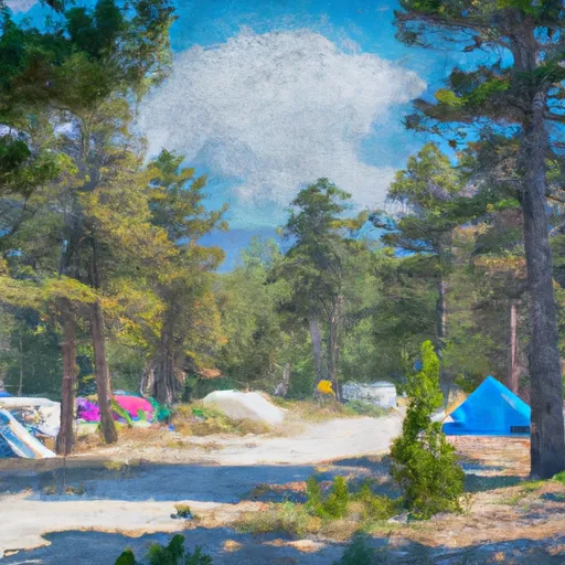
The camping area offers a range of amenities, including picnic tables, fire rings, and vault toilets. The campground also has a water source available, making it easy for visitors to refill their water bottles and coolers.
Timberlane Campground operates on a first-come, first-served basis, and there are a total of 24 campsites available for visitors. It's worth noting that this area is quite popular, so visitors should arrive early to secure a spot.
One interesting fact about the area is that it's home to the largest herd of bighorn sheep in Montana. Visitors might be lucky enough to spot these majestic creatures while exploring the surrounding wilderness.
The best time to visit Timberlane Campground is during the summer months, from June to September. During this time, temperatures average around 70 degrees Fahrenheit during the day and drop to around 40 degrees Fahrenheit at night. However, visitors should be prepared for sudden changes in weather, as the area is known for its unpredictable climate.
What's on-site at Timberlane Campground
Key facilities Snoflo tracks for this campground. Confirm with the operator before booking -- amenities can change seasonally.
Plan your trip down to the hour
Same weather feed Snoflo's iOS app uses -- updated continuously from NOAA / yr.no.
Next 5 days, hour by hour
Temperature line with weather symbols on top, snow + rain accumulation as columns, humidity as a dotted line.
5-day forecast table
Every 3 hours, broken out across temperature, snow, rain, humidity, and wind. Each cell is colour-coded relative to the column min/max so trends jump out at a glance.
| Time | Condition | Temp (°F) | Snow (in) | Rain (in) | Humidity (%) | Wind (mps) | Wind dir |
|---|---|---|---|---|---|---|---|
| Loading detailed forecast… | |||||||
15-day temperature & precipitation
Daily temperatures, snow, and rain projected over the next two weeks. Hover any point for the full breakdown.
Other campgrounds in the area
Snoflo-tracked campsites within driving distance of Timberlane Campground, with reservations status.
| Campground | Reservations | Toilets | View |
|---|---|---|---|
| Timberlane | ✓ | ✓ | → |
| Volunteer Fire Dept Campgrouns | ✗ | ✗ | → |
| Volunteer Firemans Memorial Park - Libby | ✗ | ✓ | → |
| Loon Lake | ✗ | ✓ | → |
| Big Creek Baldy Lookout | ✓ | ✗ | → |
Nearby streamflow
USGS streamgauges within reach of Timberlane Campground -- pulled live from the National Water Information System.
| Streamgauge | Discharge | View |
|---|---|---|
| Kootenai River Bl Libby Dam Nr Libby Mt | 9,070 cfs | → |
| Fisher River Near Libby Mt | 107 cfs | → |
| Yaak River Near Troy Mt | 183 cfs | → |
| Kootenai River At Leonia Id | 9,820 cfs | → |
| Kootenai River Bel Moyie River Nr Bonners Ferry Id | 10,100 cfs | → |
| Tobacco River Near Eureka Mt | 388 cfs | → |
Nearby snow depths
NRCS SNOTEL stations within reach of Timberlane Campground -- relevant when planning a shoulder-season or alpine trip.
| SNOTEL station | Snowpack | 24h Snowfall | View |
|---|---|---|---|
| Nohrsc Banfield Mountain | 0.0 in | 0.0 in | → |
| Banfield Mountain | 0.0 in | 0.0 in | → |
| Libby | 0.0 in | 0.0 in | → |
| Poorman Creek | 0.0 in | 0.0 in | → |
| Nohrsc Poorman Creek | 0.0 in | 0.0 in | → |
| Bear Mountain | 1.0 in | 0.0 in | → |
Plan a longer trip
The closest parks, lakes, boat launches, and paddle runs so a camping night can grow into a full weekend.
Parks
Boat launches
- City Service Road Libby
- Osprey Landing
- Lincoln County
- National Forest Development Road 333 Lincoln County
- Dunn Creek
- Rocky Gorge Road Lincoln County
Fishing spots
Points of interest
Paddle runs
- Junction Of The Fisher River (Three Miles Sownstream Of Libby Dam) To Tub Gulch, Approximately Four Miles Upstream From The Town Of Libby, Montana
- 10 Miles From Tub Gulch To Quartz Creek To 10 Miles From Tub Gulch To Quartz Creek
- From The Junction Of Hennesey Creek Downstream For Nine Miles To The Confluence With The Kootenai River To
- From The Boundary Of The Flagstaff Mountain Inventoried Roadless Area #690 Downstream For Three Miles To The Confluence Of Main Quartz Creek To
- From The Headwaters Of The West Fork Of Quartz Creek Downstream For Three Miles To The Boundary Of The Flagstaff Mountain Inventoried Roadless Area #690 To
- 9 Miles From Quartz Creek To Surprise Gulch,Two Miles Below Kootenai Falls To 9 Miles From Quartz Creek To Surprise Gulch,Two Miles Below Kootenai Falls
Camping essentials & Leave No Trace
- Pack it in, pack it out
- Take all trash, food scraps, and gear back with you to keep campsites clean and protect wildlife.
- Respect wildlife
- Observe animals from a distance, store food securely, and never feed wildlife to maintain natural behavior and safety.
- Know before you go
- Check weather, fire restrictions, trail conditions, and permit requirements to ensure a safe and well-planned trip.
- Minimize campfire impact
- Use established fire rings, keep fires small, fully extinguish them, or opt for a camp stove when fires are restricted.
- Leave what you find
- Preserve natural and cultural features by avoiding removal of plants, rocks, artifacts, or other elements of the environment.
Set push alerts in the Snoflo app
Save Timberlane Campground as a favorite, set a custom threshold (precipitation, snowpack, freezing temperatures), and the iOS app will push the moment conditions cross.
About Timberlane Campground
Can I make reservations at Timberlane Campground?
This campground does not appear to accept reservations -- it's typically first-come, first-served. Arrive early on summer weekends.
How fresh is the weather data on this page?
The hourly forecast updates throughout the day from the NOAA / yr.no public feeds. Streamflow data is pulled live from USGS streamgauges and snowpack from the NRCS SNOTEL network.
What's the best time of year to visit?
Use the 15-day temperature & precipitation outlook on this page to plan -- pick a window with comfortable temperatures and low precipitation. For longer trips, the 5-day hourly meteogram shows snow + rain accumulation hour-by-hour.
How do I get to Timberlane Campground?
Tap Directions in the hero above to open driving directions in Google Maps, or Open in map to center the Snoflo interactive map on the campground.
Can I get alerts when conditions change?
Yes -- alerts are managed through the Snoflo iOS app. Favorite this campground, set a threshold (temperature, snowpack, precipitation), and you'll get a push the moment it crosses.
Other campgrounds near here
Snoflo-tracked campgrounds within driving distance of Timberlane Campground.