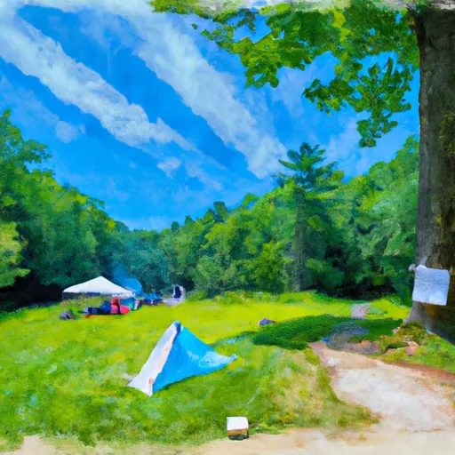
Camp Penacook Shelter Campground
Community Reviews
Been here? Share the conditions.
Reviews, ratings & photos are added in the free Snoflo iOS app — rate a spot, tag the conditions, and your visit is verified by location. Add or manage your reviews from the app.
Camp Penacook Shelter
Reservations are not required for this campground, as it operates on a first-come, first-served basis. However, it is recommended to arrive early, especially during peak seasons, to secure a spot. The best time to visit Camp Penacook Shelter is during the warmer months, from May to September, when the weather is pleasant and ideal for outdoor activities. During this time, visitors can enjoy hiking, fishing, and wildlife spotting in the surrounding area.
Campers should be aware of a few things while staying at Camp Penacook Shelter. It is advised to pack insect repellent, as mosquitoes and ticks can be prevalent in the region. Additionally, it is crucial to follow all safety guidelines and precautions regarding wildlife encounters, such as properly storing food to prevent attracting bears. Overall, Camp Penacook Shelter offers a serene camping experience with basic amenities, making it an ideal destination for nature enthusiasts seeking a peaceful retreat in the beautiful state of New Hampshire.
What's on-site at Camp Penacook Shelter
Key facilities Snoflo tracks for this campground. Confirm with the operator before booking -- amenities can change seasonally.
Plan your trip down to the hour
Same weather feed Snoflo's iOS app uses -- updated continuously from NOAA / yr.no.
Next 5 days, hour by hour
Temperature line with weather symbols on top, snow + rain accumulation as columns, humidity as a dotted line.
5-day forecast table
Every 3 hours, broken out across temperature, snow, rain, humidity, and wind. Each cell is colour-coded relative to the column min/max so trends jump out at a glance.
| Time | Condition | Temp (°F) | Snow (in) | Rain (in) | Humidity (%) | Wind (mps) | Wind dir |
|---|---|---|---|---|---|---|---|
| Loading detailed forecast… | |||||||
15-day temperature & precipitation
Daily temperatures, snow, and rain projected over the next two weeks. Hover any point for the full breakdown.
Other campgrounds in the area
Snoflo-tracked campsites within driving distance of Camp Penacook Shelter, with reservations status.
| Campground | Reservations | Toilets | View |
|---|---|---|---|
| Jim Liberty Cabin | ✗ | ✗ | → |
| Blackberry Crossing Campground | ✗ | ✓ | → |
| Covered Bridge Campground | ✗ | ✓ | → |
| Lower Falls Car Parking | ✗ | ✗ | → |
| Jigger Johnson Campground | ✗ | ✗ | → |
Nearby streamflow
USGS streamgauges within reach of Camp Penacook Shelter -- pulled live from the National Water Information System.
| Streamgauge | Discharge | View |
|---|---|---|
| Bearcamp River At South Tamworth | 14 cfs | → |
| Saco River Near Conway | 222 cfs | → |
| East Branch Pemigewasset River At Lincoln | 61 cfs | → |
| Pemigewasset River At Woodstock | 91 cfs | → |
| Pemigewasset River At Plymouth | 208 cfs | → |
| Saco River At Cornish | 738 cfs | → |
Nearby snow depths
NRCS SNOTEL stations within reach of Camp Penacook Shelter -- relevant when planning a shoulder-season or alpine trip.
| SNOTEL station | Snowpack | 24h Snowfall | View |
|---|---|---|---|
| Nohrsc Tamworth 0.4 Nnw | 0.0 in | 0.0 in | → |
| Tamworth 4 | 0.0 in | 0.0 in | → |
| Nohrsc North Conway 1.4 Ssw | 0.0 in | 0.0 in | → |
| North Conway | 0.0 in | 0.0 in | → |
| Nohrsc Center Sandwich 4.9 E | 0.0 in | 0.0 in | → |
| East Sandwich | 0.0 in | 0.0 in | → |
Plan a longer trip
The closest parks, lakes, boat launches, and paddle runs so a camping night can grow into a full weekend.
Parks
- Frank Bolles Preserve
- Madison Boulder Woods Preserve
- White Lake State Park
- Wilderness Presidential Range-Dry River
- Preserve Green Hills
- Crawford Notch State Park
Boat launches
- Upper Pea Porridge Pond Boat Launch
- Silver Lake
- Eaton Road 2984, Eaton
- Conway Lake Boat Launch
- Lakefront Landing Marina
- Berry Pond Boat Launch
Camping essentials & Leave No Trace
- Pack it in, pack it out
- Take all trash, food scraps, and gear back with you to keep campsites clean and protect wildlife.
- Respect wildlife
- Observe animals from a distance, store food securely, and never feed wildlife to maintain natural behavior and safety.
- Know before you go
- Check weather, fire restrictions, trail conditions, and permit requirements to ensure a safe and well-planned trip.
- Minimize campfire impact
- Use established fire rings, keep fires small, fully extinguish them, or opt for a camp stove when fires are restricted.
- Leave what you find
- Preserve natural and cultural features by avoiding removal of plants, rocks, artifacts, or other elements of the environment.
Set push alerts in the Snoflo app
Save Camp Penacook Shelter as a favorite, set a custom threshold (precipitation, snowpack, freezing temperatures), and the iOS app will push the moment conditions cross.
About Camp Penacook Shelter
Can I make reservations at Camp Penacook Shelter?
This campground does not appear to accept reservations -- it's typically first-come, first-served. Arrive early on summer weekends.
How fresh is the weather data on this page?
The hourly forecast updates throughout the day from the NOAA / yr.no public feeds. Streamflow data is pulled live from USGS streamgauges and snowpack from the NRCS SNOTEL network.
What's the best time of year to visit?
Use the 15-day temperature & precipitation outlook on this page to plan -- pick a window with comfortable temperatures and low precipitation. For longer trips, the 5-day hourly meteogram shows snow + rain accumulation hour-by-hour.
How do I get to Camp Penacook Shelter?
Tap Directions in the hero above to open driving directions in Google Maps, or Open in map to center the Snoflo interactive map on the campground.
Can I get alerts when conditions change?
Yes -- alerts are managed through the Snoflo iOS app. Favorite this campground, set a threshold (temperature, snowpack, precipitation), and you'll get a push the moment it crosses.
Other campgrounds near here
Snoflo-tracked campgrounds within driving distance of Camp Penacook Shelter.