#54 Nettle Creek Campground
Community Reviews
Been here? Share the conditions.
Reviews, ratings & photos are added in the free Snoflo iOS app — rate a spot, tag the conditions, and your visit is verified by location. Add or manage your reviews from the app.
#54 Nettle Creek
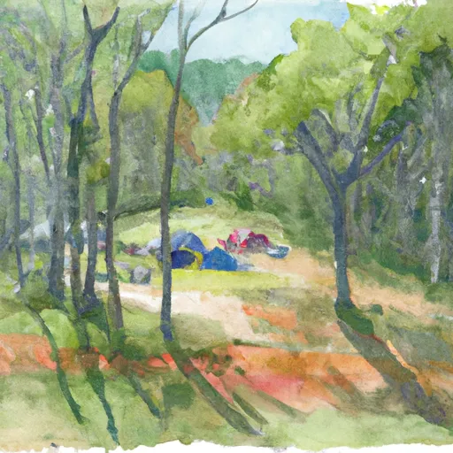
Reservations are accepted at Nettle Creek camping area, allowing visitors to secure their preferred camping spot in advance. It is recommended to make reservations, especially during peak seasons, to guarantee a spot at this popular campground. As for the best time of year to visit, the spring and fall seasons showcase the camping area's natural beauty to its fullest. Mild temperatures, blooming flowers, and vibrant foliage make these seasons ideal for outdoor activities such as hiking, fishing, and birdwatching.
While exploring Nettle Creek camping area, visitors should be cautious of poisonous plants like poison ivy, oak, and sumac. It is essential to familiarize oneself with these plants and take necessary precautions to avoid any skin irritations. Additionally, being aware of wildlife encounters is crucial. Keeping food securely stored and maintaining a safe distance from wild animals will help ensure a safe and enjoyable camping experience. With its stunning natural surroundings and well-equipped facilities, Nettle Creek camping area offers a memorable and relaxing getaway for campers seeking tranquility in North Carolina's wilderness.
What's on-site at #54 Nettle Creek
Key facilities Snoflo tracks for this campground. Confirm with the operator before booking -- amenities can change seasonally.
Plan your trip down to the hour
Same weather feed Snoflo's iOS app uses -- updated continuously from NOAA / yr.no.
Next 5 days, hour by hour
Temperature line with weather symbols on top, snow + rain accumulation as columns, humidity as a dotted line.
5-day forecast table
Every 3 hours, broken out across temperature, snow, rain, humidity, and wind. Each cell is colour-coded relative to the column min/max so trends jump out at a glance.
| Time | Condition | Temp (°F) | Snow (in) | Rain (in) | Humidity (%) | Wind (mps) | Wind dir |
|---|---|---|---|---|---|---|---|
| Loading detailed forecast… | |||||||
15-day temperature & precipitation
Daily temperatures, snow, and rain projected over the next two weeks. Hover any point for the full breakdown.
Other campgrounds in the area
Snoflo-tracked campsites within driving distance of #54 Nettle Creek, with reservations status.
| Campground | Reservations | Toilets | View |
|---|---|---|---|
| 54 | ✗ | ✗ | → |
| #55 Pole Road | ✗ | ✗ | → |
| 55 | ✗ | ✗ | → |
| #56 Burnt Spruce | ✗ | ✗ | → |
| 56 | ✗ | ✗ | → |
Nearby streamflow
USGS streamgauges within reach of #54 Nettle Creek -- pulled live from the National Water Information System.
| Streamgauge | Discharge | View |
|---|---|---|
| Oconaluftee River At Birdtown | 398 cfs | → |
| Tuckasegee River At Bryson City | 847 cfs | → |
| Tuckasegee River At Barker's Creek | 315 cfs | → |
| Little Tennessee River At Needmore | 463 cfs | → |
| Little River Above Townsend | 239 cfs | → |
| Cataloochee Creek Near Cataloochee | 79 cfs | → |
Nearby snow depths
NRCS SNOTEL stations within reach of #54 Nettle Creek -- relevant when planning a shoulder-season or alpine trip.
| SNOTEL station | Snowpack | 24h Snowfall | View |
|---|---|---|---|
| New Found Gap | 16.7 in | 0.0 in | → |
| Bryson City 4 | 0.0 in | 0.0 in | → |
| Gatlinburg | 0.0 in | 0.0 in | → |
| Dillard 0.7 Nnw | 0.0 in | 0.0 in | → |
| Germany Valley | 0.0 in | 0.0 in | → |
| Brevard | 0.0 in | 0.0 in | → |
Plan a longer trip
The closest parks, lakes, boat launches, and paddle runs so a camping night can grow into a full weekend.
Parks
- Swain County Park
- Needmore Game Land
- Great Smoky Mountains National Park
- Sevierville City Park
- Cold Mountain Game Land
- Wilderness Joyce Kilmer-Slickrock
Boat launches
- Church Street Jackson County
- Old 288
- Flat Branch
- Great Smoky Mountains Expressway 5453, Jackson County
- Tsali
- Lemmons Branch
Fishing spots
- Birchfield Branch
- Augerhole Branch
- Massey Branch Fishing Pier
- Santeetlah Lake
- Bear Creek Lake
- Allen Branch Pond
Points of interest
- Webb Overlook
- History Exhibit Overlook
- Thomas Ridge Overlook
- Swinging Bridges Overlook
- Short Beech Ridge Overlook
- Deep Creek Valley Overlook
Paddle runs
- Natahala Powerhouse To Lake Fontana (River Mile 4)
- Polecat Branch To Snowbird Picnic Area
- Headwaters In Standing Indian Basin To Slackwater Of Natahala Lake
- Owlcamp Branch To Polecat Branch
- Yellowstone Prong From Headwaters To Confluence With East Fork And Yellowstone Prong
- East Fork From Us Highway 276 To Confluence Of Dark Prong And Yellowstone Prong
Camping essentials & Leave No Trace
- Pack it in, pack it out
- Take all trash, food scraps, and gear back with you to keep campsites clean and protect wildlife.
- Respect wildlife
- Observe animals from a distance, store food securely, and never feed wildlife to maintain natural behavior and safety.
- Know before you go
- Check weather, fire restrictions, trail conditions, and permit requirements to ensure a safe and well-planned trip.
- Minimize campfire impact
- Use established fire rings, keep fires small, fully extinguish them, or opt for a camp stove when fires are restricted.
- Leave what you find
- Preserve natural and cultural features by avoiding removal of plants, rocks, artifacts, or other elements of the environment.
Set push alerts in the Snoflo app
Save #54 Nettle Creek as a favorite, set a custom threshold (precipitation, snowpack, freezing temperatures), and the iOS app will push the moment conditions cross.
About #54 Nettle Creek
Can I make reservations at #54 Nettle Creek?
This campground does not appear to accept reservations -- it's typically first-come, first-served. Arrive early on summer weekends.
How fresh is the weather data on this page?
The hourly forecast updates throughout the day from the NOAA / yr.no public feeds. Streamflow data is pulled live from USGS streamgauges and snowpack from the NRCS SNOTEL network.
What's the best time of year to visit?
Use the 15-day temperature & precipitation outlook on this page to plan -- pick a window with comfortable temperatures and low precipitation. For longer trips, the 5-day hourly meteogram shows snow + rain accumulation hour-by-hour.
How do I get to #54 Nettle Creek?
Tap Directions in the hero above to open driving directions in Google Maps, or Open in map to center the Snoflo interactive map on the campground.
Can I get alerts when conditions change?
Yes -- alerts are managed through the Snoflo iOS app. Favorite this campground, set a threshold (temperature, snowpack, precipitation), and you'll get a push the moment it crosses.
Other campgrounds near here
Snoflo-tracked campgrounds within driving distance of #54 Nettle Creek.