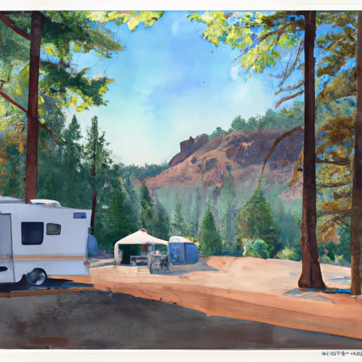
Edson 18 Campground
Community Reviews
Been here? Share the conditions.
Reviews, ratings & photos are added in the free Snoflo iOS app — rate a spot, tag the conditions, and your visit is verified by location. Add or manage your reviews from the app.
Edson 18
Nearby points of interest include the Cape Blanco Lighthouse, which is less than 10 miles away and offers spectacular views of the Pacific Ocean. The campground is also close to the Oregon coast, which is known for its rugged cliffs, sandy beaches, and breathtaking sunsets.
The Edson 18 Campsite is well-equipped with several amenities, including drinking water, picnic tables, fire rings, and restrooms. There are also several hiking trails nearby, offering visitors the chance to explore the surrounding wilderness.
Interesting facts about the area include that the Sixes River watershed is home to several species of fish, including steelhead and coho salmon. The area also has a rich history dating back to the 1800s, with several historic landmarks and museums nearby.
The best time of year to visit Edson 18 Campsite is in the summer months, from June to August, when temperatures are mild and pleasant, ranging from the mid-60s to low 70s Fahrenheit. However, visitors should be prepared for occasional rain showers throughout the year as the area is known for its mild and wet climate.
Sources:
- Oregon State Parks & Recreation: Edson Creek Campground
- Sixes River Watershed Council: About the Sixes River Watershed
- Travel Oregon: Exploring the South Coast of Oregon
What's on-site at Edson 18
Key facilities Snoflo tracks for this campground. Confirm with the operator before booking -- amenities can change seasonally.
Plan your trip down to the hour
Same weather feed Snoflo's iOS app uses -- updated continuously from NOAA / yr.no.
Next 5 days, hour by hour
Temperature line with weather symbols on top, snow + rain accumulation as columns, humidity as a dotted line.
5-day forecast table
Every 3 hours, broken out across temperature, snow, rain, humidity, and wind. Each cell is colour-coded relative to the column min/max so trends jump out at a glance.
| Time | Condition | Temp (°F) | Snow (in) | Rain (in) | Humidity (%) | Wind (mps) | Wind dir |
|---|---|---|---|---|---|---|---|
| Loading detailed forecast… | |||||||
15-day temperature & precipitation
Daily temperatures, snow, and rain projected over the next two weeks. Hover any point for the full breakdown.
Nearby streamflow
USGS streamgauges within reach of Edson 18 -- pulled live from the National Water Information System.
| Streamgauge | Discharge | View |
|---|---|---|
| South Fork Coquille River At Powers | 40 cfs | → |
| Rogue River Near Agness | 1,410 cfs | → |
| Rogue River At Hwy 101 Bridge | 3,580 cfs | → |
| West Fork Cow Creek Near Glendale | 5 cfs | → |
| Chetco River Near Brookings | 76 cfs | → |
| Cow Creek Near Riddle | 50 cfs | → |
Plan a longer trip
The closest parks, lakes, boat launches, and paddle runs so a camping night can grow into a full weekend.
Parks
- Port Orford Cedar State Scenic Corridor
- Cape Blanco State Park
- Floras Lake State Natural Area
- Buffington Memorial Park
- Battle Rock Wayside
- Paradise Point State Recreation Site
Boat launches
- Edson Creek Recreation Site
- Edson Boat Ramp
- Sixes River Store
- Iron Head
- Pinehurst
- Cape Blanco State Park
Points of interest
- Hughes House
- New River
- West Coast Game Park Safari
- Prehistoric Gardens
- Big Tree Observation Site
- Bullards Bridge
Paddle runs
- Sixes River
- Headwaters To Confluence With Johnson Creek
- Confluence With Sucker Creek To Confluence With South Fork Coquille River
- South Fork Coquille River
- Coquille River Rna Boundary (Western) To Siskiyou Nf Boundary (North Section Line Sec 6, T32s, R11w
- Coquille River Falls (Eastern Boundary) To Coquille River Falls (Western Boundary)
Camping essentials & Leave No Trace
- Pack it in, pack it out
- Take all trash, food scraps, and gear back with you to keep campsites clean and protect wildlife.
- Respect wildlife
- Observe animals from a distance, store food securely, and never feed wildlife to maintain natural behavior and safety.
- Know before you go
- Check weather, fire restrictions, trail conditions, and permit requirements to ensure a safe and well-planned trip.
- Minimize campfire impact
- Use established fire rings, keep fires small, fully extinguish them, or opt for a camp stove when fires are restricted.
- Leave what you find
- Preserve natural and cultural features by avoiding removal of plants, rocks, artifacts, or other elements of the environment.
Set push alerts in the Snoflo app
Save Edson 18 as a favorite, set a custom threshold (precipitation, snowpack, freezing temperatures), and the iOS app will push the moment conditions cross.
About Edson 18
Can I make reservations at Edson 18?
This campground does not appear to accept reservations -- it's typically first-come, first-served. Arrive early on summer weekends.
How fresh is the weather data on this page?
The hourly forecast updates throughout the day from the NOAA / yr.no public feeds. Streamflow data is pulled live from USGS streamgauges and snowpack from the NRCS SNOTEL network.
What's the best time of year to visit?
Use the 15-day temperature & precipitation outlook on this page to plan -- pick a window with comfortable temperatures and low precipitation. For longer trips, the 5-day hourly meteogram shows snow + rain accumulation hour-by-hour.
How do I get to Edson 18?
Tap Directions in the hero above to open driving directions in Google Maps, or Open in map to center the Snoflo interactive map on the campground.
Can I get alerts when conditions change?
Yes -- alerts are managed through the Snoflo iOS app. Favorite this campground, set a threshold (temperature, snowpack, precipitation), and you'll get a push the moment it crosses.
Other campgrounds near here
Snoflo-tracked campgrounds within driving distance of Edson 18.