Hoover Campground Campground
Community Reviews
Been here? Share the conditions.
Reviews, ratings & photos are added in the free Snoflo iOS app — rate a spot, tag the conditions, and your visit is verified by location. Add or manage your reviews from the app.
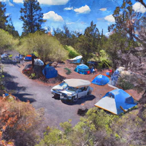
Hoover Campground
When it comes to reservations, it is advisable to secure your spot in advance, as Hoover Campground operates on a first-come, first-served basis. The peak season generally runs from late spring to early fall, so making reservations during this time is highly recommended to ensure availability. However, it's worth noting that the campground has a limited number of sites, so planning ahead is crucial.
The best time to visit Hoover Campground is during the summer months when the weather is warm, and the surrounding landscape is lush and vibrant. This presents an ideal setting for hiking, wildlife-spotting, and photography. However, it is important to be cautious of potential hazards in the area. Being aware of wildlife, particularly bears, and properly storing food to prevent any encounters is essential. Additionally, campers should be cautious of changing weather conditions and always bring appropriate gear and clothing for unpredictable weather patterns that can occur in the region. Overall, Hoover Campground promises an unforgettable camping experience with its amenities, beautiful surroundings, and the chance to reconnect with nature in Oregon's great outdoors.
What's on-site at Hoover Campground
Key facilities Snoflo tracks for this campground. Confirm with the operator before booking -- amenities can change seasonally.
Plan your trip down to the hour
Same weather feed Snoflo's iOS app uses -- updated continuously from NOAA / yr.no.
Next 5 days, hour by hour
Temperature line with weather symbols on top, snow + rain accumulation as columns, humidity as a dotted line.
5-day forecast table
Every 3 hours, broken out across temperature, snow, rain, humidity, and wind. Each cell is colour-coded relative to the column min/max so trends jump out at a glance.
| Time | Condition | Temp (°F) | Snow (in) | Rain (in) | Humidity (%) | Wind (mps) | Wind dir |
|---|---|---|---|---|---|---|---|
| Loading detailed forecast… | |||||||
15-day temperature & precipitation
Daily temperatures, snow, and rain projected over the next two weeks. Hover any point for the full breakdown.
Other campgrounds in the area
Snoflo-tracked campsites within driving distance of Hoover Campground, with reservations status.
| Campground | Reservations | Toilets | View |
|---|---|---|---|
| Hoover Group Campground | ✗ | ✗ | → |
| Hoover Group Campsite | ✓ | ✗ | → |
| Santiam Flats Campground | ✗ | ✗ | → |
| Cove Creek Campground | ✓ | ✗ | → |
| Cove Creek Group Campsite | ✓ | ✗ | → |
Nearby streamflow
USGS streamgauges within reach of Hoover Campground -- pulled live from the National Water Information System.
| Streamgauge | Discharge | View |
|---|---|---|
| No Santiam R Blw Boulder Crk | 382 cfs | → |
| Breitenbush R Abv French Cr Nr Detroit | 116 cfs | → |
| Blowout Creek Near Detroit | 6 cfs | → |
| North Santiam River At Niagara | 999 cfs | → |
| Schafer Creek Near Lacomb | 0 cfs | → |
| Quartzville Creek Near Cascadia | 21 cfs | → |
Nearby snow depths
NRCS SNOTEL stations within reach of Hoover Campground -- relevant when planning a shoulder-season or alpine trip.
| SNOTEL station | Snowpack | 24h Snowfall | View |
|---|---|---|---|
| Little Meadows | 0.0 in | 0.0 in | → |
| Little Meadows | 0.0 in | 0.0 in | → |
| Nohrsc Marion Forks | 0.0 in | 0.0 in | → |
| Marion Forks | 0.0 in | 0.0 in | → |
| Daly Lake | 0.0 in | 0.0 in | → |
| Santiam Jct. | 1.0 in | 1.0 in | → |
Plan a longer trip
The closest parks, lakes, boat launches, and paddle runs so a camping night can grow into a full weekend.
Parks
- Detroit Lake State Recreation Area
- Detroit Lake- Mongold Wayside
- Santiam State Forest
- Wilderness Opal Creek
- Wilderness Bull Of The Woods
- Minto County Park
Boat launches
- Hoover Campground
- Cove Creek Campground
- Kane's Marina
- Detroit Lake Marina
- South Shore - Detroit Lake
- Detroit Lake State Park - G Ramp
Points of interest
- Gold Butte Lookout
- Coffin Mountain Lookout
- Phantom Natural Bridge
- Natural Rock Arch
- Breitenbush Hot Springs Parking
- Three Pools
Paddle runs
- Confluence With North Fork Breitenbush River To Detroit Reservoir
- Highway 22 To Confluence With Rainbow Creek
- North Santiam River
- Mt. Jefferson Wilderness Boundary To Confluence With Breitenbush River
- Headwaters To Confluence With Unnamed Creek West Of Bruler Creek
- Opal Lake To Confluence With Battle Axe Creek
Camping essentials & Leave No Trace
- Pack it in, pack it out
- Take all trash, food scraps, and gear back with you to keep campsites clean and protect wildlife.
- Respect wildlife
- Observe animals from a distance, store food securely, and never feed wildlife to maintain natural behavior and safety.
- Know before you go
- Check weather, fire restrictions, trail conditions, and permit requirements to ensure a safe and well-planned trip.
- Minimize campfire impact
- Use established fire rings, keep fires small, fully extinguish them, or opt for a camp stove when fires are restricted.
- Leave what you find
- Preserve natural and cultural features by avoiding removal of plants, rocks, artifacts, or other elements of the environment.
Set push alerts in the Snoflo app
Save Hoover Campground as a favorite, set a custom threshold (precipitation, snowpack, freezing temperatures), and the iOS app will push the moment conditions cross.
About Hoover Campground
Can I make reservations at Hoover Campground?
Yes -- this campground accepts reservations. Snoflo recommends booking early for peak season; check the operator (Recreation.gov / state park system / private operator) for the booking window and cancellation policy.
How fresh is the weather data on this page?
The hourly forecast updates throughout the day from the NOAA / yr.no public feeds. Streamflow data is pulled live from USGS streamgauges and snowpack from the NRCS SNOTEL network.
What's the best time of year to visit?
Use the 15-day temperature & precipitation outlook on this page to plan -- pick a window with comfortable temperatures and low precipitation. For longer trips, the 5-day hourly meteogram shows snow + rain accumulation hour-by-hour.
How do I get to Hoover Campground?
Tap Directions in the hero above to open driving directions in Google Maps, or Open in map to center the Snoflo interactive map on the campground.
Can I get alerts when conditions change?
Yes -- alerts are managed through the Snoflo iOS app. Favorite this campground, set a threshold (temperature, snowpack, precipitation), and you'll get a push the moment it crosses.
Other campgrounds near here
Snoflo-tracked campgrounds within driving distance of Hoover Campground.