Lightning Springs Camp Campground
Community Reviews
Been here? Share the conditions.
Reviews, ratings & photos are added in the free Snoflo iOS app — rate a spot, tag the conditions, and your visit is verified by location. Add or manage your reviews from the app.
Lightning Springs Camp
One of the most popular nearby points of interest is the Toketee Falls, a picturesque waterfall that is easily accessible from the campground. Other nearby attractions include the Rogue-Umpqua Scenic Byway, which offers stunning views of the surrounding forests and mountains, as well as the Diamond Lake Recreation Area, which offers opportunities for boating, fishing, and hiking.
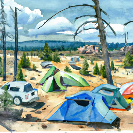
The campground itself offers a variety of amenities, including picnic tables, fire rings, and vault toilets. There is also a nearby hiking trail that leads to a scenic overlook of the North Umpqua River. Visitors can also enjoy fishing and swimming in the river, which is home to a variety of fish species.
Interesting facts about the area include that it is home to a variety of wildlife species, including black bears, mountain lions, and elk. Additionally, the Umpqua National Forest is known for its historic sites, including the Civilian Conservation Corps camp that was established in the 1930s.
The best time of year to visit the Lightning Springs Camp camping area is during the summer months, from June to September, when temperatures range from the mid-60s to mid-80s. However, visitors should be prepared for cooler temperatures at night, as well as occasional rain showers.
Sources:
- U.S. Forest Service: https://www.fs.usda.gov/recarea/umpqua/recarea/?recid=63427
- AllTrails: https://www.alltrails.com/trail/us/oregon/lightning-springs-camp-to-north-umpqua-river-overlook-trail
What's on-site at Lightning Springs Camp
Key facilities Snoflo tracks for this campground. Confirm with the operator before booking -- amenities can change seasonally.
Plan your trip down to the hour
Same weather feed Snoflo's iOS app uses -- updated continuously from NOAA / yr.no.
Next 5 days, hour by hour
Temperature line with weather symbols on top, snow + rain accumulation as columns, humidity as a dotted line.
5-day forecast table
Every 3 hours, broken out across temperature, snow, rain, humidity, and wind. Each cell is colour-coded relative to the column min/max so trends jump out at a glance.
| Time | Condition | Temp (°F) | Snow (in) | Rain (in) | Humidity (%) | Wind (mps) | Wind dir |
|---|---|---|---|---|---|---|---|
| Loading detailed forecast… | |||||||
15-day temperature & precipitation
Daily temperatures, snow, and rain projected over the next two weeks. Hover any point for the full breakdown.
Other campgrounds in the area
Snoflo-tracked campsites within driving distance of Lightning Springs Camp, with reservations status.
| Campground | Reservations | Toilets | View |
|---|---|---|---|
| Lightning Springs Backcountry Campsite | ✗ | ✗ | → |
| Bybee Creek | ✗ | ✗ | → |
| Dutton Camp | ✗ | ✗ | → |
| Red Cone Backcountry Campsite | ✗ | ✗ | → |
| Red Cone Springs Camp | ✗ | ✗ | → |
Nearby streamflow
USGS streamgauges within reach of Lightning Springs Camp -- pulled live from the National Water Information System.
| Streamgauge | Discharge | View |
|---|---|---|
| Lake Creek Near Diamond | 113 cfs | → |
| South Fork Rogue River Near Prospect | 42 cfs | → |
| Rogue River Above Prospect | 811 cfs | → |
| Williamson River Near Klamath Agency | · | → |
| Rogue River Below Prospect | 617 cfs | → |
| Clearwater R Ab Trap Cr Nr T Falls | 52 cfs | → |
Nearby snow depths
NRCS SNOTEL stations within reach of Lightning Springs Camp -- relevant when planning a shoulder-season or alpine trip.
| SNOTEL station | Snowpack | 24h Snowfall | View |
|---|---|---|---|
| Crater Lake National Park Hq | 0.0 in | 0.0 in | → |
| Annie Springs | 0.0 in | 0.0 in | → |
| Annie Springs | 0.0 in | 0.0 in | → |
| Sun Pass | 0.0 in | 0.0 in | → |
| Nohrsc Sun Pass | 0.0 in | 0.0 in | → |
| Sevenmile Marsh | 0.0 in | 0.0 in | → |
Plan a longer trip
The closest parks, lakes, boat launches, and paddle runs so a camping night can grow into a full weekend.
Parks
- Crater Lake National Park
- Wilderness Mount Thielsen
- Jackson F. Kimball State Recreation Site
- Wilderness Rogue-Umpqua Divide
- Sun Pass State Forest
- Prospect State Scenic Viewpoint
Boat launches
- South Shore Boating Site (Diamond Lake)
- South Shore - Diamond Lake
- Diamond Lake Campground - M Loop
- Diamond Lake Campground - C Loop
- Thielsen View
- North End Boat Ramp
Points of interest
- Watchman Lookout Station
- The Watchman
- Watchman Overlook
- Discovery Point
- Wizard Island
- Rim Village Visitor Center
Paddle runs
- Headwaters To Confluence With Rogue River
- Headwaters To Confluence Of Foster Creek
- Rogue-Umpqua Wilderness Boundary To Confluence With North Fork Rogue River
- Crater Lake Np Boundary To Confluence With Rogue River
- Headwaters To Rogue-Umpqua Wilderness Boundary
- Headwaters To Sw1/4 Of Sec 1, T33s, R4e
Camping essentials & Leave No Trace
- Pack it in, pack it out
- Take all trash, food scraps, and gear back with you to keep campsites clean and protect wildlife.
- Respect wildlife
- Observe animals from a distance, store food securely, and never feed wildlife to maintain natural behavior and safety.
- Know before you go
- Check weather, fire restrictions, trail conditions, and permit requirements to ensure a safe and well-planned trip.
- Minimize campfire impact
- Use established fire rings, keep fires small, fully extinguish them, or opt for a camp stove when fires are restricted.
- Leave what you find
- Preserve natural and cultural features by avoiding removal of plants, rocks, artifacts, or other elements of the environment.
Set push alerts in the Snoflo app
Save Lightning Springs Camp as a favorite, set a custom threshold (precipitation, snowpack, freezing temperatures), and the iOS app will push the moment conditions cross.
About Lightning Springs Camp
Can I make reservations at Lightning Springs Camp?
This campground does not appear to accept reservations -- it's typically first-come, first-served. Arrive early on summer weekends.
How fresh is the weather data on this page?
The hourly forecast updates throughout the day from the NOAA / yr.no public feeds. Streamflow data is pulled live from USGS streamgauges and snowpack from the NRCS SNOTEL network.
What's the best time of year to visit?
Use the 15-day temperature & precipitation outlook on this page to plan -- pick a window with comfortable temperatures and low precipitation. For longer trips, the 5-day hourly meteogram shows snow + rain accumulation hour-by-hour.
How do I get to Lightning Springs Camp?
Tap Directions in the hero above to open driving directions in Google Maps, or Open in map to center the Snoflo interactive map on the campground.
Can I get alerts when conditions change?
Yes -- alerts are managed through the Snoflo iOS app. Favorite this campground, set a threshold (temperature, snowpack, precipitation), and you'll get a push the moment it crosses.
Other campgrounds near here
Snoflo-tracked campgrounds within driving distance of Lightning Springs Camp.