Limberlost Campground Campground
Community Reviews
Been here? Share the conditions.
Reviews, ratings & photos are added in the free Snoflo iOS app — rate a spot, tag the conditions, and your visit is verified by location. Add or manage your reviews from the app.
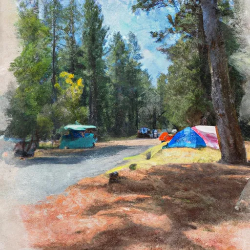
Limberlost Campground
Reservations are not accepted at Limberlost Campground, and it operates on a first-come, first-served basis. Therefore, it is recommended to arrive early to secure a spot, especially during peak seasons. The best time to visit this camping area is during the summer months when the weather is pleasant and allows for outdoor activities such as hiking, fishing, and wildlife viewing.
While exploring the camping area, campers can immerse themselves in the natural beauty of the surrounding forests and enjoy the serene ambiance. However, it is important to be cautious of potential wildlife encounters, such as black bears and cougars, and to store food properly to prevent any unwanted visitors. Additionally, campers should be mindful of potential fire hazards and adhere to all fire safety regulations. Overall, Limberlost Campground offers a tranquil and scenic camping experience for outdoor enthusiasts seeking to connect with nature in the beautiful state of Oregon.
What's on-site at Limberlost Campground
Key facilities Snoflo tracks for this campground. Confirm with the operator before booking -- amenities can change seasonally.
Plan your trip down to the hour
Same weather feed Snoflo's iOS app uses -- updated continuously from NOAA / yr.no.
Next 5 days, hour by hour
Temperature line with weather symbols on top, snow + rain accumulation as columns, humidity as a dotted line.
5-day forecast table
Every 3 hours, broken out across temperature, snow, rain, humidity, and wind. Each cell is colour-coded relative to the column min/max so trends jump out at a glance.
| Time | Condition | Temp (°F) | Snow (in) | Rain (in) | Humidity (%) | Wind (mps) | Wind dir |
|---|---|---|---|---|---|---|---|
| Loading detailed forecast… | |||||||
15-day temperature & precipitation
Daily temperatures, snow, and rain projected over the next two weeks. Hover any point for the full breakdown.
Other campgrounds in the area
Snoflo-tracked campsites within driving distance of Limberlost Campground, with reservations status.
| Campground | Reservations | Toilets | View |
|---|---|---|---|
| Camp White Branch | ✗ | ✗ | → |
| Horse Creek Group Campground | ✓ | ✗ | → |
| Olallie Campground | ✓ | ✗ | → |
| Mckenzie Bridge Campground | ✓ | ✗ | → |
| Alder Springs Campground | ✗ | ✗ | → |
Nearby streamflow
USGS streamgauges within reach of Limberlost Campground -- pulled live from the National Water Information System.
| Streamgauge | Discharge | View |
|---|---|---|
| Mckenzie R Blw Trail Br Dam Nr Belknap Springs | 634 cfs | → |
| Mckenzie River Bl Payne Cr | 171 cfs | → |
| Smith River Abv Trail Brdg Resv Nr Belknap Springs | 6 cfs | → |
| South Fork Mckenzie River Near Rainbow | 322 cfs | → |
| Lookout Creek Near Blue River | 16 cfs | → |
| Smith R Ab Smith R Res Nr Belknap Sprgs | 5 cfs | → |
Nearby snow depths
NRCS SNOTEL stations within reach of Limberlost Campground -- relevant when planning a shoulder-season or alpine trip.
| SNOTEL station | Snowpack | 24h Snowfall | View |
|---|---|---|---|
| Smith Ridge | 1.0 in | 0.0 in | → |
| Nohrsc Mckenzie | 4.0 in | 0.0 in | → |
| Mckenzie | 4.0 in | 0.0 in | → |
| Nohrsc Bear Grass | 0.0 in | 0.0 in | → |
| Bear Grass | 0.0 in | 0.0 in | → |
| Nohrsc Jump Off Joe | 2.0 in | 0.0 in | → |
Plan a longer trip
The closest parks, lakes, boat launches, and paddle runs so a camping night can grow into a full weekend.
Parks
- Jennie B. Harris State Recreation Site
- Wilderness Mount Washington
- Wilderness Mount Jefferson
- Wilderness Menagerie
- Elliott Corbett Memorial State Recreation Site
- Ben & Kay Dorris State Recreation Area
Boat launches
- Paradise Campground
- Mckenzie Bridge Campground
- Trail Bridge Campground
- Echo Picnic Area And Boat Launch
- Smith Reservoir
Points of interest
- Carpenter Mountain Lookout
- Belknap Bridge
- Terwilliger (Cougar) Hot Springs
- Sahalie And Koosah Falls
- Dee Wright Observatory
- Indian Ridge Lookout
Paddle runs
- Headwaters To Blue River Reservoir
- Three Sisters Wilderness Boundary To Cougar Reservoir
- Below Cougar Dam To Confluence With Mckenzie River
- Mill City To Mehama
- Headwaters To Three Sisters Wilderness Boundary
- Headwaters Of Sevenmile Creek To Confluence With Latiwi Creek
Camping essentials & Leave No Trace
- Pack it in, pack it out
- Take all trash, food scraps, and gear back with you to keep campsites clean and protect wildlife.
- Respect wildlife
- Observe animals from a distance, store food securely, and never feed wildlife to maintain natural behavior and safety.
- Know before you go
- Check weather, fire restrictions, trail conditions, and permit requirements to ensure a safe and well-planned trip.
- Minimize campfire impact
- Use established fire rings, keep fires small, fully extinguish them, or opt for a camp stove when fires are restricted.
- Leave what you find
- Preserve natural and cultural features by avoiding removal of plants, rocks, artifacts, or other elements of the environment.
Set push alerts in the Snoflo app
Save Limberlost Campground as a favorite, set a custom threshold (precipitation, snowpack, freezing temperatures), and the iOS app will push the moment conditions cross.
About Limberlost Campground
Can I make reservations at Limberlost Campground?
Yes -- this campground accepts reservations. Snoflo recommends booking early for peak season; check the operator (Recreation.gov / state park system / private operator) for the booking window and cancellation policy.
How fresh is the weather data on this page?
The hourly forecast updates throughout the day from the NOAA / yr.no public feeds. Streamflow data is pulled live from USGS streamgauges and snowpack from the NRCS SNOTEL network.
What's the best time of year to visit?
Use the 15-day temperature & precipitation outlook on this page to plan -- pick a window with comfortable temperatures and low precipitation. For longer trips, the 5-day hourly meteogram shows snow + rain accumulation hour-by-hour.
How do I get to Limberlost Campground?
Tap Directions in the hero above to open driving directions in Google Maps, or Open in map to center the Snoflo interactive map on the campground.
Can I get alerts when conditions change?
Yes -- alerts are managed through the Snoflo iOS app. Favorite this campground, set a threshold (temperature, snowpack, precipitation), and you'll get a push the moment it crosses.
Other campgrounds near here
Snoflo-tracked campgrounds within driving distance of Limberlost Campground.