Ochoco Reservoir Hiker Biker Campsite Campground
Community Reviews
Been here? Share the conditions.
Reviews, ratings & photos are added in the free Snoflo iOS app — rate a spot, tag the conditions, and your visit is verified by location. Add or manage your reviews from the app.
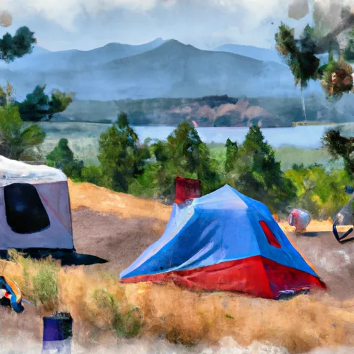
Ochoco Reservoir Hiker Biker Campsite
Reservations are not accepted at the Ochoco Reservoir Hiker Biker Campsite, as it operates on a first-come, first-served basis. It is recommended to arrive early, especially during peak seasons, to secure a spot. The best time to visit this camping area is during the summer months, specifically from June to September, when the weather is pleasant and ideal for outdoor activities like hiking and biking.
While enjoying your stay at the Ochoco Reservoir Hiker Biker Campsite, be cautious of wildlife in the area. Black bears and cougars have been spotted, so it is important to store food properly and be aware of your surroundings. Additionally, it is advised to bring bug repellent as mosquitoes can be quite bothersome during certain times of the year. Overall, this camping area offers a serene and picturesque setting for outdoor enthusiasts to indulge in nature's tranquility.
What's on-site at Ochoco Reservoir Hiker Biker Campsite
Key facilities Snoflo tracks for this campground. Confirm with the operator before booking -- amenities can change seasonally.
Plan your trip down to the hour
Same weather feed Snoflo's iOS app uses -- updated continuously from NOAA / yr.no.
Next 5 days, hour by hour
Temperature line with weather symbols on top, snow + rain accumulation as columns, humidity as a dotted line.
5-day forecast table
Every 3 hours, broken out across temperature, snow, rain, humidity, and wind. Each cell is colour-coded relative to the column min/max so trends jump out at a glance.
| Time | Condition | Temp (°F) | Snow (in) | Rain (in) | Humidity (%) | Wind (mps) | Wind dir |
|---|---|---|---|---|---|---|---|
| Loading detailed forecast… | |||||||
15-day temperature & precipitation
Daily temperatures, snow, and rain projected over the next two weeks. Hover any point for the full breakdown.
Nearby streamflow
USGS streamgauges within reach of Ochoco Reservoir Hiker Biker Campsite -- pulled live from the National Water Information System.
| Streamgauge | Discharge | View |
|---|---|---|
| Crooked River Blw Osborne Canyon | 112 cfs | → |
| Crooked River Below Opal Springs | 1,210 cfs | → |
| Deschutes River Near Culver | 518 cfs | → |
| Bridge Cr Abv Coyote Canyon Nr Mitchell | 1 cfs | → |
| Deschutes River Near Madras | 3,540 cfs | → |
| Shitike Creek Near Warm Springs | 38 cfs | → |
Nearby snow depths
NRCS SNOTEL stations within reach of Ochoco Reservoir Hiker Biker Campsite -- relevant when planning a shoulder-season or alpine trip.
| SNOTEL station | Snowpack | 24h Snowfall | View |
|---|---|---|---|
| Ochoco Meadows | 0.0 in | 0.0 in | → |
| Ochoco Meadows | 0.0 in | 0.0 in | → |
| Bend 7 Ne | 0.0 in | 0.0 in | → |
| Nohrsc Derr. | 0.0 in | 0.0 in | → |
| Derr. | 0.0 in | 0.0 in | → |
| Three Creeks Meadow | 0.0 in | 0.0 in | → |
Plan a longer trip
The closest parks, lakes, boat launches, and paddle runs so a camping night can grow into a full weekend.
Parks
- Ochoco Lake State Park
- Ochoco Creek Park
- Davidson Park
- Harwood Park
- Ochoco State Scenic Viewpoint
- Wilderness Mill Creek
Boat launches
- Ochoco Reservoir County Park
- Jasper Point
- County Ramp
- Prineville Reservoir State Park
- Roberts Bay East
- Prineville Reservoir Resort
Points of interest
- A. R. Bowman Memorial Museum
- U.S. Forest Service
- Crooked River
- Rimrock Springs Wildlife Management Area
- Crescent Moon Ranch
- Rex T. Barber Veterans Memorial Bridge
Paddle runs
- Cline Falls State Park To Lower Bridge
- Canyon Run (Lower Bridge To Billy Chinook Res.)
- Crooked River National Grassland Boundary To Confluence With Deschutes River
- Tumalo State Park To Cline Falls State Park
- Bend To Tumalo State Park (Riverhouse Run)
- Warm Springs To Sherars Falls
Camping essentials & Leave No Trace
- Pack it in, pack it out
- Take all trash, food scraps, and gear back with you to keep campsites clean and protect wildlife.
- Respect wildlife
- Observe animals from a distance, store food securely, and never feed wildlife to maintain natural behavior and safety.
- Know before you go
- Check weather, fire restrictions, trail conditions, and permit requirements to ensure a safe and well-planned trip.
- Minimize campfire impact
- Use established fire rings, keep fires small, fully extinguish them, or opt for a camp stove when fires are restricted.
- Leave what you find
- Preserve natural and cultural features by avoiding removal of plants, rocks, artifacts, or other elements of the environment.
Set push alerts in the Snoflo app
Save Ochoco Reservoir Hiker Biker Campsite as a favorite, set a custom threshold (precipitation, snowpack, freezing temperatures), and the iOS app will push the moment conditions cross.
About Ochoco Reservoir Hiker Biker Campsite
Can I make reservations at Ochoco Reservoir Hiker Biker Campsite?
This campground does not appear to accept reservations -- it's typically first-come, first-served. Arrive early on summer weekends.
How fresh is the weather data on this page?
The hourly forecast updates throughout the day from the NOAA / yr.no public feeds. Streamflow data is pulled live from USGS streamgauges and snowpack from the NRCS SNOTEL network.
What's the best time of year to visit?
Use the 15-day temperature & precipitation outlook on this page to plan -- pick a window with comfortable temperatures and low precipitation. For longer trips, the 5-day hourly meteogram shows snow + rain accumulation hour-by-hour.
How do I get to Ochoco Reservoir Hiker Biker Campsite?
Tap Directions in the hero above to open driving directions in Google Maps, or Open in map to center the Snoflo interactive map on the campground.
Can I get alerts when conditions change?
Yes -- alerts are managed through the Snoflo iOS app. Favorite this campground, set a threshold (temperature, snowpack, precipitation), and you'll get a push the moment it crosses.
Other campgrounds near here
Snoflo-tracked campgrounds within driving distance of Ochoco Reservoir Hiker Biker Campsite.