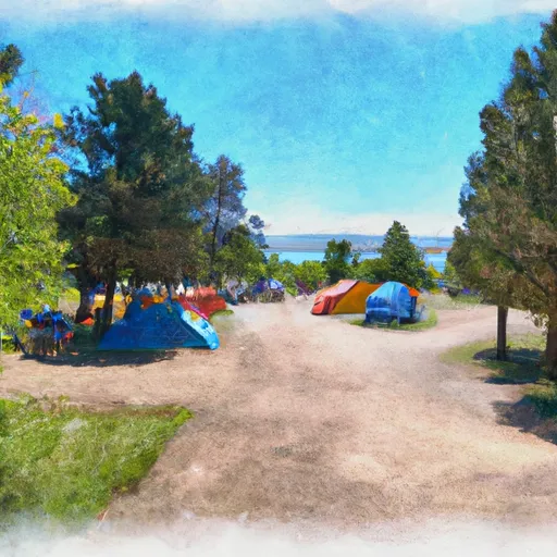
Sacandaga Campground Campground
Community Reviews
Been here? Share the conditions.
Reviews, ratings & photos are added in the free Snoflo iOS app — rate a spot, tag the conditions, and your visit is verified by location. Add or manage your reviews from the app.
Sacandaga Campground
Reservations are not accepted at Sacandaga Campground, as campsites are available on a first-come, first-served basis. Therefore, it is recommended to arrive early, especially during peak camping season, to secure a spot. The campground is open year-round, providing camping opportunities throughout all seasons. However, the best time to visit is typically during the summer months when the weather is milder and there are more outdoor activities to enjoy in the surrounding area.
One of the notable features of Sacandaga Campground is its proximity to various attractions and recreational opportunities. This includes hiking trails, fishing spots, and scenic viewpoints, allowing campers to immerse themselves in the natural beauty of the region. However, it is important to be cautious of wildlife, such as bears and cougars, that may occasionally be present in the area. Proper food storage and adhering to established safety guidelines are essential for a safe camping experience. Overall, Sacandaga Campground provides a peaceful and picturesque camping opportunity for outdoor enthusiasts seeking a memorable adventure in Oregon.
What's on-site at Sacandaga Campground
Key facilities Snoflo tracks for this campground. Confirm with the operator before booking -- amenities can change seasonally.
Plan your trip down to the hour
Same weather feed Snoflo's iOS app uses -- updated continuously from NOAA / yr.no.
Next 5 days, hour by hour
Temperature line with weather symbols on top, snow + rain accumulation as columns, humidity as a dotted line.
5-day forecast table
Every 3 hours, broken out across temperature, snow, rain, humidity, and wind. Each cell is colour-coded relative to the column min/max so trends jump out at a glance.
| Time | Condition | Temp (°F) | Snow (in) | Rain (in) | Humidity (%) | Wind (mps) | Wind dir |
|---|---|---|---|---|---|---|---|
| Loading detailed forecast… | |||||||
15-day temperature & precipitation
Daily temperatures, snow, and rain projected over the next two weeks. Hover any point for the full breakdown.
Other campgrounds in the area
Snoflo-tracked campsites within driving distance of Sacandaga Campground, with reservations status.
| Campground | Reservations | Toilets | View |
|---|---|---|---|
| Indigo Springs Campground | ✗ | ✗ | → |
| Campers Flat | ✗ | ✓ | → |
| Campers Flat Campground | ✓ | ✗ | → |
| Secret | ✗ | ✓ | → |
| Secret Campground | ✓ | ✗ | → |
Nearby streamflow
USGS streamgauges within reach of Sacandaga Campground -- pulled live from the National Water Information System.
| Streamgauge | Discharge | View |
|---|---|---|
| N.Umpqua R Blw Warm Springs Ck Nr Toketee Falls | 92 cfs | → |
| N.Umpqua R Abv White Mule Ck | 89 cfs | → |
| North Umpqua R Bl Lemolo Lk Nr T Falls | 87 cfs | → |
| N.Umpqua R Blw Soda Spgs Resv | 306 cfs | → |
| M F Willamette R Ab Salt Cr. | 551 cfs | → |
| N.Umpqua R Blw Slide Ck Dam Nr Toketee Falls | 265 cfs | → |
Nearby snow depths
NRCS SNOTEL stations within reach of Sacandaga Campground -- relevant when planning a shoulder-season or alpine trip.
| SNOTEL station | Snowpack | 24h Snowfall | View |
|---|---|---|---|
| Nohrsc Summit Lake | 4.0 in | 0.0 in | → |
| Summit Lake | 0.0 in | 0.0 in | → |
| Lemolo Lake 3 Nnw | 0.0 in | 0.0 in | → |
| Railroad Overpass | 0.0 in | 0.0 in | → |
| Salt Creek Falls | 3.0 in | 0.0 in | → |
| Salt Creek Falls | 0.0 in | 0.0 in | → |
Plan a longer trip
The closest parks, lakes, boat launches, and paddle runs so a camping night can grow into a full weekend.
Parks
- Willamette National Forest
- Wilderness Diamond Peak
- Wilderness Boulder Creek
- Greenwater Rest & Recreation Area
- Andrew Wiley Park
- Salmon Creek Park
Boat launches
- Bingham Boat Ramp
- Summit Lake
- Packard Creek Day Use Area
- Forest Road 2100-019 Lane County
- Lemolo Lake Resort
- C.T. Beach Picnic Area
Fishing spots
Points of interest
- Warner Mountain Lookout
- Lemolo Falls
- Salt Creek Falls Observation Site And Picnic Area
- Betchtel Shelter
- Fuji Shelter
- Westview Shelter
Paddle runs
- Lower Timpanogas Lake To Confluence With Echo Creek
- Confluence With Echo Creek To Hills Creek Reservoir
- Lemolo Lake To Oregon Cacades Recreation Area Boundary
- Headwaters To Boulder Creek Wilderness Boundary
- Oregon Cascades Recreation Area Boundary To Mt. Thielsen Wilderness Boundary
- Headwaters Of East Fork Steamboat Creek To Confluence With Siwash Creek
Camping essentials & Leave No Trace
- Pack it in, pack it out
- Take all trash, food scraps, and gear back with you to keep campsites clean and protect wildlife.
- Respect wildlife
- Observe animals from a distance, store food securely, and never feed wildlife to maintain natural behavior and safety.
- Know before you go
- Check weather, fire restrictions, trail conditions, and permit requirements to ensure a safe and well-planned trip.
- Minimize campfire impact
- Use established fire rings, keep fires small, fully extinguish them, or opt for a camp stove when fires are restricted.
- Leave what you find
- Preserve natural and cultural features by avoiding removal of plants, rocks, artifacts, or other elements of the environment.
Set push alerts in the Snoflo app
Save Sacandaga Campground as a favorite, set a custom threshold (precipitation, snowpack, freezing temperatures), and the iOS app will push the moment conditions cross.
About Sacandaga Campground
Can I make reservations at Sacandaga Campground?
Yes -- this campground accepts reservations. Snoflo recommends booking early for peak season; check the operator (Recreation.gov / state park system / private operator) for the booking window and cancellation policy.
How fresh is the weather data on this page?
The hourly forecast updates throughout the day from the NOAA / yr.no public feeds. Streamflow data is pulled live from USGS streamgauges and snowpack from the NRCS SNOTEL network.
What's the best time of year to visit?
Use the 15-day temperature & precipitation outlook on this page to plan -- pick a window with comfortable temperatures and low precipitation. For longer trips, the 5-day hourly meteogram shows snow + rain accumulation hour-by-hour.
How do I get to Sacandaga Campground?
Tap Directions in the hero above to open driving directions in Google Maps, or Open in map to center the Snoflo interactive map on the campground.
Can I get alerts when conditions change?
Yes -- alerts are managed through the Snoflo iOS app. Favorite this campground, set a threshold (temperature, snowpack, precipitation), and you'll get a push the moment it crosses.
Other campgrounds near here
Snoflo-tracked campgrounds within driving distance of Sacandaga Campground.