Shady Campground Campground
Community Reviews
Been here? Share the conditions.
Reviews, ratings & photos are added in the free Snoflo iOS app — rate a spot, tag the conditions, and your visit is verified by location. Add or manage your reviews from the app.
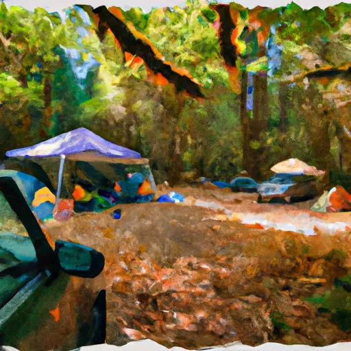
Shady Campground
Reservations are not accepted at Shady Campground and campsites are available on a first-come, first-served basis. However, it is advisable to arrive early, especially during peak season, to secure a spot. The best time of year to visit this camping area is during the summer months when the weather is warm and conducive to outdoor activities. It is recommended to bring insect repellent as mosquitoes can be quite prevalent in the area.
Located in Oregon, Shady Campground offers nature enthusiasts and adventure seekers a picturesque and enjoyable camping experience. With its range of amenities, beautiful surroundings, and hiking opportunities, it is a popular destination for those seeking to reconnect with nature. Remember to plan your trip accordingly and arrive early to secure a campsite, especially during busy periods. Don't forget your insect repellent to ensure a comfortable stay.
What's on-site at Shady Campground
Key facilities Snoflo tracks for this campground. Confirm with the operator before booking -- amenities can change seasonally.
Plan your trip down to the hour
Same weather feed Snoflo's iOS app uses -- updated continuously from NOAA / yr.no.
Next 5 days, hour by hour
Temperature line with weather symbols on top, snow + rain accumulation as columns, humidity as a dotted line.
5-day forecast table
Every 3 hours, broken out across temperature, snow, rain, humidity, and wind. Each cell is colour-coded relative to the column min/max so trends jump out at a glance.
| Time | Condition | Temp (°F) | Snow (in) | Rain (in) | Humidity (%) | Wind (mps) | Wind dir |
|---|---|---|---|---|---|---|---|
| Loading detailed forecast… | |||||||
15-day temperature & precipitation
Daily temperatures, snow, and rain projected over the next two weeks. Hover any point for the full breakdown.
Other campgrounds in the area
Snoflo-tracked campsites within driving distance of Shady Campground, with reservations status.
| Campground | Reservations | Toilets | View |
|---|---|---|---|
| Shady | ✗ | ✓ | → |
| Arrow Forest Camp | ✗ | ✗ | → |
| Two Pan Campground | ✗ | ✗ | → |
| Two Pan | ✗ | ✓ | → |
| Turkey Flat Forest Camp | ✗ | ✓ | → |
Nearby streamflow
USGS streamgauges within reach of Shady Campground -- pulled live from the National Water Information System.
| Streamgauge | Discharge | View |
|---|---|---|
| Minam River Near Minam | 124 cfs | → |
| Snake River At Hells Canyon Dam Id-Or State Line | 19,200 cfs | → |
| Imnaha River At Imnaha | 150 cfs | → |
| Grande Ronde River At Troy | 510 cfs | → |
| Little Salmon River At Riggins Id | 253 cfs | → |
| Umatilla River Above Meacham Creek | 39 cfs | → |
Nearby snow depths
NRCS SNOTEL stations within reach of Shady Campground -- relevant when planning a shoulder-season or alpine trip.
| SNOTEL station | Snowpack | 24h Snowfall | View |
|---|---|---|---|
| Nohrsc Aneroid Lake #2 | 0.0 in | 0.0 in | → |
| Joseph | 0.0 in | 0.0 in | → |
| Aneroid Lake #2 | 0.0 in | 0.0 in | → |
| Nohrsc Mt. Howard | 1.0 in | 0.0 in | → |
| Mt. Howard | 0.0 in | 0.0 in | → |
| Taylor Green | 0.0 in | 0.0 in | → |
Plan a longer trip
The closest parks, lakes, boat launches, and paddle runs so a camping night can grow into a full weekend.
Parks
- Wallowa Lake State Park
- Iwetemlaykin State Heritage Site
- National Wild And Scenic River Eagle Creek, Oregon (Wallowa-Whitman Nf)
- Catherine Creek State Park
- Wilderness Hells Canyon
- Minam State Recreation Area
Boat launches
Points of interest
- Little Alps Day Use Area
- Yurt 18
- Yurt 19
- Riverside Day Use Area
- Phinney Gallery
- Railrider Cycling Joseph Branch
Paddle runs
- Headwaters To Eagle Cap Wilderness Boundary
- Eagle Cap Wilderness Boundary To Confluence With Eagle Crek
- Hells Canyon (Hells Canyon Dam To Pittsburg Landing)
- Headwaters (Just North Of Confluence Of Mf Five Points Creek) To Wallowa-Whitman Nf Boundary
- Headwaters To Confluence With Van Patten Creek
Camping essentials & Leave No Trace
- Pack it in, pack it out
- Take all trash, food scraps, and gear back with you to keep campsites clean and protect wildlife.
- Respect wildlife
- Observe animals from a distance, store food securely, and never feed wildlife to maintain natural behavior and safety.
- Know before you go
- Check weather, fire restrictions, trail conditions, and permit requirements to ensure a safe and well-planned trip.
- Minimize campfire impact
- Use established fire rings, keep fires small, fully extinguish them, or opt for a camp stove when fires are restricted.
- Leave what you find
- Preserve natural and cultural features by avoiding removal of plants, rocks, artifacts, or other elements of the environment.
Set push alerts in the Snoflo app
Save Shady Campground as a favorite, set a custom threshold (precipitation, snowpack, freezing temperatures), and the iOS app will push the moment conditions cross.
About Shady Campground
Can I make reservations at Shady Campground?
This campground does not appear to accept reservations -- it's typically first-come, first-served. Arrive early on summer weekends.
How fresh is the weather data on this page?
The hourly forecast updates throughout the day from the NOAA / yr.no public feeds. Streamflow data is pulled live from USGS streamgauges and snowpack from the NRCS SNOTEL network.
What's the best time of year to visit?
Use the 15-day temperature & precipitation outlook on this page to plan -- pick a window with comfortable temperatures and low precipitation. For longer trips, the 5-day hourly meteogram shows snow + rain accumulation hour-by-hour.
How do I get to Shady Campground?
Tap Directions in the hero above to open driving directions in Google Maps, or Open in map to center the Snoflo interactive map on the campground.
Can I get alerts when conditions change?
Yes -- alerts are managed through the Snoflo iOS app. Favorite this campground, set a threshold (temperature, snowpack, precipitation), and you'll get a push the moment it crosses.
Other campgrounds near here
Snoflo-tracked campgrounds within driving distance of Shady Campground.