Upper Dant Camp Campground
Community Reviews
Been here? Share the conditions.
Reviews, ratings & photos are added in the free Snoflo iOS app — rate a spot, tag the conditions, and your visit is verified by location. Add or manage your reviews from the app.
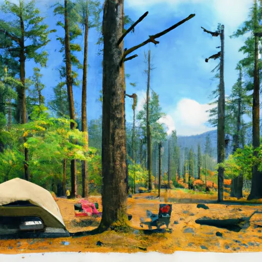
Upper Dant Camp
The campground offers a variety of amenities, including drinking water, vault toilets, and picnic tables. The campground is first-come, first-served, with 17 campsites available for visitors.
One interesting fact about the area is that it is home to a large number of black bears, which can often be seen foraging in the surrounding forests. Visitors are reminded to take precautions when camping in bear country, such as properly storing food and disposing of waste.
The best time to visit Upper Dant Campground is during the summer months, with July and August being the peak season. Average temperatures during this time range from the mid-70s to low 80s during the day, with cool nights in the 50s. However, visitors should be aware that weather conditions can change quickly in the mountains and should come prepared for all types of weather.
What's on-site at Upper Dant Camp
Key facilities Snoflo tracks for this campground. Confirm with the operator before booking -- amenities can change seasonally.
Plan your trip down to the hour
Same weather feed Snoflo's iOS app uses -- updated continuously from NOAA / yr.no.
Next 5 days, hour by hour
Temperature line with weather symbols on top, snow + rain accumulation as columns, humidity as a dotted line.
5-day forecast table
Every 3 hours, broken out across temperature, snow, rain, humidity, and wind. Each cell is colour-coded relative to the column min/max so trends jump out at a glance.
| Time | Condition | Temp (°F) | Snow (in) | Rain (in) | Humidity (%) | Wind (mps) | Wind dir |
|---|---|---|---|---|---|---|---|
| Loading detailed forecast… | |||||||
15-day temperature & precipitation
Daily temperatures, snow, and rain projected over the next two weeks. Hover any point for the full breakdown.
Nearby streamflow
USGS streamgauges within reach of Upper Dant Camp -- pulled live from the National Water Information System.
| Streamgauge | Discharge | View |
|---|---|---|
| Warm Springs River Near Kahneeta Hot Springs | 194 cfs | → |
| Beaver Creek | 31 cfs | → |
| Shitike Creek Near Warm Springs | 38 cfs | → |
| Deschutes River Near Madras | 3,540 cfs | → |
| Shitike Cr | 29 cfs | → |
| Pine Creek Near Clarno | 8 cfs | → |
Nearby snow depths
NRCS SNOTEL stations within reach of Upper Dant Camp -- relevant when planning a shoulder-season or alpine trip.
| SNOTEL station | Snowpack | 24h Snowfall | View |
|---|---|---|---|
| Nohrsc Fifteenmile Snotel | 0.0 in | 0.0 in | → |
| Clear Lake | 0.0 in | 0.0 in | → |
| Nohrsc Clear Lake | 0.0 in | 0.0 in | → |
| Clackamas Lake | 0.0 in | 0.0 in | → |
| Nohrsc Clackamas Lake | 0.0 in | 0.0 in | → |
| Mt. Hood Meadows Base | 13.0 in | 0.0 in | → |
Plan a longer trip
The closest parks, lakes, boat launches, and paddle runs so a camping night can grow into a full weekend.
Parks
- White River Falls State Park
- Lower White River Wilderness
- National Wild And Scenic River White, Oregon
- Warm Springs State Recreation Site
- Wilderness Badger Creek
- National Wild And Scenic River Fifteenmile Creek, Oregon
Boat launches
- Nena Primitive Launch
- Long Bend Primitive North Launch
- Harpham Flat
- Harpham Flat Boat Launch
- Wapanitia Primitive South Launch
- Wapanitia Primitive North Launch
Points of interest
- Maupin Section Foreman's House
- The Incurable Hobbyist
- Wamic Historical Museum
- Shaniko Historic Historic Stage Coach Stop
- Museum At Warm Springs
- Dufur Historical Society
Paddle runs
- Lower Deschutes (Sherars Falls To Columbia River)
- Warm Springs To Sherars Falls
- Salmon River Canyon (Split Falls To Road Access)
- Breitenbush Lake To Confluence With North Fork Breitenbush River
- Timothy Lake Dam To Slackwater Of Harriet Lake
- Confluence Clear And Coe Creeks To Mt. Hood Nf Boundary
Camping essentials & Leave No Trace
- Pack it in, pack it out
- Take all trash, food scraps, and gear back with you to keep campsites clean and protect wildlife.
- Respect wildlife
- Observe animals from a distance, store food securely, and never feed wildlife to maintain natural behavior and safety.
- Know before you go
- Check weather, fire restrictions, trail conditions, and permit requirements to ensure a safe and well-planned trip.
- Minimize campfire impact
- Use established fire rings, keep fires small, fully extinguish them, or opt for a camp stove when fires are restricted.
- Leave what you find
- Preserve natural and cultural features by avoiding removal of plants, rocks, artifacts, or other elements of the environment.
Set push alerts in the Snoflo app
Save Upper Dant Camp as a favorite, set a custom threshold (precipitation, snowpack, freezing temperatures), and the iOS app will push the moment conditions cross.
About Upper Dant Camp
Can I make reservations at Upper Dant Camp?
This campground does not appear to accept reservations -- it's typically first-come, first-served. Arrive early on summer weekends.
How fresh is the weather data on this page?
The hourly forecast updates throughout the day from the NOAA / yr.no public feeds. Streamflow data is pulled live from USGS streamgauges and snowpack from the NRCS SNOTEL network.
What's the best time of year to visit?
Use the 15-day temperature & precipitation outlook on this page to plan -- pick a window with comfortable temperatures and low precipitation. For longer trips, the 5-day hourly meteogram shows snow + rain accumulation hour-by-hour.
How do I get to Upper Dant Camp?
Tap Directions in the hero above to open driving directions in Google Maps, or Open in map to center the Snoflo interactive map on the campground.
Can I get alerts when conditions change?
Yes -- alerts are managed through the Snoflo iOS app. Favorite this campground, set a threshold (temperature, snowpack, precipitation), and you'll get a push the moment it crosses.