Custer Trail - Usfs Campground
Community Reviews
Been here? Share the conditions.
Reviews, ratings & photos are added in the free Snoflo iOS app — rate a spot, tag the conditions, and your visit is verified by location. Add or manage your reviews from the app.
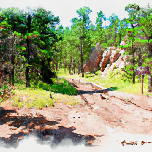
Custer Trail - Usfs
Reservations for campsites at Custer Trail are not accepted. The campground operates on a first-come, first-served basis, so it is recommended to arrive early to secure a spot, especially during peak seasons.
The best time to visit Custer Trail is during the warmer months of late spring, summer, and early fall. South Dakota experiences a continental climate, with hot summers and cold winters. Visitors can expect pleasant temperatures and clear skies during these seasons, allowing for enjoyable camping and exploration of the surrounding natural beauty.
While camping at Custer Trail, campers should be cautious of wildlife encounters, as the area is known for its diverse wildlife population. It is advisable to store food securely and respect the natural habitat. Additionally, bringing insect repellent is recommended, as mosquitoes can be prevalent in some areas. Overall, Custer Trail offers a serene and well-equipped camping experience for nature enthusiasts seeking to explore the beauty of South Dakota.
What's on-site at Custer Trail - Usfs
Key facilities Snoflo tracks for this campground. Confirm with the operator before booking -- amenities can change seasonally.
Plan your trip down to the hour
Same weather feed Snoflo's iOS app uses -- updated continuously from NOAA / yr.no.
Next 5 days, hour by hour
Temperature line with weather symbols on top, snow + rain accumulation as columns, humidity as a dotted line.
5-day forecast table
Every 3 hours, broken out across temperature, snow, rain, humidity, and wind. Each cell is colour-coded relative to the column min/max so trends jump out at a glance.
| Time | Condition | Temp (°F) | Snow (in) | Rain (in) | Humidity (%) | Wind (mps) | Wind dir |
|---|---|---|---|---|---|---|---|
| Loading detailed forecast… | |||||||
15-day temperature & precipitation
Daily temperatures, snow, and rain projected over the next two weeks. Hover any point for the full breakdown.
Other campgrounds in the area
Snoflo-tracked campsites within driving distance of Custer Trail - Usfs, with reservations status.
| Campground | Reservations | Toilets | View |
|---|---|---|---|
| Custer Trail | ✗ | ✓ | → |
| Deerfield | ✗ | ✗ | → |
| Dutchman - Usfs | ✗ | ✓ | → |
| Whitetail Campground | ✗ | ✗ | → |
| Dutchman | ✓ | ✓ | → |
Nearby streamflow
USGS streamgauges within reach of Custer Trail - Usfs -- pulled live from the National Water Information System.
| Streamgauge | Discharge | View |
|---|---|---|
| Castle Cr Below Deerfield Dam Sd | 11 cfs | → |
| Castle Cr Above Deerfield Res Near Hill City Sd | 9 cfs | → |
| Rhoads Fork Near Rochford Sd | 5 cfs | → |
| Rapid Cr Above Pactola Res At Silver City | 17 cfs | → |
| Beaver Creek At Mallo Camp | 3 cfs | → |
| Rapid Cr Below Pactola Dam Sd | 64 cfs | → |
Nearby snow depths
NRCS SNOTEL stations within reach of Custer Trail - Usfs -- relevant when planning a shoulder-season or alpine trip.
| SNOTEL station | Snowpack | 24h Snowfall | View |
|---|---|---|---|
| Nohrsc Blind Park (Snotel) | 0.0 in | 0.0 in | → |
| Blind Park | 0.0 in | 0.0 in | → |
| Nohrsc North Rapid Creek (Snotel) | 0.0 in | 0.0 in | → |
| Hill City | 0.0 in | 0.0 in | → |
| North Rapid Creek | 0.0 in | 0.0 in | → |
| Lead 5.5 Ssw | 0.0 in | 0.0 in | → |
Plan a longer trip
The closest parks, lakes, boat launches, and paddle runs so a camping night can grow into a full weekend.
Parks
- Black Hills National Forest
- Mount Rushmore National Memorial
- Jewel Cave National Monument
- Wilderness Black Elk
- Seventy-Six Sports Complex
- Canyon Lake Park
Boat launches
- Deerfield - Custer Crossing Public Water Access
- Deerfield Cove Road Pennington County
- Jenney Gulch Picnic Area Fishing Access
- Fsr 450 Pennington County
- Pactola South Public Water Access
- Pennington County
Camping essentials & Leave No Trace
- Pack it in, pack it out
- Take all trash, food scraps, and gear back with you to keep campsites clean and protect wildlife.
- Respect wildlife
- Observe animals from a distance, store food securely, and never feed wildlife to maintain natural behavior and safety.
- Know before you go
- Check weather, fire restrictions, trail conditions, and permit requirements to ensure a safe and well-planned trip.
- Minimize campfire impact
- Use established fire rings, keep fires small, fully extinguish them, or opt for a camp stove when fires are restricted.
- Leave what you find
- Preserve natural and cultural features by avoiding removal of plants, rocks, artifacts, or other elements of the environment.
Set push alerts in the Snoflo app
Save Custer Trail - Usfs as a favorite, set a custom threshold (precipitation, snowpack, freezing temperatures), and the iOS app will push the moment conditions cross.
About Custer Trail - Usfs
Can I make reservations at Custer Trail - Usfs?
This campground does not appear to accept reservations -- it's typically first-come, first-served. Arrive early on summer weekends.
How fresh is the weather data on this page?
The hourly forecast updates throughout the day from the NOAA / yr.no public feeds. Streamflow data is pulled live from USGS streamgauges and snowpack from the NRCS SNOTEL network.
What's the best time of year to visit?
Use the 15-day temperature & precipitation outlook on this page to plan -- pick a window with comfortable temperatures and low precipitation. For longer trips, the 5-day hourly meteogram shows snow + rain accumulation hour-by-hour.
How do I get to Custer Trail - Usfs?
Tap Directions in the hero above to open driving directions in Google Maps, or Open in map to center the Snoflo interactive map on the campground.
Can I get alerts when conditions change?
Yes -- alerts are managed through the Snoflo iOS app. Favorite this campground, set a threshold (temperature, snowpack, precipitation), and you'll get a push the moment it crosses.
Other campgrounds near here
Snoflo-tracked campgrounds within driving distance of Custer Trail - Usfs.