Campground: Moss Creek Campground
Community Reviews
Been here? Share the conditions.
Reviews, ratings & photos are added in the free Snoflo iOS app — rate a spot, tag the conditions, and your visit is verified by location. Add or manage your reviews from the app.
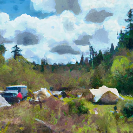
Campground: Moss Creek
Reservations are accepted at Moss Creek camping area, which is great for those who prefer to plan their trips in advance. This ensures that campers have a guaranteed spot, especially during peak seasons, when the campground tends to be quite popular. It is recommended to book early to secure a site.
The best time to visit Moss Creek camping area is during the summer months when the weather is mild and pleasant. The campground offers opportunities for hiking, fishing, and wildlife spotting, making it an ideal destination for outdoor enthusiasts. However, it is important to be cautious of the local wildlife, such as bears, and to properly store food to avoid any unwanted encounters. Overall, Moss Creek camping area provides a peaceful and enjoyable camping experience amidst the picturesque surroundings of Washington state.
What's on-site at Campground: Moss Creek
Key facilities Snoflo tracks for this campground. Confirm with the operator before booking -- amenities can change seasonally.
Plan your trip down to the hour
Same weather feed Snoflo's iOS app uses -- updated continuously from NOAA / yr.no.
Next 5 days, hour by hour
Temperature line with weather symbols on top, snow + rain accumulation as columns, humidity as a dotted line.
5-day forecast table
Every 3 hours, broken out across temperature, snow, rain, humidity, and wind. Each cell is colour-coded relative to the column min/max so trends jump out at a glance.
| Time | Condition | Temp (°F) | Snow (in) | Rain (in) | Humidity (%) | Wind (mps) | Wind dir |
|---|---|---|---|---|---|---|---|
| Loading detailed forecast… | |||||||
15-day temperature & precipitation
Daily temperatures, snow, and rain projected over the next two weeks. Hover any point for the full breakdown.
Other campgrounds in the area
Snoflo-tracked campsites within driving distance of Campground: Moss Creek, with reservations status.
| Campground | Reservations | Toilets | View |
|---|---|---|---|
| Moss Creek | ✓ | ✓ | → |
| Big Cedars Campground | ✗ | ✗ | → |
| Campground: Oklahoma | ✓ | ✗ | → |
| Oklahoma Campground | ✗ | ✗ | → |
| Oklahoma | ✓ | ✓ | → |
Nearby streamflow
USGS streamgauges within reach of Campground: Moss Creek -- pulled live from the National Water Information System.
| Streamgauge | Discharge | View |
|---|---|---|
| White Salmon River Near Underwood | 527 cfs | → |
| Hood River At Tucker Bridge | 220 cfs | → |
| Mosier Creek Near Mosier | 1 cfs | → |
| Klickitat River Near Pitt | 767 cfs | → |
| Lewis River Above Muddy River Near Cougar | 257 cfs | → |
| Bull Run River At Lower Flume Nr Brightwood | 20 cfs | → |
Nearby snow depths
NRCS SNOTEL stations within reach of Campground: Moss Creek -- relevant when planning a shoulder-season or alpine trip.
| SNOTEL station | Snowpack | 24h Snowfall | View |
|---|---|---|---|
| Hood River | 0.0 in | 0.0 in | → |
| Greenpoint | 0.0 in | 0.0 in | → |
| Nohrsc Greenpoint | 0.0 in | 0.0 in | → |
| Snowden | 0.0 in | 0.0 in | → |
| Cascade Locks | 0.0 in | 0.0 in | → |
| Trout Lake 0.8 Ssw | 0.0 in | 0.0 in | → |
Plan a longer trip
The closest parks, lakes, boat launches, and paddle runs so a camping night can grow into a full weekend.
Parks
- Big Cedars County Park
- Gifford Pinchot National Forest
- Viento State Park
- Vincenz Lausmann Memorial State Natural Area
- Seneca Fouts Memorial State Natural Area
- Wygant State Natural Area
Boat launches
- Drano Lake
- Northwestern Park
- Lewis And Clark Trail Highway Skamania County
- Husum Boating Site
- Port Of Hood River Marina Park
- Old Hatchery Road (Wind River)
Points of interest
- Dog Creek Falls Observation Site
- Wet Planet Rafting
- Gallery At Columbia Center For The Arts
- Little Huckleberry Trail No 47 Trailhead
- Dylan Martinez Glass Studio
- Hood River Bridge
Paddle runs
- Hemlock Road Bridge To Gifford Pinchot Nf Boundary
- Headwaters In Sw1/4 Of Sec 13, T6n, R7e To Hemlock Road Bridge In Nw1/4 Of Sec 26, T4n, R7e
- Confluence Clear And Coe Creeks To Mt. Hood Nf Boundary
- Mt. Adams Wilderness Boundary To Gifford Pinchot Nf Boundary
- Confluence With Smith Creek To Confluence With Lewis River
- Gifford Pinchot Nf Boundary To Maximum Pool Of Swift Reservoir In Nw1/4 Of Sec 35, T7n, R6e
Camping essentials & Leave No Trace
- Pack it in, pack it out
- Take all trash, food scraps, and gear back with you to keep campsites clean and protect wildlife.
- Respect wildlife
- Observe animals from a distance, store food securely, and never feed wildlife to maintain natural behavior and safety.
- Know before you go
- Check weather, fire restrictions, trail conditions, and permit requirements to ensure a safe and well-planned trip.
- Minimize campfire impact
- Use established fire rings, keep fires small, fully extinguish them, or opt for a camp stove when fires are restricted.
- Leave what you find
- Preserve natural and cultural features by avoiding removal of plants, rocks, artifacts, or other elements of the environment.
Set push alerts in the Snoflo app
Save Campground: Moss Creek as a favorite, set a custom threshold (precipitation, snowpack, freezing temperatures), and the iOS app will push the moment conditions cross.
About Campground: Moss Creek
Can I make reservations at Campground: Moss Creek?
Yes -- this campground accepts reservations. Snoflo recommends booking early for peak season; check the operator (Recreation.gov / state park system / private operator) for the booking window and cancellation policy.
How fresh is the weather data on this page?
The hourly forecast updates throughout the day from the NOAA / yr.no public feeds. Streamflow data is pulled live from USGS streamgauges and snowpack from the NRCS SNOTEL network.
What's the best time of year to visit?
Use the 15-day temperature & precipitation outlook on this page to plan -- pick a window with comfortable temperatures and low precipitation. For longer trips, the 5-day hourly meteogram shows snow + rain accumulation hour-by-hour.
How do I get to Campground: Moss Creek?
Tap Directions in the hero above to open driving directions in Google Maps, or Open in map to center the Snoflo interactive map on the campground.
Can I get alerts when conditions change?
Yes -- alerts are managed through the Snoflo iOS app. Favorite this campground, set a threshold (temperature, snowpack, precipitation), and you'll get a push the moment it crosses.
Other campgrounds near here
Snoflo-tracked campgrounds within driving distance of Campground: Moss Creek.