Klapatche Park Camp Campground
Community Reviews
Been here? Share the conditions.
Reviews, ratings & photos are added in the free Snoflo iOS app — rate a spot, tag the conditions, and your visit is verified by location. Add or manage your reviews from the app.
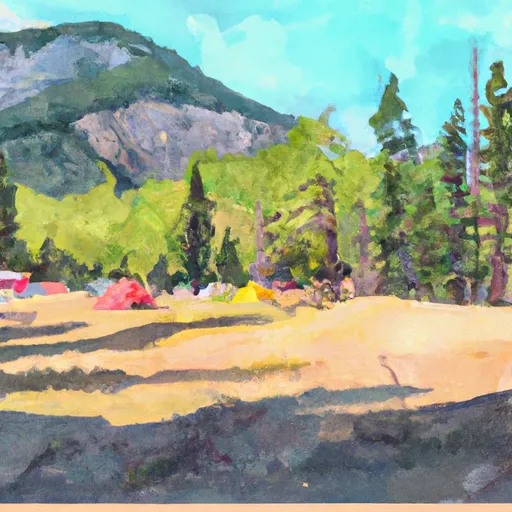
Klapatche Park Camp
Reservations are accepted for Klapatche Park Camp and can be made through the Mount Rainier National Park website. This ensures that campers have a guaranteed spot, especially during peak seasons. The best time to visit this camping area is typically from late spring to early fall when the weather is milder and the landscape is in full bloom. It is important to check for any road closures or weather advisories before planning a trip to Klapatche Park Camp.
While enjoying the beauty of the camping area, visitors should be cautious of wildlife encounters, particularly bears. Proper food storage techniques, such as using bear-resistant containers, are strongly recommended to prevent any unwanted interactions. Additionally, it is essential to adhere to Leave No Trace principles and be respectful of the natural environment, ensuring that the camping area remains pristine for future visitors. With its stunning scenery and peaceful ambiance, Klapatche Park Camp is a must-visit destination for nature enthusiasts seeking a memorable camping experience in Washington State.
What's on-site at Klapatche Park Camp
Key facilities Snoflo tracks for this campground. Confirm with the operator before booking -- amenities can change seasonally.
Plan your trip down to the hour
Same weather feed Snoflo's iOS app uses -- updated continuously from NOAA / yr.no.
Next 5 days, hour by hour
Temperature line with weather symbols on top, snow + rain accumulation as columns, humidity as a dotted line.
5-day forecast table
Every 3 hours, broken out across temperature, snow, rain, humidity, and wind. Each cell is colour-coded relative to the column min/max so trends jump out at a glance.
| Time | Condition | Temp (°F) | Snow (in) | Rain (in) | Humidity (%) | Wind (mps) | Wind dir |
|---|---|---|---|---|---|---|---|
| Loading detailed forecast… | |||||||
15-day temperature & precipitation
Daily temperatures, snow, and rain projected over the next two weeks. Hover any point for the full breakdown.
Other campgrounds in the area
Snoflo-tracked campsites within driving distance of Klapatche Park Camp, with reservations status.
| Campground | Reservations | Toilets | View |
|---|---|---|---|
| North Puyallup River Camp | ✓ | ✗ | → |
| South Puyallup River Camp | ✓ | ✗ | → |
| Golden Lakes Camp | ✓ | ✗ | → |
| Devil's Dream Camp | ✓ | ✗ | → |
| Camp Hazard | ✓ | ✗ | → |
Nearby streamflow
USGS streamgauges within reach of Klapatche Park Camp -- pulled live from the National Water Information System.
| Streamgauge | Discharge | View |
|---|---|---|
| Puyallup River Near Electron | 571 cfs | → |
| Nisqually River Near National | 634 cfs | → |
| Mineral Creek Near Mineral | 31 cfs | → |
| Carbon River Near Fairfax | 410 cfs | → |
| Cowlitz River At Packwood | 593 cfs | → |
| Ohop Creek Near Eatonville | 4 cfs | → |
Nearby snow depths
NRCS SNOTEL stations within reach of Klapatche Park Camp -- relevant when planning a shoulder-season or alpine trip.
| SNOTEL station | Snowpack | 24h Snowfall | View |
|---|---|---|---|
| Paradise | 0.0 in | 0.0 in | → |
| Nohrsc Paradise | 0.0 in | 0.0 in | → |
| Paradise | 5.9 in | 0.0 in | → |
| Rainier Paradise Ranger Stn | 0.0 in | 0.0 in | → |
| Mowich | 0.0 in | 0.0 in | → |
| Skate Creek | 0.0 in | 0.0 in | → |
Plan a longer trip
The closest parks, lakes, boat launches, and paddle runs so a camping night can grow into a full weekend.
Parks
- Wilderness Glacier View
- Wilderness Clearwater
- Mount Rainier National Park
- Wilderness Tatoosh
- Rimrock County Park
- Van Eaton Park
Boat launches
- Lion's Den Park
- Mineral Lake
- Rocky Point Recreation Area
- Orville Road East 29517, Orting
- Orville Road East 39200-41144, Eatonville
- Benbow Resort
Points of interest
- Gobbler's Knob Fire Lookout
- Transportation Exhibit
- Longmire Museum
- Mowich Lake Ranger Station
- Nisqually Vista
- Tolmie Peak Lookout
Paddle runs
- Headwaters In The Mystic Lake Basin On The North Side Of Mount Rainier To Northern Boundary Of Mount Rainier National Park
- Headwaters On The Nw Slope Of Mount Rainier At Carbon Glacier To Confluence With Ipsut Creek
- Headwaters At The Terminus Of The Ingraham Glacier To Ends 1/4 Mile North Of Box Canyon
- Confluence With Ipsut Creek To Western Boundary Of Mount Rainier National Park
- Headwaters On The Southeast Flank Of Mount Rainier At An Elevation Of 5500 Ft To Confluence With Chinook Creek
- Begins 1/4 Mile South Of Box Canyon To Southern Boundary Of Mount Rainier National Park
Camping essentials & Leave No Trace
- Pack it in, pack it out
- Take all trash, food scraps, and gear back with you to keep campsites clean and protect wildlife.
- Respect wildlife
- Observe animals from a distance, store food securely, and never feed wildlife to maintain natural behavior and safety.
- Know before you go
- Check weather, fire restrictions, trail conditions, and permit requirements to ensure a safe and well-planned trip.
- Minimize campfire impact
- Use established fire rings, keep fires small, fully extinguish them, or opt for a camp stove when fires are restricted.
- Leave what you find
- Preserve natural and cultural features by avoiding removal of plants, rocks, artifacts, or other elements of the environment.
Set push alerts in the Snoflo app
Save Klapatche Park Camp as a favorite, set a custom threshold (precipitation, snowpack, freezing temperatures), and the iOS app will push the moment conditions cross.
About Klapatche Park Camp
Can I make reservations at Klapatche Park Camp?
Yes -- this campground accepts reservations. Snoflo recommends booking early for peak season; check the operator (Recreation.gov / state park system / private operator) for the booking window and cancellation policy.
How fresh is the weather data on this page?
The hourly forecast updates throughout the day from the NOAA / yr.no public feeds. Streamflow data is pulled live from USGS streamgauges and snowpack from the NRCS SNOTEL network.
What's the best time of year to visit?
Use the 15-day temperature & precipitation outlook on this page to plan -- pick a window with comfortable temperatures and low precipitation. For longer trips, the 5-day hourly meteogram shows snow + rain accumulation hour-by-hour.
How do I get to Klapatche Park Camp?
Tap Directions in the hero above to open driving directions in Google Maps, or Open in map to center the Snoflo interactive map on the campground.
Can I get alerts when conditions change?
Yes -- alerts are managed through the Snoflo iOS app. Favorite this campground, set a threshold (temperature, snowpack, precipitation), and you'll get a push the moment it crosses.
Other campgrounds near here
Snoflo-tracked campgrounds within driving distance of Klapatche Park Camp.