

-
 Snoflo Premium
Get unlimited access to all our content
With no Ad interruptions! - Start Your Free Trial Login with existing account
Ten-Sleep
Eden Index
Climate
7.2
•
Recreation
2.8
•
Community
•
Safeguard
3.8/10
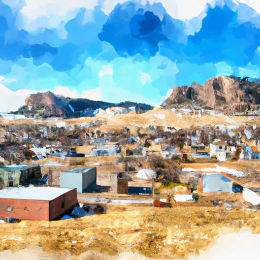
Ten Sleep is a small town located in Washakie County, Wyoming. It is nestled in the foothills of the Bighorn Mountains and offers a picturesque setting with an elevation of approximately 4,000 feet. The climate in Ten Sleep is semi-arid, characterized by hot summers and cold winters. Average temperatures range from 20°F (-7°C) in winter to 85°F (29°C) in summer. The area receives around 12 inches of precipitation annually, with most of it falling as snow during the winter months.
Hydrologically, Ten Sleep is known for its pristine water sources. The town is surrounded by clear mountain streams and rivers, including the Ten Sleep Creek, which flows through the heart of the town. These water sources provide excellent fishing opportunities for trout enthusiasts.
Outdoor recreation is abundant in Ten Sleep, attracting visitors from across the region. The Bighorn Mountains offer numerous hiking trails, rock climbing routes, and camping spots. Ten Sleep Canyon, located just outside the town, is a popular destination for climbers, with over 500 routes available. Additionally, the area is renowned for its excellent hunting and off-roading opportunities, with miles of trails and vast open spaces to explore. Whether you enjoy fishing, hiking, climbing, or simply immersing yourself in nature, Ten Sleep provides a wealth of outdoor recreation opportunities.
What is the Eden Index?
The Snoflo Eden Index serves as a comprehensive rating system for regions, evaluating their desirability through a holistic assessment of climate health, outdoor recreation opportunities, and natural disaster risk, acknowledging the profound impact of these factors on livability and well-being.
Climate Health Indicator (CHI): 7.2
Ten-Sleep receives approximately
323mm of rain per year,
with humidity levels near 61%
and air temperatures averaging around
7°C.
Ten-Sleep has a plant hardyness factor of
4, meaning
plants and agriculture in this region thrive during a short period during spring and early summer. Most
plants will die off during the colder winter months.
By considering the ideal temperature range, reliable water supplies, clean air, and stable seasonal rain or snowpacks, the Climate Health Indicator (CHI) underscores the significance of a healthy climate as the foundation for quality living.
A healthy climate is paramount for ensuring a high quality of life and livability in a region, fostering both physical well-being and environmental harmony. This can be characterized by ideal temperatures, reliable access to water supplies, clean air, and consistent seasonal rain or snowpacks.
Weather Forecast
Streamflow Conditions
Big Horn
Area Rivers
Big Horn
Snowpack Depths
Big Horn
Reservoir Storage Capacity
Big Horn
Groundwater Levels
Recreational Opportunity Index (ROI): 2.8
The Recreational Opportunity Index (ROI) recognizes the value of outdoor recreational options, such as parks, hiking trails, camping sites, and fishing spots, while acknowledging that climate plays a pivotal role in ensuring the comfort and consistency of these experiences.
Access to outdoor recreational opportunities, encompassing activities such as parks, hiking, camping, and fishing, is crucial for overall well-being, and the climate plays a pivotal role in enabling and enhancing these experiences, ensuring that individuals can engage in nature-based activities comfortably and consistently.
Camping Areas
| Campground | Campsites | Reservations | Toilets | Showers | Elevation |
|---|---|---|---|---|---|
| Deer Park | 7 | 8,903 ft | |||
| Tensleep Creek | 5 | 5,480 ft | |||
| Sitting Bull | 43 | 8,657 ft | |||
| Boulder Park | 28 | 7,981 ft | |||
| West Tensleep Lake | 10 | 9,089 ft | |||
| Leigh Creek | 11 | 5,354 ft | |||
| Bull Creek | 10 | 8,556 ft | |||
| Medicine Lodge Archaeological Site | 25 | 4,798 ft | |||
| Lake View | 25 | 8,547 ft | |||
| Island Park | 10 | 8,536 ft |
Nearby Fishing
Nearby Ski Areas
Catastrophe Safeguard Index (CSI):
The Catastrophe Safeguard Index (CSI) recognizes that natural disaster risk, encompassing floods, fires, hurricanes, and tornadoes, can drastically affect safety and the overall appeal of an area.
The level of natural disaster risk in a region significantly affects safety and the overall livability, with climate change amplifying these risks by potentially increasing the frequency and intensity of events like floods, fires, hurricanes, and tornadoes, thereby posing substantial challenges to community resilience and well-being.
Community Resilience Indicator (CRI):
The Community Resilience Indicator (CRI) recognizes that education, healthcare, and socioeconomics are crucial to the well-being of a region. The CRI acknowledges the profound impact of these elements on residents' overall quality of life. By evaluating educational resources, healthcare accessibility, and economic inclusivity, the index captures the essential aspects that contribute to a thriving community, fostering resident satisfaction, equity, and social cohesion.