

-
 Snoflo Premium
Get unlimited access to all our content
With no Ad interruptions! - Start Your Free Trial Login with existing account
Tie-Siding
Eden Index
Climate
6.8
•
Recreation
3.0
•
Community
•
Safeguard
3.8/10
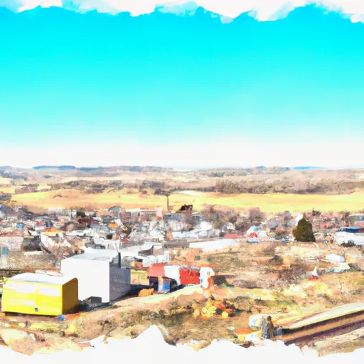
Tie Siding is a small unincorporated community located in southeastern Wyoming, United States. It is situated in Albany County and is known for its scenic beauty and abundance of outdoor recreation opportunities. The climate in Tie Siding is characterized by long, cold winters and short, mild summers. Average temperatures range from around 20°F (-6°C) in winter to 75°F (24°C) in summer.
The hydrology constituents in Tie Siding include the Laramie River, which flows nearby and provides a water source for various outdoor activities. This river is popular for fishing, particularly for trout, and offers opportunities for boating and canoeing.
As for outdoor recreation, Tie Siding is a haven for nature enthusiasts. The surrounding area boasts numerous hiking and biking trails, allowing visitors to explore the breathtaking landscapes and enjoy the fresh mountain air. There are also opportunities for camping and wildlife viewing, with the nearby Medicine Bow National Forest providing ample space for outdoor adventures.
In conclusion, Tie Siding, Wyoming offers a picturesque setting with a diverse range of outdoor recreation opportunities, making it an ideal destination for nature lovers and outdoor enthusiasts.
What is the Eden Index?
The Snoflo Eden Index serves as a comprehensive rating system for regions, evaluating their desirability through a holistic assessment of climate health, outdoor recreation opportunities, and natural disaster risk, acknowledging the profound impact of these factors on livability and well-being.
Climate Health Indicator (CHI): 6.8
Tie-Siding receives approximately
473mm of rain per year,
with humidity levels near 61%
and air temperatures averaging around
6°C.
Tie-Siding has a plant hardyness factor of
4, meaning
plants and agriculture in this region thrive during a short period during spring and early summer. Most
plants will die off during the colder winter months.
By considering the ideal temperature range, reliable water supplies, clean air, and stable seasonal rain or snowpacks, the Climate Health Indicator (CHI) underscores the significance of a healthy climate as the foundation for quality living.
A healthy climate is paramount for ensuring a high quality of life and livability in a region, fostering both physical well-being and environmental harmony. This can be characterized by ideal temperatures, reliable access to water supplies, clean air, and consistent seasonal rain or snowpacks.
Weather Forecast
Streamflow Conditions
South Platte
Area Rivers
South Platte
Snowpack Depths
South Platte
Reservoir Storage Capacity
South Platte
Groundwater Levels
Recreational Opportunity Index (ROI): 3.0
The Recreational Opportunity Index (ROI) recognizes the value of outdoor recreational options, such as parks, hiking trails, camping sites, and fishing spots, while acknowledging that climate plays a pivotal role in ensuring the comfort and consistency of these experiences.
Access to outdoor recreational opportunities, encompassing activities such as parks, hiking, camping, and fishing, is crucial for overall well-being, and the climate plays a pivotal role in enabling and enhancing these experiences, ensuring that individuals can engage in nature-based activities comfortably and consistently.
Camping Areas
| Campground | Campsites | Reservations | Toilets | Showers | Elevation |
|---|---|---|---|---|---|
| Pinewood Reservoir | 22 | 6,604 ft | |||
| Meadow Park | None | 5,349 ft | |||
| Moraine Park | None | 8,111 ft | |||
| Tom Bennett | 10 | 8,963 ft | |||
| Longs Peak - Rocky Mountain National Park | 26 | 9,397 ft | |||
| Meeker Park Overflow | 29 | 8,611 ft | |||
| Glacier Basin - Rocky Mountain National Park | 150 | 8,604 ft | |||
| Hermit Park Open Space | None | 8,313 ft | |||
| Aspenglen - Rocky Mountain National Park | 51 | 8,227 ft | |||
| Marys Lake - USBR | 270 | 8,032 ft |
Nearby Ski Areas
Catastrophe Safeguard Index (CSI):
The Catastrophe Safeguard Index (CSI) recognizes that natural disaster risk, encompassing floods, fires, hurricanes, and tornadoes, can drastically affect safety and the overall appeal of an area.
The level of natural disaster risk in a region significantly affects safety and the overall livability, with climate change amplifying these risks by potentially increasing the frequency and intensity of events like floods, fires, hurricanes, and tornadoes, thereby posing substantial challenges to community resilience and well-being.
Community Resilience Indicator (CRI):
The Community Resilience Indicator (CRI) recognizes that education, healthcare, and socioeconomics are crucial to the well-being of a region. The CRI acknowledges the profound impact of these elements on residents' overall quality of life. By evaluating educational resources, healthcare accessibility, and economic inclusivity, the index captures the essential aspects that contribute to a thriving community, fostering resident satisfaction, equity, and social cohesion.