

-
 Snoflo Premium
Get unlimited access to all our content
With no Ad interruptions! - Start Your Free Trial Login with existing account
Whittier
Eden Index
Climate
9.3
•
Recreation
3.6
•
Community
3.0
•
Safeguard
5.7/10
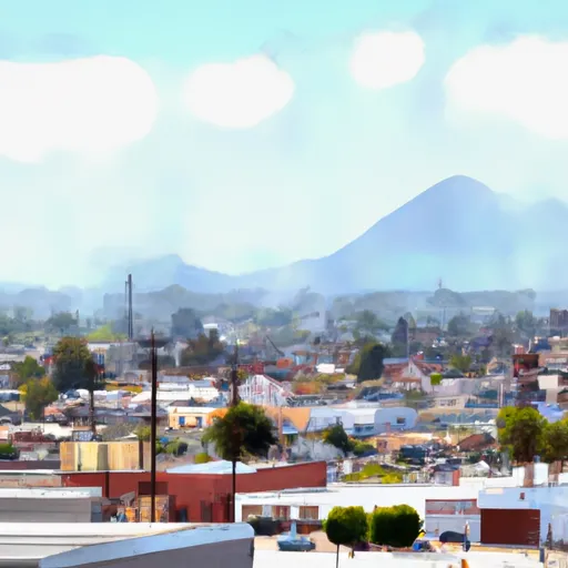
Whittier, California, located in Los Angeles County, offers a Mediterranean climate characterized by warm, dry summers and mild, damp winters. Summers are typically sunny and hot, with average temperatures in the high 80s to low 90s Fahrenheit. Winters are cooler, with average temperatures ranging from the mid-60s to low 70s. The city experiences minimal rainfall, receiving about 14 inches per year, primarily during the winter months.
Hydrologically, Whittier is situated in the San Gabriel Valley and benefits from the underlying groundwater basin. The groundwater is sourced from local rainfall and imported water supplies, which are managed by the Central Basin Municipal Water District.
Outdoor enthusiasts can enjoy various recreational opportunities in and around Whittier. The city is home to numerous parks and trails, such as Turnbull Canyon, Sycamore Canyon Park, and the Whittier Greenway Trail. These offer opportunities for hiking, biking, and picnicking. Nearby, the Whittier Narrows Recreation Area provides additional outdoor activities like fishing, birdwatching, and boating. Additionally, golfers can visit the Whittier Narrows Golf Course, which offers a challenging 27-hole layout. Overall, Whittier offers a pleasant climate, access to water resources, and a range of outdoor activities for residents and visitors alike.
What is the Eden Index?
The Snoflo Eden Index serves as a comprehensive rating system for regions, evaluating their desirability through a holistic assessment of climate health, outdoor recreation opportunities, and natural disaster risk, acknowledging the profound impact of these factors on livability and well-being.
Climate Health Indicator (CHI): 9.3
Whittier receives approximately
407mm of rain per year,
with humidity levels near 58%
and air temperatures averaging around
19°C.
Whittier has a plant hardyness factor of
10, meaning
plants and agriculture in this region tend to thrive here all year round.
By considering the ideal temperature range, reliable water supplies, clean air, and stable seasonal rain or snowpacks, the Climate Health Indicator (CHI) underscores the significance of a healthy climate as the foundation for quality living.
A healthy climate is paramount for ensuring a high quality of life and livability in a region, fostering both physical well-being and environmental harmony. This can be characterized by ideal temperatures, reliable access to water supplies, clean air, and consistent seasonal rain or snowpacks.
Weather Forecast
Streamflow Conditions
Ventura-San Gabriel Coastal
Area Rivers
Ventura-San Gabriel Coastal
Snowpack Depths
Ventura-San Gabriel Coastal
Reservoir Storage Capacity
Ventura-San Gabriel Coastal
Groundwater Levels
Recreational Opportunity Index (ROI): 3.6
The Recreational Opportunity Index (ROI) recognizes the value of outdoor recreational options, such as parks, hiking trails, camping sites, and fishing spots, while acknowledging that climate plays a pivotal role in ensuring the comfort and consistency of these experiences.
Access to outdoor recreational opportunities, encompassing activities such as parks, hiking, camping, and fishing, is crucial for overall well-being, and the climate plays a pivotal role in enabling and enhancing these experiences, ensuring that individuals can engage in nature-based activities comfortably and consistently.
Camping Areas
| Campground | Campsites | Reservations | Toilets | Showers | Elevation |
|---|---|---|---|---|---|
| Millard | 5 | 1,980 ft | |||
| Chino Hills - State Park | 20 | 480 ft | |||
| Seabreeze at Seal Beach Military | None | 15 ft | |||
| Glenn Camp | 8 | 2,095 ft | |||
| Devore | 6 | 2,914 ft | |||
| Sunset Vista RV Park | None | 19 ft | |||
| Crystal Cove State Park - Moro Campground | 57 | 126 ft | |||
| Bolsa Chica State Beach | 57 | 12 ft | |||
| Los Alamitos Army Military | None | 25 ft | |||
| Gould Mesa | 7 | 1,418 ft |
Catastrophe Safeguard Index (CSI):
The Catastrophe Safeguard Index (CSI) recognizes that natural disaster risk, encompassing floods, fires, hurricanes, and tornadoes, can drastically affect safety and the overall appeal of an area.
The level of natural disaster risk in a region significantly affects safety and the overall livability, with climate change amplifying these risks by potentially increasing the frequency and intensity of events like floods, fires, hurricanes, and tornadoes, thereby posing substantial challenges to community resilience and well-being.
Community Resilience Indicator (CRI): 3.0
The Community Resilience Indicator (CRI) recognizes that education, healthcare, and socioeconomics are crucial to the well-being of a region. The CRI acknowledges the profound impact of these elements on residents' overall quality of life. By evaluating educational resources, healthcare accessibility, and economic inclusivity, the index captures the essential aspects that contribute to a thriving community, fostering resident satisfaction, equity, and social cohesion.