Santa Ynez Lake fishing
As of July 15, 2026, the nearest streamgauge to Santa Ynez Lake — Los Angeles R A Sepulveda Dam Ca — reports 32 cfs. Source: USGS gauge data, refreshed throughout the day.
Community Reviews
Been here? Share the conditions.
Reviews, ratings & photos are added in the free Snoflo iOS app — rate a spot, tag the conditions, and your visit is verified by location. Add or manage your reviews from the app.
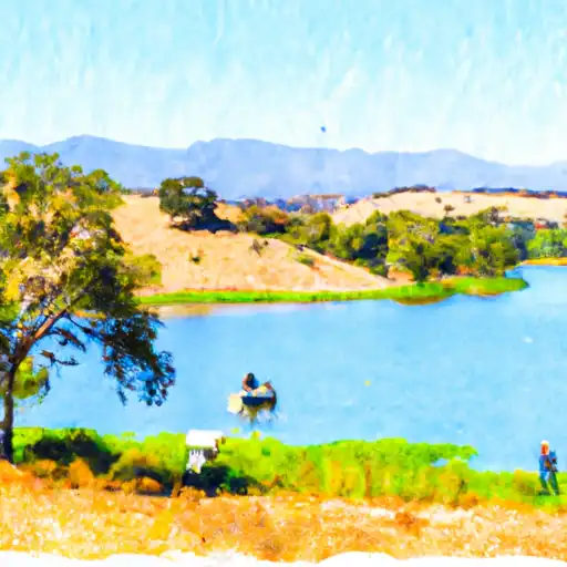
Santa Ynez Lake
What's biting at Santa Ynez Lake
Species commonly reported here -- tap any card for techniques, target seasons, and other waters where it's been caught.
Plan your trip down to the hour
Same weather feed Snoflo's iOS app uses -- updated continuously from NOAA / yr.no.
Next 5 days, hour by hour
Temperature line with weather symbols on top, snow + rain accumulation as columns, humidity as a dotted line.
5-day forecast table
Every 3 hours, broken out across temperature, snow, rain, humidity, and wind. Each cell is colour-coded relative to the column min/max so trends jump out at a glance.
| Time | Condition | Temp (°F) | Snow (in) | Rain (in) | Humidity (%) | Wind (mps) | Wind dir |
|---|---|---|---|---|---|---|---|
| Loading detailed forecast… | |||||||
15-day temperature & precipitation
Daily temperatures, snow, and rain projected over the next two weeks. Hover any point for the full breakdown.
Nearby streamflow
USGS streamgauges within reach of Santa Ynez Lake -- updated continuously from the National Water Information System.
| Streamgauge | Discharge | View |
|---|---|---|
| Los Angeles R A Sepulveda Dam Ca | 32 cfs | → |
| Big Tujunga C Bl Hansen Dam Ca | · | → |
| Arroyo Seco Nr Pasadena Ca | 1 cfs | → |
| Rio Hondo Bl Whittier Narrows Dam Ca | · | → |
| Santa Clara R Nr Piru Ca | 38 cfs | → |
| Rio Hondo Ab Whittier Narrows Dam Ca | 1 cfs | → |
Plan a longer trip
The closest campgrounds, parks, boat launches, and reservoirs so a fishing run can grow into a weekend.
Campgrounds
- Musch Hike-In Camp
- Musch Ranch Hike-In
- Malibu Creek Group Walk-In
- Malibu Creek Family
- Malibu Creek - State Park
- Dockweiler Beach Rv
Parks
- Topanga State Park
- Almar Plaza
- Santa Ynez Canyon Park
- Asilomar Park
- Temescal Canyon Parks
- Temescal Gateway Park
Reservoirs
Boat launches
- California Yacht Club
- Lighthouse Yacht Landing
- Al Larson Marina
- Los Angeles Harbor
- Long Beach Marine Bureau (South Shore)
- Granada Launch Ramp - Long Beach
Points of interest
- Thelma Todd Landmark Building
- Bruce Lurie Gallery
- Long Wharf In Santa Monica
- Eames House
- Case Study House #9
- Maison Johnny Halliday
Paddle runs
- Headwaters In The Santa Monica Mountains To Mouth At Pacific Ocean
- West Fork - Headwaters (Se 1/4, Ne 1/4, Sec 14, T2n, R12w) To Cogswell Reservoir (Ne 1/4, Sw 1/4, Sec 24, T2n, R9w
- Site Of St Francis Dam Disaster To Seco Canyon At The Nf Boundary
- Lower Piru Creek (Oulet At Pyramid Reservoir) To Piru Reservoir
- Gaging Station Below Spillway Of Cogswell Dam (Ne 1/4, Se 1/4, Sec 19, T2n, R10w) To Confluence With Nf San Gabriel River (Sw 1/4.Sw 1/4, Sec 15, T2n, R9w)
- Green Valley At The Nf Boundary To Site Of St Francis Dam Disaster
Angling safety & ethics
- Know the regulations
- Check local fishing rules, seasons, size limits, and license requirements to ensure legal and sustainable angling.
- Handle fish responsibly
- Use wet hands, minimize air exposure, and release fish gently to improve survival rates when practicing catch-and-release.
- Choose the right gear
- Match your rod, line, and tackle to the species and conditions to increase success and reduce unnecessary harm to fish.
- Respect the waterway
- Avoid disturbing habitat, prevent bank erosion, and keep a safe distance from spawning areas to protect ecosystems.
- Keep it clean
- Pack out all line, hooks, bait containers, and trash. Discarded gear can injure wildlife and degrade waterways.
Set push alerts in the Snoflo app
Save Santa Ynez Lake as a favorite, set a custom threshold (water temperature, streamflow, snowpack), and the iOS app will push the moment conditions cross.
About Santa Ynez Lake
What fish species are found at Santa Ynez Lake?
Snoflo tracks the species commonly reported at Santa Ynez Lake -- see the Fish Species panel above for the live list with images and links to per-species pages.
How fresh is the weather data on this page?
The hourly forecast updates throughout the day from the NOAA / yr.no public feeds. Streamflow data comes live from USGS streamgauges, also refreshed continuously.
Can I get alerts when conditions change?
Yes -- alerts are managed through the Snoflo iOS app. Favorite this area, set a threshold (water temperature, streamflow, snowpack), and you'll get a push the moment it crosses.
Do I need a fishing license?
Yes. Check your state agency's regulations for license requirements, seasons, size limits, and any waterbody-specific rules before fishing Santa Ynez Lake.
How do I get to Santa Ynez Lake?
Tap Open in map in the hero above to center the Snoflo interactive map on this area, or grab the coordinates from the location facts panel.
Other angling spots near here
Snoflo-tracked fishing areas within driving distance of Santa Ynez Lake.