Confluence With Turkey Creek To Forest Road 60 Just Above Tin Hat Ranch River Run
Community Reviews
Been here? Share the conditions.
Reviews, ratings & photos are added in the free Snoflo iOS app — rate a spot, tag the conditions, and your visit is verified by location. Add or manage your reviews from the app.
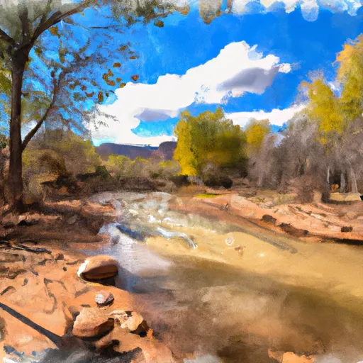
Confluence With Turkey Creek To Forest Road 60 Just Above Tin Hat Ranch
One of the biggest challenges for this run is navigating around obstacles such as rocks and fallen trees. Additionally, the river can become very narrow in some sections, adding to the difficulty of the rapids. It is recommended that only experienced kayakers attempt this run.
In terms of regulations, the area is managed by the Apache-Sitgreaves National Forest and permits are required for overnight camping. Visitors are also required to follow Leave No Trace principles to minimize their impact on the environment.
It is important to note that streamflow and river conditions can vary greatly depending on weather patterns and other factors, so it is always important to check the current conditions before embarking on any whitewater adventure.
Plan your run down to the hour
Same weather feed Snoflo's iOS app uses -- updated continuously from NOAA / yr.no. Watch the precipitation column on the meteogram; rain ahead of a run typically lifts flows 12-48 hours later depending on the basin.
Next 5 days, hour by hour
Temperature line with weather symbols on top, snow + rain accumulation as columns, humidity as a dotted line.
5-day forecast table
Every 3 hours, broken out across temperature, snow, rain, humidity, and wind. Each cell is colour-coded relative to the column min/max.
| Time | Condition | Temp (°F) | Snow (in) | Rain (in) | Humidity (%) | Wind (mps) | Wind dir |
|---|---|---|---|---|---|---|---|
| Loading detailed forecast… | |||||||
15-day temperature & precipitation
Daily temperatures, snow, and rain projected over the next two weeks -- the upstream story that drives next week's flows.
Regional streamflow levels
USGS streamgauges around Confluence With Turkey Creek To Forest Road 60 Just Above Tin Hat Ranch -- useful for spotting upstream pulses and gauging which tributary is contributing what.
| Streamgauge | Discharge | View |
|---|---|---|
| South Fork Parker Creek Near Roosevelt | · | → |
| Cherry Creek Near Globe | 4 cfs | → |
| Tonto Creek Abv Gun Creek | 60 cfs | → |
| Salt River Near Roosevelt | 292 cfs | → |
| Pinal Creek At Inspiration Dam | 2 cfs | → |
| Cibecue Creek Near Chysotile | 46 cfs | → |
Plan a longer trip
The closest boat launches, other paddle runs, and campgrounds so a day on the water can grow into a full weekend.
Boat launches
- Roosevelt Lake - 1
- Roosevelt Lake - 2
- Roosevelt Lake - 3
- Roosevelt Lake - 6
- Roosevelt Lake - 7
- Roosevelt Lake - 5
Other river runs
- Salome Wilderness Boundary To Confluence With Salome Creek
- Forest Road 486 To Hellsgate Wilderness Boundary
- Workman Falls To Salome Wilderness Boundary
- Rock Springs To Confluence With Cottonwood Wash
- Billy Lawrence Creek To North Property Boundary Of Ellison Ranch
Campgrounds
- Reynolds Creek Group Campground
- Reynolds Creek Campground
- Sawmill Flats
- Rose Creek
- Sawmill Flats Dispersed
- Falls
Whitewater safety
- Check the flow before you run
- Use the linked-gauge card and Regional Flow panel above. Class ratings change with flow -- a Class III at low water can become Class IV+ at high water.
- Know your skill ceiling
- Pick runs comfortably below your ceiling. Cold-water and big-water runs raise the consequences of any mistake.
- Wear the right gear
- Helmet, PFD, drysuit / wetsuit when water is below 60°F. Throw bag, knife, and whistle on your person, not in the boat.
- Scout, set safety, and run with a team
- Scout new rapids on foot, set safety with throw bags above the consequence pool, and run with at least one other competent paddler.
- Respect the river
- Strainers, undercuts, low-head dams, and wood can kill at any class rating. When in doubt, portage.
Set push alerts in the Snoflo app
Save Confluence With Turkey Creek To Forest Road 60 Just Above Tin Hat Ranch as a favorite, set a discharge threshold (e.g. "alert me when flow hits 600 cfs"), and the iOS app pushes the moment the linked gauge crosses.
About Confluence With Turkey Creek To Forest Road 60 Just Above Tin Hat Ranch
What's the optimal flow for Confluence With Turkey Creek To Forest Road 60 Just Above Tin Hat Ranch?
The optimal flow depends on the section and the craft. Check the Run Details panel for the linked gauge and current status.
How fresh is the cfs reading on this page?
The linked USGS streamgauge reports continuously (every 15 minutes); Snoflo refreshes throughout the day. Hover the streamflow sparkline to read individual datapoints.
What's the whitewater class?
See the Run Details panel for the class rating Snoflo tracks for this run. Class ratings change with flow -- a Class III at low water can become Class IV in high water.
Where do I put in / take out?
Tap Directions in the hero above to open driving directions to the put-in. For shuttle planning, check the Nearby Boat Launches panel and the river run operator's site.
Can I get alerts when flows hit the optimal range?
Yes -- alerts are managed in the Snoflo iOS app. Favorite this run, set a discharge threshold, and you'll get a push the moment the gauge crosses.
Other runs near here
Snoflo-tracked paddle runs within driving distance of Confluence With Turkey Creek To Forest Road 60 Just Above Tin Hat Ranch.