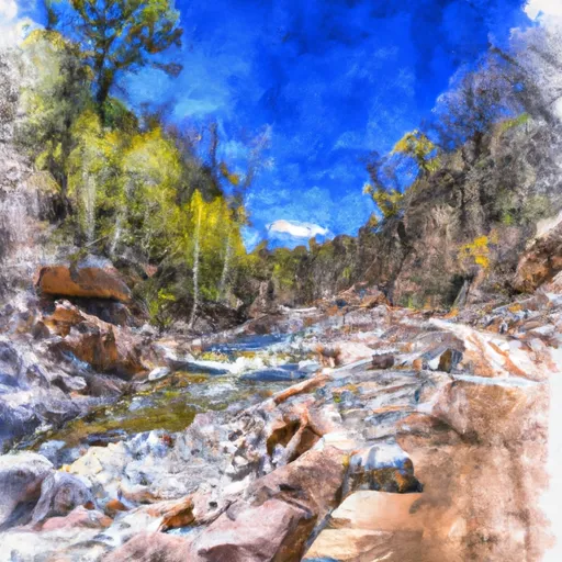
Forest Road 486 To Hellsgate Wilderness Boundary River Run
Community Reviews
Been here? Share the conditions.
Reviews, ratings & photos are added in the free Snoflo iOS app — rate a spot, tag the conditions, and your visit is verified by location. Add or manage your reviews from the app.
Forest Road 486 To Hellsgate Wilderness Boundary
Some of the notable rapids and obstacles on this section include El Capitan Rapid, which is a Class IV drop that requires precise navigation. The Corkscrew Rapid offers a technical challenge and requires advanced maneuvering skills. Other notable rapids include Pinball and Nasty Habit. It is important to note that high water levels can make this section extremely dangerous and should be avoided.
Specific regulations to the area include the requirement of a permit from the Tonto National Forest, which can be obtained online or in-person. Camping is permitted in designated areas along the river, but campfires are only allowed in established fire rings. Littering and disturbing the natural environment are strictly prohibited. Visitors are also advised to carry out all trash and leave the area as they found it.
Plan your run down to the hour
Same weather feed Snoflo's iOS app uses -- updated continuously from NOAA / yr.no. Watch the precipitation column on the meteogram; rain ahead of a run typically lifts flows 12-48 hours later depending on the basin.
Next 5 days, hour by hour
Temperature line with weather symbols on top, snow + rain accumulation as columns, humidity as a dotted line.
5-day forecast table
Every 3 hours, broken out across temperature, snow, rain, humidity, and wind. Each cell is colour-coded relative to the column min/max.
| Time | Condition | Temp (°F) | Snow (in) | Rain (in) | Humidity (%) | Wind (mps) | Wind dir |
|---|---|---|---|---|---|---|---|
| Loading detailed forecast… | |||||||
15-day temperature & precipitation
Daily temperatures, snow, and rain projected over the next two weeks -- the upstream story that drives next week's flows.
Regional streamflow levels
USGS streamgauges around Forest Road 486 To Hellsgate Wilderness Boundary -- useful for spotting upstream pulses and gauging which tributary is contributing what.
| Streamgauge | Discharge | View |
|---|---|---|
| Tonto Creek Abv Gun Creek | 60 cfs | → |
| South Fork Parker Creek Near Roosevelt | · | → |
| Cherry Creek Near Globe | 4 cfs | → |
| Salt River Near Roosevelt | 292 cfs | → |
| Cibecue Creek Near Chysotile | 46 cfs | → |
| East Verde R Div From East Clear Cr Nr Pine | 11 cfs | → |
Plan a longer trip
The closest boat launches, other paddle runs, and campgrounds so a day on the water can grow into a full weekend.
Other river runs
- Confluence With Turkey Creek To Forest Road 60 Just Above Tin Hat Ranch
- Forest Road 329 To Billy Lawrence Creek
- Hellsgate Wilderness Boundary To Confluence With Tonto Creek
- Salome Wilderness Boundary To Confluence With Salome Creek
- Billy Lawrence Creek To North Property Boundary Of Ellison Ranch
Campgrounds
- Reynolds Creek Campground
- Reynolds Creek Group Campground
- Sawmill Flats
- Rose Creek
- Sawmill Flats Dispersed
- Alderwood
Whitewater safety
- Check the flow before you run
- Use the linked-gauge card and Regional Flow panel above. Class ratings change with flow -- a Class III at low water can become Class IV+ at high water.
- Know your skill ceiling
- Pick runs comfortably below your ceiling. Cold-water and big-water runs raise the consequences of any mistake.
- Wear the right gear
- Helmet, PFD, drysuit / wetsuit when water is below 60°F. Throw bag, knife, and whistle on your person, not in the boat.
- Scout, set safety, and run with a team
- Scout new rapids on foot, set safety with throw bags above the consequence pool, and run with at least one other competent paddler.
- Respect the river
- Strainers, undercuts, low-head dams, and wood can kill at any class rating. When in doubt, portage.
Set push alerts in the Snoflo app
Save Forest Road 486 To Hellsgate Wilderness Boundary as a favorite, set a discharge threshold (e.g. "alert me when flow hits 600 cfs"), and the iOS app pushes the moment the linked gauge crosses.
About Forest Road 486 To Hellsgate Wilderness Boundary
What's the optimal flow for Forest Road 486 To Hellsgate Wilderness Boundary?
The optimal flow depends on the section and the craft. Check the Run Details panel for the linked gauge and current status.
How fresh is the cfs reading on this page?
The linked USGS streamgauge reports continuously (every 15 minutes); Snoflo refreshes throughout the day. Hover the streamflow sparkline to read individual datapoints.
What's the whitewater class?
See the Run Details panel for the class rating Snoflo tracks for this run. Class ratings change with flow -- a Class III at low water can become Class IV in high water.
Where do I put in / take out?
Tap Directions in the hero above to open driving directions to the put-in. For shuttle planning, check the Nearby Boat Launches panel and the river run operator's site.
Can I get alerts when flows hit the optimal range?
Yes -- alerts are managed in the Snoflo iOS app. Favorite this run, set a discharge threshold, and you'll get a push the moment the gauge crosses.
Other runs near here
Snoflo-tracked paddle runs within driving distance of Forest Road 486 To Hellsgate Wilderness Boundary.