Boundary Of The Primary Jurisdiction Below Stewart Mountain Dam To Salt River Indian Reservation Boundary River Run
Community Reviews
Been here? Share the conditions.
Reviews, ratings & photos are added in the free Snoflo iOS app — rate a spot, tag the conditions, and your visit is verified by location. Add or manage your reviews from the app.
Boundary Of The Primary Jurisdiction Below Stewart Mountain Dam To Salt River Indian Reservation Boundary
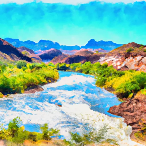
This section of the river is rated as a Class III-IV, making it suitable for intermediate to advanced paddlers. The segment covers a distance of 10.5 miles, and it is characterized by a series of rapids and obstacles, including S-Turn, Exhibition, and Corkscrew.
Regulations in the area require that all river runners obtain a permit from the Tonto National Forest. Additionally, all river runners are required to wear a Personal Flotation Device (PFD) and a helmet at all times while on the river. Campfires are not allowed on the riverbank, and all trash must be carried out of the area.
In conclusion, the Boundary Of The Primary Jurisdiction Below Stewart Mountain Dam To Salt River Indian Reservation Boundary is a popular whitewater river run that requires intermediate to advanced skills. The ideal streamflow range is between 800-1200 cfs, and the segment covers a distance of 10.5 miles. Specific rapids and obstacles include S-Turn, Exhibition, and Corkscrew. Regulations require a permit, the use of PFD and helmet, no campfires, and all trash must be carried out of the area.
Plan your run down to the hour
Same weather feed Snoflo's iOS app uses -- updated continuously from NOAA / yr.no. Watch the precipitation column on the meteogram; rain ahead of a run typically lifts flows 12-48 hours later depending on the basin.
Next 5 days, hour by hour
Temperature line with weather symbols on top, snow + rain accumulation as columns, humidity as a dotted line.
5-day forecast table
Every 3 hours, broken out across temperature, snow, rain, humidity, and wind. Each cell is colour-coded relative to the column min/max.
| Time | Condition | Temp (°F) | Snow (in) | Rain (in) | Humidity (%) | Wind (mps) | Wind dir |
|---|---|---|---|---|---|---|---|
| Loading detailed forecast… | |||||||
15-day temperature & precipitation
Daily temperatures, snow, and rain projected over the next two weeks -- the upstream story that drives next week's flows.
Regional streamflow levels
USGS streamgauges around Boundary Of The Primary Jurisdiction Below Stewart Mountain Dam To Salt River Indian Reservation Boundary -- useful for spotting upstream pulses and gauging which tributary is contributing what.
| Streamgauge | Discharge | View |
|---|---|---|
| Salt River Blw Stewart Mountain Dam | 475 cfs | → |
| Verde River Near Scottsdale | 103 cfs | → |
| Sycamore Creek Near Fort Mcdowell | 11 cfs | → |
| Verde River Blw Bartlett Dam | 144 cfs | → |
| Indian Bend Wash At Curry Road | · | → |
| Queen Creek Below Whitlow Dam Nr Superior | 1 cfs | → |
Plan a longer trip
The closest boat launches, other paddle runs, and campgrounds so a day on the water can grow into a full weekend.
Boat launches
- Saguaro - 1
- East Saguaro Del Norte Road 469, Maricopa County
- East Saguaro Del Norte Road Maricopa County
- Rafter Take-Out Parking
- Apache Trail Maricopa County
- Canyon Lake - 2
Other river runs
- Lower Salt
- Salt River Indian Reservation Boundary To Immediately Above Granite Reef Dam Impoundment
- Lower Verde
- Telegraph Creek - Forest Road #4 To Confluence With Arnett Creek
- Arnett Creek - Forest Road #4 To Middle Of Sec 7,T2s, R12e
Campgrounds
- The Rolls Ohv Area - Butcher Jones Access
- The Rolls Ohv Area - Pobrecito Access
- Larry Forbis Group Site
- Bagley Flat
- Bagley Flat Campground And Boat Dock
- Bulldog Canyon Off-Highway Vehicle Area
Fishing spots
Whitewater safety
- Check the flow before you run
- Use the linked-gauge card and Regional Flow panel above. Class ratings change with flow -- a Class III at low water can become Class IV+ at high water.
- Know your skill ceiling
- Pick runs comfortably below your ceiling. Cold-water and big-water runs raise the consequences of any mistake.
- Wear the right gear
- Helmet, PFD, drysuit / wetsuit when water is below 60°F. Throw bag, knife, and whistle on your person, not in the boat.
- Scout, set safety, and run with a team
- Scout new rapids on foot, set safety with throw bags above the consequence pool, and run with at least one other competent paddler.
- Respect the river
- Strainers, undercuts, low-head dams, and wood can kill at any class rating. When in doubt, portage.
Set push alerts in the Snoflo app
Save Boundary Of The Primary Jurisdiction Below Stewart Mountain Dam To Salt River Indian Reservation Boundary as a favorite, set a discharge threshold (e.g. "alert me when flow hits 600 cfs"), and the iOS app pushes the moment the linked gauge crosses.
About Boundary Of The Primary Jurisdiction Below Stewart Mountain Dam To Salt River Indian Reservation Boundary
What's the optimal flow for Boundary Of The Primary Jurisdiction Below Stewart Mountain Dam To Salt River Indian Reservation Boundary?
The optimal flow depends on the section and the craft. Check the Run Details panel for the linked gauge and current status.
How fresh is the cfs reading on this page?
The linked USGS streamgauge reports continuously (every 15 minutes); Snoflo refreshes throughout the day. Hover the streamflow sparkline to read individual datapoints.
What's the whitewater class?
See the Run Details panel for the class rating Snoflo tracks for this run. Class ratings change with flow -- a Class III at low water can become Class IV in high water.
Where do I put in / take out?
Tap Directions in the hero above to open driving directions to the put-in. For shuttle planning, check the Nearby Boat Launches panel and the river run operator's site.
Can I get alerts when flows hit the optimal range?
Yes -- alerts are managed in the Snoflo iOS app. Favorite this run, set a discharge threshold, and you'll get a push the moment the gauge crosses.
Other runs near here
Snoflo-tracked paddle runs within driving distance of Boundary Of The Primary Jurisdiction Below Stewart Mountain Dam To Salt River Indian Reservation Boundary.