Cima Creek - Headwaters To Wilderness Boundary river run
Community Reviews
Been here? Share the conditions.
Reviews, ratings & photos are added in the free Snoflo iOS app — rate a spot, tag the conditions, and your visit is verified by location. Add or manage your reviews from the app.
Cima Creek - Headwaters To Wilderness Boundary
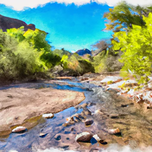
One of the notable rapids in this run is the Cima Falls, a class IV rapid. Other rapids include the Waterfall Rapid and the S-Turn Rapid. The run also features several tight and technical sections that require advanced paddling skills.
As for regulations, this run is located in the Tonto National Forest and requires a wilderness permit. The permit can be obtained through the forest service and is limited to a certain number of users per day. Additionally, all boaters must follow Leave No Trace principles and pack out all trash and waste.
Overall, the Cima Creek-Headwaters to Wilderness Boundary run is a thrilling and challenging whitewater experience for experienced paddlers. It is important to check the streamflow before attempting the run and to ensure compliance with all regulations to protect the natural environment.
Plan your run down to the hour
Same weather feed Snoflo's iOS app uses -- updated continuously from NOAA / yr.no. Watch the precipitation column on the meteogram; rain ahead of a run typically lifts flows 12-48 hours later depending on the basin.
Next 5 days, hour by hour
Temperature line with weather symbols on top, snow + rain accumulation as columns, humidity as a dotted line.
5-day forecast table
Every 3 hours, broken out across temperature, snow, rain, humidity, and wind. Each cell is colour-coded relative to the column min/max.
| Time | Condition | Temp (°F) | Snow (in) | Rain (in) | Humidity (%) | Wind (mps) | Wind dir |
|---|---|---|---|---|---|---|---|
| Loading detailed forecast… | |||||||
15-day temperature & precipitation
Daily temperatures, snow, and rain projected over the next two weeks -- the upstream story that drives next week's flows.
Regional streamflow levels
USGS streamgauges around Cima Creek - Headwaters To Wilderness Boundary -- useful for spotting upstream pulses and gauging which tributary is contributing what.
| Streamgauge | Discharge | View |
|---|---|---|
| Leslie Creek Near Mcneal | · | → |
| Whitewater Draw Near Douglas | 0 cfs | → |
| Banning Creek Near Bisbee | · | → |
| San Pedro River Near Tombstone | 5 cfs | → |
| San Pedro River At Charleston | 10 cfs | → |
| Babocomari River Near Tombstone | 0 cfs | → |
Plan a longer trip
The closest boat launches, other paddle runs, and campgrounds so a day on the water can grow into a full weekend.
Other river runs
- Headwaters Within Wilderness To Wilderness Boundary
- Headwaters To Wilderness Boundary
- Cower Cave Creek - Wilderness Boundary To Coronado National Forest Boundary (Near Portal)
- Wilderness Boundary To Confluence With Cave Creek
- Babocomari River
Campgrounds
- Aspen Saddle Camp
- Cliff Camp
- Morse Canyon Campground
- Sycamore Campground
- Rustler Park Campground
- Rustler Park
Parks
Whitewater safety
- Check the flow before you run
- Use the linked-gauge card and Regional Flow panel above. Class ratings change with flow -- a Class III at low water can become Class IV+ at high water.
- Know your skill ceiling
- Pick runs comfortably below your ceiling. Cold-water and big-water runs raise the consequences of any mistake.
- Wear the right gear
- Helmet, PFD, drysuit / wetsuit when water is below 60°F. Throw bag, knife, and whistle on your person, not in the boat.
- Scout, set safety, and run with a team
- Scout new rapids on foot, set safety with throw bags above the consequence pool, and run with at least one other competent paddler.
- Respect the river
- Strainers, undercuts, low-head dams, and wood can kill at any class rating. When in doubt, portage.
Set push alerts in the Snoflo app
Save Cima Creek - Headwaters To Wilderness Boundary as a favorite, set a discharge threshold (e.g. "alert me when flow hits 600 cfs"), and the iOS app pushes the moment the linked gauge crosses.
About Cima Creek - Headwaters To Wilderness Boundary
What's the optimal flow for Cima Creek - Headwaters To Wilderness Boundary?
The optimal flow depends on the section and the craft. Check the Run Details panel for the linked gauge and current status.
How fresh is the cfs reading on this page?
The linked USGS streamgauge reports continuously (every 15 minutes); Snoflo refreshes throughout the day. Hover the streamflow sparkline to read individual datapoints.
What's the whitewater class?
See the Run Details panel for the class rating Snoflo tracks for this run. Class ratings change with flow -- a Class III at low water can become Class IV in high water.
Where do I put in / take out?
Tap Directions in the hero above to open driving directions to the put-in. For shuttle planning, check the Nearby Boat Launches panel and the river run operator's site.
Can I get alerts when flows hit the optimal range?
Yes -- alerts are managed in the Snoflo iOS app. Favorite this run, set a discharge threshold, and you'll get a push the moment the gauge crosses.
Other runs near here
Snoflo-tracked paddle runs within driving distance of Cima Creek - Headwaters To Wilderness Boundary.