Mcclure Place (North Fork) To Nf Boundary At Payne Place (Dept. Of Fish And Game Land) River Run
Community Reviews
Been here? Share the conditions.
Reviews, ratings & photos are added in the free Snoflo iOS app — rate a spot, tag the conditions, and your visit is verified by location. Add or manage your reviews from the app.
Mcclure Place (North Fork) To Nf Boundary At Payne Place (Dept. Of Fish And Game Land)
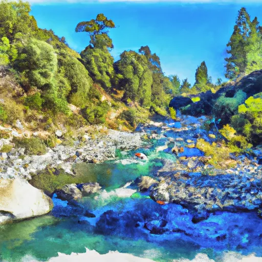
The Whitewater River Run from McClure Place (North Fork) to NF Boundary at Payne Place (Dept. of Fish and Game Land) in California is a popular destination for rafters and kayakers. The ideal streamflow range for this stretch of the river is between 200 and 700 cubic feet per second (cfs). This stretch of the river is rated as a Class III-IV and is suitable for intermediate to advanced paddlers.
The segment mileage of this run is approximately 6 miles, with several rapids and obstacles along the way. Some of the most notable rapids include "Pinball," "Screaming Left," and "Sidewinder." These rapids range from Class III to Class IV and require skilled maneuvering to navigate safely.
There are specific regulations and guidelines that visitors to this area must follow. The California Department of Fish and Wildlife requires all visitors to have a valid fishing license and follow all fishing regulations. Additionally, visitors must follow all Leave No Trace principles and pack out all trash and waste.
In conclusion, the Whitewater River Run from McClure Place (North Fork) to NF Boundary at Payne Place (Dept. of Fish and Game Land) is a challenging and exciting destination for experienced paddlers. The ideal streamflow range is between 200 and 700 cfs, and the segment mileage is approximately 6 miles. Visitors must follow specific regulations and guidelines to ensure the protection of this beautiful natural area.
Plan your run down to the hour
Same weather feed Snoflo's iOS app uses -- updated continuously from NOAA / yr.no. Watch the precipitation column on the meteogram; rain ahead of a run typically lifts flows 12-48 hours later depending on the basin.
Next 5 days, hour by hour
Temperature line with weather symbols on top, snow + rain accumulation as columns, humidity as a dotted line.
5-day forecast table
Every 3 hours, broken out across temperature, snow, rain, humidity, and wind. Each cell is colour-coded relative to the column min/max.
| Time | Condition | Temp (°F) | Snow (in) | Rain (in) | Humidity (%) | Wind (mps) | Wind dir |
|---|---|---|---|---|---|---|---|
| Loading detailed forecast… | |||||||
15-day temperature & precipitation
Daily temperatures, snow, and rain projected over the next two weeks -- the upstream story that drives next week's flows.
Regional streamflow levels
USGS streamgauges around Mcclure Place (North Fork) To Nf Boundary At Payne Place (Dept. Of Fish And Game Land) -- useful for spotting upstream pulses and gauging which tributary is contributing what.
| Streamgauge | Discharge | View |
|---|---|---|
| Mill C Nr Los Molinos Ca | 136 cfs | → |
| Deer C Nr Vina Ca | 99 cfs | → |
| Sacramento R Ab Bend Bridge Nr Red Bluff Ca | 13,300 cfs | → |
| Battle C Bl Coleman Fish Hatchery Nr Cottonwood Ca | 245 cfs | → |
| Cottonwood C Nr Cottonwood Ca | 64 cfs | → |
| Cow C Nr Millville Ca | 34 cfs | → |
Plan a longer trip
The closest boat launches, other paddle runs, and campgrounds so a day on the water can grow into a full weekend.
Boat launches
- Jellys Ferry
- Jelly's Ferry
- Sycamore Campground Boat Launch
- Red Bluff Recreation Area, Red Bluff
- Bend Bridge Fishing Access
Other river runs
- South Fork From Antelope Campground To One-Quarter Mile Above North Fork Antelope Creek
- North Fork From Nf Boundary At Section Line Between 17/18, T28n, R1e. To Mcclure Place
- Mill Creek
- One Mile Downstream From Black Rock To Western Nf Boundary
- Sec Line Between 14/23, T27n, R2e To One Mile Downstream From Black Rock
Campgrounds
- Facht Place Campground
- Battle Creek Campground
- Battle Creek
- Massacre Flat
- Massacre Flat Primitive Camping Area
- Hole In The Ground
Fishing spots
Parks
Whitewater safety
- Check the flow before you run
- Use the linked-gauge card and Regional Flow panel above. Class ratings change with flow -- a Class III at low water can become Class IV+ at high water.
- Know your skill ceiling
- Pick runs comfortably below your ceiling. Cold-water and big-water runs raise the consequences of any mistake.
- Wear the right gear
- Helmet, PFD, drysuit / wetsuit when water is below 60°F. Throw bag, knife, and whistle on your person, not in the boat.
- Scout, set safety, and run with a team
- Scout new rapids on foot, set safety with throw bags above the consequence pool, and run with at least one other competent paddler.
- Respect the river
- Strainers, undercuts, low-head dams, and wood can kill at any class rating. When in doubt, portage.
Set push alerts in the Snoflo app
Save Mcclure Place (North Fork) To Nf Boundary At Payne Place (Dept. Of Fish And Game Land) as a favorite, set a discharge threshold (e.g. "alert me when flow hits 600 cfs"), and the iOS app pushes the moment the linked gauge crosses.
About Mcclure Place (North Fork) To Nf Boundary At Payne Place (Dept. Of Fish And Game Land)
What's the optimal flow for Mcclure Place (North Fork) To Nf Boundary At Payne Place (Dept. Of Fish And Game Land)?
The optimal flow depends on the section and the craft. Check the Run Details panel for the linked gauge and current status.
How fresh is the cfs reading on this page?
The linked USGS streamgauge reports continuously (every 15 minutes); Snoflo refreshes throughout the day. Hover the streamflow sparkline to read individual datapoints.
What's the whitewater class?
See the Run Details panel for the class rating Snoflo tracks for this run. Class ratings change with flow -- a Class III at low water can become Class IV in high water.
Where do I put in / take out?
Tap Directions in the hero above to open driving directions to the put-in. For shuttle planning, check the Nearby Boat Launches panel and the river run operator's site.
Can I get alerts when flows hit the optimal range?
Yes -- alerts are managed in the Snoflo iOS app. Favorite this run, set a discharge threshold, and you'll get a push the moment the gauge crosses.
Other runs near here
Snoflo-tracked paddle runs within driving distance of Mcclure Place (North Fork) To Nf Boundary At Payne Place (Dept. Of Fish And Game Land).