0.15 Mile Downstream From Road 4n26b To Confluence With Lilly Creek River Run
Community Reviews
Been here? Share the conditions.
Reviews, ratings & photos are added in the free Snoflo iOS app — rate a spot, tag the conditions, and your visit is verified by location. Add or manage your reviews from the app.
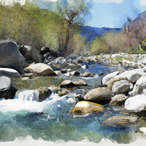
0.15 Mile Downstream From Road 4n26b To Confluence With Lilly Creek
There are several specific river rapids and obstacles to be aware of on the Whitewater River Run. One of the most notable is the "Slam Dunk" rapid, which features a steep drop followed by a large hole that can easily flip rafts or kayaks. Other notable features include the "Sledgehammer" and "Pinball" rapids, which require precise navigation to avoid getting stuck on rocks or overturned.
There are several regulations to be aware of when visiting this area. The use of personal flotation devices (PFDs) is mandatory, and all boaters must have a valid California Boater Card. Additionally, there are restrictions on camping and fires in the surrounding area, and visitors are encouraged to practice Leave No Trace principles to minimize their impact on the environment.
Plan your run down to the hour
Same weather feed Snoflo's iOS app uses -- updated continuously from NOAA / yr.no. Watch the precipitation column on the meteogram; rain ahead of a run typically lifts flows 12-48 hours later depending on the basin.
Next 5 days, hour by hour
Temperature line with weather symbols on top, snow + rain accumulation as columns, humidity as a dotted line.
5-day forecast table
Every 3 hours, broken out across temperature, snow, rain, humidity, and wind. Each cell is colour-coded relative to the column min/max.
| Time | Condition | Temp (°F) | Snow (in) | Rain (in) | Humidity (%) | Wind (mps) | Wind dir |
|---|---|---|---|---|---|---|---|
| Loading detailed forecast… | |||||||
15-day temperature & precipitation
Daily temperatures, snow, and rain projected over the next two weeks -- the upstream story that drives next week's flows.
Regional streamflow levels
USGS streamgauges around 0.15 Mile Downstream From Road 4n26b To Confluence With Lilly Creek -- useful for spotting upstream pulses and gauging which tributary is contributing what.
| Streamgauge | Discharge | View |
|---|---|---|
| Lk Eleanor Div To Cherry Lake Nr Hetch Hetchy Ca | 1 cfs | → |
| Cherry C Bl Valley Dam Nr Hetch Hetchy Ca | 15 cfs | → |
| Eleanor C Nr Hetch Hetchy Ca | 21 cfs | → |
| Tuolumne R Nr Hetch Hetchy Ca | 114 cfs | → |
| Cherry C Nr Early Intake Ca | 43 cfs | → |
| Cherry C Bl Dion R Holm Ph | 42 cfs | → |
Plan a longer trip
The closest boat launches, other paddle runs, and campgrounds so a day on the water can grow into a full weekend.
Boat launches
Other river runs
- One-Tenth Mile Downstream Of Coffin Hollow To Confluence With Bell Creek And Clavey River
- Lilly Creek (Source At Chewing Gum Lake And Y Meadow Lake) To One-Tenth Mile Downstream Of Coffin Hollow
- One-Tenth Mile Upstream Of Crabtree Trailhead To 0.15 Mile Downstream Of Road 4n26b
- Bell Creek Headwaters To One-Tenth Mile Upstream Of Crabtree Trailhead
- Clavey River At Confluence Of Bell And Lily Creeks To 3n01
Campgrounds
Fishing spots
Whitewater safety
- Check the flow before you run
- Use the linked-gauge card and Regional Flow panel above. Class ratings change with flow -- a Class III at low water can become Class IV+ at high water.
- Know your skill ceiling
- Pick runs comfortably below your ceiling. Cold-water and big-water runs raise the consequences of any mistake.
- Wear the right gear
- Helmet, PFD, drysuit / wetsuit when water is below 60°F. Throw bag, knife, and whistle on your person, not in the boat.
- Scout, set safety, and run with a team
- Scout new rapids on foot, set safety with throw bags above the consequence pool, and run with at least one other competent paddler.
- Respect the river
- Strainers, undercuts, low-head dams, and wood can kill at any class rating. When in doubt, portage.
Set push alerts in the Snoflo app
Save 0.15 Mile Downstream From Road 4n26b To Confluence With Lilly Creek as a favorite, set a discharge threshold (e.g. "alert me when flow hits 600 cfs"), and the iOS app pushes the moment the linked gauge crosses.
About 0.15 Mile Downstream From Road 4n26b To Confluence With Lilly Creek
What's the optimal flow for 0.15 Mile Downstream From Road 4n26b To Confluence With Lilly Creek?
The optimal flow depends on the section and the craft. Check the Run Details panel for the linked gauge and current status.
How fresh is the cfs reading on this page?
The linked USGS streamgauge reports continuously (every 15 minutes); Snoflo refreshes throughout the day. Hover the streamflow sparkline to read individual datapoints.
What's the whitewater class?
See the Run Details panel for the class rating Snoflo tracks for this run. Class ratings change with flow -- a Class III at low water can become Class IV in high water.
Where do I put in / take out?
Tap Directions in the hero above to open driving directions to the put-in. For shuttle planning, check the Nearby Boat Launches panel and the river run operator's site.
Can I get alerts when flows hit the optimal range?
Yes -- alerts are managed in the Snoflo iOS app. Favorite this run, set a discharge threshold, and you'll get a push the moment the gauge crosses.
Other runs near here
Snoflo-tracked paddle runs within driving distance of 0.15 Mile Downstream From Road 4n26b To Confluence With Lilly Creek.