Hoover Wilderness Boundary To Humboldt-Toiyabe National Forest Boundary River Run
Community Reviews
Been here? Share the conditions.
Reviews, ratings & photos are added in the free Snoflo iOS app — rate a spot, tag the conditions, and your visit is verified by location. Add or manage your reviews from the app.
Hoover Wilderness Boundary To Humboldt-Toiyabe National Forest Boundary
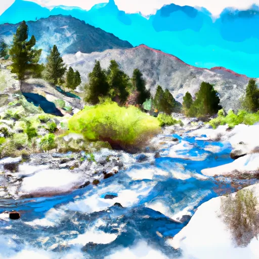
The ideal stream flow range for the Whitewater River Run is between 400 and 1,000 cubic feet per second (cfs), which typically occurs during the spring snowmelt or after summer thunderstorms. The river features several challenging rapids, including "Confluence Rapid," "The Squeeze," and "The Narrows." The latter is a particularly challenging section, with steep drops and tight turns.
It is important to note that the Whitewater River Run is located within the Hoover Wilderness, and as such, there are strict regulations in place to protect the area. Only non-motorized watercraft are permitted on the river, and all visitors must obtain a wilderness permit before entering the area. Additionally, visitors are required to follow Leave No Trace principles and pack out all trash.
Overall, the Whitewater River Run is a challenging and exciting whitewater experience for experienced kayakers and rafters. It is important to always check stream flow levels before embarking on this run, and to follow all regulations in order to protect the wilderness area.
Plan your run down to the hour
Same weather feed Snoflo's iOS app uses -- updated continuously from NOAA / yr.no. Watch the precipitation column on the meteogram; rain ahead of a run typically lifts flows 12-48 hours later depending on the basin.
Next 5 days, hour by hour
Temperature line with weather symbols on top, snow + rain accumulation as columns, humidity as a dotted line.
5-day forecast table
Every 3 hours, broken out across temperature, snow, rain, humidity, and wind. Each cell is colour-coded relative to the column min/max.
| Time | Condition | Temp (°F) | Snow (in) | Rain (in) | Humidity (%) | Wind (mps) | Wind dir |
|---|---|---|---|---|---|---|---|
| Loading detailed forecast… | |||||||
15-day temperature & precipitation
Daily temperatures, snow, and rain projected over the next two weeks -- the upstream story that drives next week's flows.
Regional streamflow levels
USGS streamgauges around Hoover Wilderness Boundary To Humboldt-Toiyabe National Forest Boundary -- useful for spotting upstream pulses and gauging which tributary is contributing what.
| Streamgauge | Discharge | View |
|---|---|---|
| Robinson C At Twin Lks Outlet Nr Bridgeport | 100 cfs | → |
| Green Creek Near Bridgeport | 22 cfs | → |
| Buckeye C Nr Bridgeport | 32 cfs | → |
| E Walker R Nr Bridgeport | 145 cfs | → |
| W Walker R Blw L Walker R Nr Coleville | 117 cfs | → |
| Tuolumne R A Grand Cyn Of Tuolumne Ab Hetch Hetchy | 125 cfs | → |
Plan a longer trip
The closest boat launches, other paddle runs, and campgrounds so a day on the water can grow into a full weekend.
Boat launches
- Lundy Lake
- Annett's Mono Village Fishing Resort
- Lee Vining Creek
- Paradise Shore Rv Park
- Ramp Road Mono County
- Navy Beach Paddle Boat Launch
Other river runs
- Headwaters, Includes East Fork And West Fork To Hoover Wilderness Boundary
- Headwaters To Hoover Wilderness Boundary
- Dog Creek
- Virginia Creek
- Green Creek
Campgrounds
- Green Creek
- Green Creek Campground
- Green Creek Group Campground
- Trumbull Lake Campground
- Trumbull Lake
- Upper Virginia Creek Primitive Campground
Fishing spots
Whitewater safety
- Check the flow before you run
- Use the linked-gauge card and Regional Flow panel above. Class ratings change with flow -- a Class III at low water can become Class IV+ at high water.
- Know your skill ceiling
- Pick runs comfortably below your ceiling. Cold-water and big-water runs raise the consequences of any mistake.
- Wear the right gear
- Helmet, PFD, drysuit / wetsuit when water is below 60°F. Throw bag, knife, and whistle on your person, not in the boat.
- Scout, set safety, and run with a team
- Scout new rapids on foot, set safety with throw bags above the consequence pool, and run with at least one other competent paddler.
- Respect the river
- Strainers, undercuts, low-head dams, and wood can kill at any class rating. When in doubt, portage.
Set push alerts in the Snoflo app
Save Hoover Wilderness Boundary To Humboldt-Toiyabe National Forest Boundary as a favorite, set a discharge threshold (e.g. "alert me when flow hits 600 cfs"), and the iOS app pushes the moment the linked gauge crosses.
About Hoover Wilderness Boundary To Humboldt-Toiyabe National Forest Boundary
What's the optimal flow for Hoover Wilderness Boundary To Humboldt-Toiyabe National Forest Boundary?
The optimal flow depends on the section and the craft. Check the Run Details panel for the linked gauge and current status.
How fresh is the cfs reading on this page?
The linked USGS streamgauge reports continuously (every 15 minutes); Snoflo refreshes throughout the day. Hover the streamflow sparkline to read individual datapoints.
What's the whitewater class?
See the Run Details panel for the class rating Snoflo tracks for this run. Class ratings change with flow -- a Class III at low water can become Class IV in high water.
Where do I put in / take out?
Tap Directions in the hero above to open driving directions to the put-in. For shuttle planning, check the Nearby Boat Launches panel and the river run operator's site.
Can I get alerts when flows hit the optimal range?
Yes -- alerts are managed in the Snoflo iOS app. Favorite this run, set a discharge threshold, and you'll get a push the moment the gauge crosses.
Other runs near here
Snoflo-tracked paddle runs within driving distance of Hoover Wilderness Boundary To Humboldt-Toiyabe National Forest Boundary.