1 Mile West Of Devil's Corral To To Susanville River Run
Community Reviews
Been here? Share the conditions.
Reviews, ratings & photos are added in the free Snoflo iOS app — rate a spot, tag the conditions, and your visit is verified by location. Add or manage your reviews from the app.
1 Mile West Of Devil's Corral To To Susanville
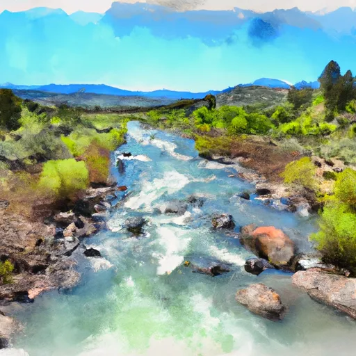
The run features a variety of rapids and obstacles, including Devil's Corral, a class IV drop that requires advanced maneuvering skills, as well as several class III rapids such as Old Red Bluff and Duck Falls. There are also sections of calm water that allow for rest and relaxation.
Specific regulations for the area include requiring life jackets for all participants, limiting group sizes to no more than 12 people, and prohibiting alcohol consumption during the run. Additionally, participants are required to carry out all trash and respect the natural surroundings.
Overall, the Whitewater River run 1 Mile West of Devil's Corral to Susanville offers a thrilling and challenging whitewater experience for experienced paddlers with the proper equipment and skills. It is important to follow all regulations and guidelines for a safe and enjoyable experience.
Plan your run down to the hour
Same weather feed Snoflo's iOS app uses -- updated continuously from NOAA / yr.no. Watch the precipitation column on the meteogram; rain ahead of a run typically lifts flows 12-48 hours later depending on the basin.
Next 5 days, hour by hour
Temperature line with weather symbols on top, snow + rain accumulation as columns, humidity as a dotted line.
5-day forecast table
Every 3 hours, broken out across temperature, snow, rain, humidity, and wind. Each cell is colour-coded relative to the column min/max.
| Time | Condition | Temp (°F) | Snow (in) | Rain (in) | Humidity (%) | Wind (mps) | Wind dir |
|---|---|---|---|---|---|---|---|
| Loading detailed forecast… | |||||||
15-day temperature & precipitation
Daily temperatures, snow, and rain projected over the next two weeks -- the upstream story that drives next week's flows.
Regional streamflow levels
USGS streamgauges around 1 Mile West Of Devil's Corral To To Susanville -- useful for spotting upstream pulses and gauging which tributary is contributing what.
| Streamgauge | Discharge | View |
|---|---|---|
| Spanish C Ab Blackhawk C At Keddie Ca | 32 cfs | → |
| Spanish C A Quincy Ca | 16 cfs | → |
| Hat C Nr Hat Creek Ca | 127 cfs | → |
| Pit R Bl Pit No 1 Ph Nr Fall River Mills Ca | 889 cfs | → |
| Sf Pit R Nr Likely Ca | 92 cfs | → |
| N Yuba R Bl Goodyears Bar Ca | 162 cfs | → |
Plan a longer trip
The closest boat launches, other paddle runs, and campgrounds so a day on the water can grow into a full weekend.
Boat launches
Other river runs
- Susan River
- Willow Creek
- Within Tunnison Wsa To Within Tunnison Wsa
- Sec 17, T25n, R14e To Confluence With Last Chance Creek
Campgrounds
Fishing spots
Whitewater safety
- Check the flow before you run
- Use the linked-gauge card and Regional Flow panel above. Class ratings change with flow -- a Class III at low water can become Class IV+ at high water.
- Know your skill ceiling
- Pick runs comfortably below your ceiling. Cold-water and big-water runs raise the consequences of any mistake.
- Wear the right gear
- Helmet, PFD, drysuit / wetsuit when water is below 60°F. Throw bag, knife, and whistle on your person, not in the boat.
- Scout, set safety, and run with a team
- Scout new rapids on foot, set safety with throw bags above the consequence pool, and run with at least one other competent paddler.
- Respect the river
- Strainers, undercuts, low-head dams, and wood can kill at any class rating. When in doubt, portage.
Set push alerts in the Snoflo app
Save 1 Mile West Of Devil's Corral To To Susanville as a favorite, set a discharge threshold (e.g. "alert me when flow hits 600 cfs"), and the iOS app pushes the moment the linked gauge crosses.
About 1 Mile West Of Devil's Corral To To Susanville
What's the optimal flow for 1 Mile West Of Devil's Corral To To Susanville?
The optimal flow depends on the section and the craft. Check the Run Details panel for the linked gauge and current status.
How fresh is the cfs reading on this page?
The linked USGS streamgauge reports continuously (every 15 minutes); Snoflo refreshes throughout the day. Hover the streamflow sparkline to read individual datapoints.
What's the whitewater class?
See the Run Details panel for the class rating Snoflo tracks for this run. Class ratings change with flow -- a Class III at low water can become Class IV in high water.
Where do I put in / take out?
Tap Directions in the hero above to open driving directions to the put-in. For shuttle planning, check the Nearby Boat Launches panel and the river run operator's site.
Can I get alerts when flows hit the optimal range?
Yes -- alerts are managed in the Snoflo iOS app. Favorite this run, set a discharge threshold, and you'll get a push the moment the gauge crosses.
Other runs near here
Snoflo-tracked paddle runs within driving distance of 1 Mile West Of Devil's Corral To To Susanville.