Cedar Creek River Run
Community Reviews
Been here? Share the conditions.
Reviews, ratings & photos are added in the free Snoflo iOS app — rate a spot, tag the conditions, and your visit is verified by location. Add or manage your reviews from the app.
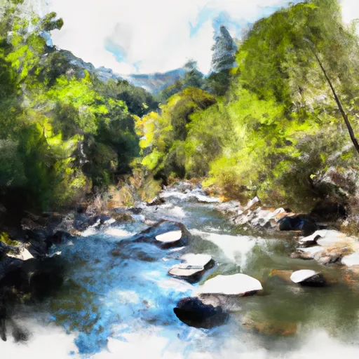
Cedar Creek
Cedar Creek is classified as a class IV-V river, with steep and technical rapids that require advanced paddling skills and experience. The segment of Cedar Creek that is typically paddled is approximately 5 miles in length, from the put-in at the Cedar Creek Bridge to the take-out at the Middle Fork American River.
The river features several challenging rapids and obstacles, including "Deadwood Falls," a steep and rocky drop that requires precise navigation, and "Chamberlain Falls," a large and complex rapid with multiple chutes and holes. Paddlers should be prepared for continuous class IV-V rapids throughout the run.
There are specific regulations in place for paddling Cedar Creek, including a permit requirement from the Auburn State Recreation Area and a mandatory safety briefing conducted by the park rangers. Additionally, paddlers are required to wear a personal flotation device at all times while on the water.
In summary, Cedar Creek is a challenging and exciting whitewater river run in California that requires advanced skills and experience. Paddlers should be prepared for steep and technical rapids, with an ideal streamflow range of 400-1200 cfs. Specific regulations are in place to ensure safety and protect the environment, including a permit requirement and mandatory safety briefing.
Plan your run down to the hour
Same weather feed Snoflo's iOS app uses -- updated continuously from NOAA / yr.no. Watch the precipitation column on the meteogram; rain ahead of a run typically lifts flows 12-48 hours later depending on the basin.
Next 5 days, hour by hour
Temperature line with weather symbols on top, snow + rain accumulation as columns, humidity as a dotted line.
5-day forecast table
Every 3 hours, broken out across temperature, snow, rain, humidity, and wind. Each cell is colour-coded relative to the column min/max.
| Time | Condition | Temp (°F) | Snow (in) | Rain (in) | Humidity (%) | Wind (mps) | Wind dir |
|---|---|---|---|---|---|---|---|
| Loading detailed forecast… | |||||||
15-day temperature & precipitation
Daily temperatures, snow, and rain projected over the next two weeks -- the upstream story that drives next week's flows.
Regional streamflow levels
USGS streamgauges around Cedar Creek -- useful for spotting upstream pulses and gauging which tributary is contributing what.
| Streamgauge | Discharge | View |
|---|---|---|
| Sf Eel R A Leggett Ca | 23 cfs | → |
| Elder C Nr Branscomb Ca | 1 cfs | → |
| Mf Eel R Nr Dos Rios Ca | 17 cfs | → |
| Sf Eel R Nr Miranda Ca | 29 cfs | → |
| Eel R A Fort Seward Ca | 51 cfs | → |
| Mattole R Nr Ettersburg Ca | 8 cfs | → |
Plan a longer trip
The closest boat launches, other paddle runs, and campgrounds so a day on the water can grow into a full weekend.
Other river runs
- Cedar Creek Trib
- North Fork Cedar Creek
- East Branch South Fork Eel
- Bell Springs Creek Trib
- Bell Springs Creek
Campgrounds
- Hiker-Biker Campsite - Standish-Hickey
- Redwoods River Resort Campground
- Dawn Redwood Group Campground
- Richardson Grove Camping
- Hike And Bike Campsite
- Hotel Gulch Campsite
Whitewater safety
- Check the flow before you run
- Use the linked-gauge card and Regional Flow panel above. Class ratings change with flow -- a Class III at low water can become Class IV+ at high water.
- Know your skill ceiling
- Pick runs comfortably below your ceiling. Cold-water and big-water runs raise the consequences of any mistake.
- Wear the right gear
- Helmet, PFD, drysuit / wetsuit when water is below 60°F. Throw bag, knife, and whistle on your person, not in the boat.
- Scout, set safety, and run with a team
- Scout new rapids on foot, set safety with throw bags above the consequence pool, and run with at least one other competent paddler.
- Respect the river
- Strainers, undercuts, low-head dams, and wood can kill at any class rating. When in doubt, portage.
Set push alerts in the Snoflo app
Save Cedar Creek as a favorite, set a discharge threshold (e.g. "alert me when flow hits 600 cfs"), and the iOS app pushes the moment the linked gauge crosses.
About Cedar Creek
What's the optimal flow for Cedar Creek?
The optimal flow depends on the section and the craft. Check the Run Details panel for the linked gauge and current status.
How fresh is the cfs reading on this page?
The linked USGS streamgauge reports continuously (every 15 minutes); Snoflo refreshes throughout the day. Hover the streamflow sparkline to read individual datapoints.
What's the whitewater class?
See the Run Details panel for the class rating Snoflo tracks for this run. Class ratings change with flow -- a Class III at low water can become Class IV in high water.
Where do I put in / take out?
Tap Directions in the hero above to open driving directions to the put-in. For shuttle planning, check the Nearby Boat Launches panel and the river run operator's site.
Can I get alerts when flows hit the optimal range?
Yes -- alerts are managed in the Snoflo iOS app. Favorite this run, set a discharge threshold, and you'll get a push the moment the gauge crosses.
Other runs near here
Snoflo-tracked paddle runs within driving distance of Cedar Creek.