Begins 0.5 Miles Away From Trail Ridge Road To Ends Where River Segment Exits Rocky Mountain National Park River Run
Community Reviews
Been here? Share the conditions.
Reviews, ratings & photos are added in the free Snoflo iOS app — rate a spot, tag the conditions, and your visit is verified by location. Add or manage your reviews from the app.
Begins 0.5 Miles Away From Trail Ridge Road To Ends Where River Segment Exits Rocky Mountain National Park
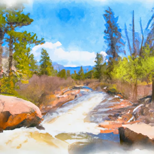
The Whitewater River Run is rated Class III to IV rapids, making it a challenging and exciting river run. The river rapids and obstacles include Big Bend, Guide Ejector, Twilight Zone, and Screaming Left Turn, among others.
There are specific regulations that visitors must adhere to when visiting the area. For instance, visitors must have a valid Rocky Mountain National Park pass, and commercial outfitters must have a permit to operate in the park. Additionally, visitors are not allowed to swim or dive in the river, and they must wear life jackets at all times.
In conclusion, the Whitewater River Run in Colorado is an excellent destination for adventure enthusiasts. It offers exciting rapids and obstacles, with an ideal streamflow range of between 200 and 500 cfs. The segment spans for 6.5 miles and has specific regulations that visitors must adhere to when visiting the area.
Plan your run down to the hour
Same weather feed Snoflo's iOS app uses -- updated continuously from NOAA / yr.no. Watch the precipitation column on the meteogram; rain ahead of a run typically lifts flows 12-48 hours later depending on the basin.
Next 5 days, hour by hour
Temperature line with weather symbols on top, snow + rain accumulation as columns, humidity as a dotted line.
5-day forecast table
Every 3 hours, broken out across temperature, snow, rain, humidity, and wind. Each cell is colour-coded relative to the column min/max.
| Time | Condition | Temp (°F) | Snow (in) | Rain (in) | Humidity (%) | Wind (mps) | Wind dir |
|---|---|---|---|---|---|---|---|
| Loading detailed forecast… | |||||||
15-day temperature & precipitation
Daily temperatures, snow, and rain projected over the next two weeks -- the upstream story that drives next week's flows.
Regional streamflow levels
USGS streamgauges around Begins 0.5 Miles Away From Trail Ridge Road To Ends Where River Segment Exits Rocky Mountain National Park -- useful for spotting upstream pulses and gauging which tributary is contributing what.
| Streamgauge | Discharge | View |
|---|---|---|
| Grand River Ditch At La Poudre Pass | 19 cfs | → |
| Michigan River Near Cameron Pass | 1 cfs | → |
| Colorado R Below Baker Gulch | 25 cfs | → |
| Joe Wright Creek Above Joe Wright Reservoir | 3 cfs | → |
| Joe Wright Creek Below Joe Wright Reservoir | 37 cfs | → |
| Grand Lake Outlet Blw Chipmunk Ln At Grand Lk | 193 cfs | → |
Plan a longer trip
The closest boat launches, other paddle runs, and campgrounds so a day on the water can grow into a full weekend.
Boat launches
- State Forest State Park
- Chambers Lake Boating Site
- Hilltop Boating Site
- Boat Launch Grand Lake
- Grand County
Other river runs
- Headwaters To Ends 0.5 Miles Upstream From End Of Fern Lake Road
- Headwaters To Fan Lake
- Big South
- Headwaters To Ends 0.5 Miles Away From Trail Ridge Road
- Headwaters To Boundary Of Rocky Mountain National Park
Campgrounds
- Dutch Town Campsite
- Ditch Camp Group/Stock Site
- Ditch Camp Individual Site
- Timber Creek - Rocky Mountain National Park
- B044
- A009
Fishing spots
- Timber Lake - Rmnp
- Arrowhead Lake - Rmnp
- Rock Lake & Little Rock Lake - Rmnp
- Long Draw #3 Fishing Site
- Long Draw #2 Fishing Site
- Haynach Lakes & Drainage - Rmnp
Parks
Whitewater safety
- Check the flow before you run
- Use the linked-gauge card and Regional Flow panel above. Class ratings change with flow -- a Class III at low water can become Class IV+ at high water.
- Know your skill ceiling
- Pick runs comfortably below your ceiling. Cold-water and big-water runs raise the consequences of any mistake.
- Wear the right gear
- Helmet, PFD, drysuit / wetsuit when water is below 60°F. Throw bag, knife, and whistle on your person, not in the boat.
- Scout, set safety, and run with a team
- Scout new rapids on foot, set safety with throw bags above the consequence pool, and run with at least one other competent paddler.
- Respect the river
- Strainers, undercuts, low-head dams, and wood can kill at any class rating. When in doubt, portage.
Set push alerts in the Snoflo app
Save Begins 0.5 Miles Away From Trail Ridge Road To Ends Where River Segment Exits Rocky Mountain National Park as a favorite, set a discharge threshold (e.g. "alert me when flow hits 600 cfs"), and the iOS app pushes the moment the linked gauge crosses.
About Begins 0.5 Miles Away From Trail Ridge Road To Ends Where River Segment Exits Rocky Mountain National Park
What's the optimal flow for Begins 0.5 Miles Away From Trail Ridge Road To Ends Where River Segment Exits Rocky Mountain National Park?
The optimal flow depends on the section and the craft. Check the Run Details panel for the linked gauge and current status.
How fresh is the cfs reading on this page?
The linked USGS streamgauge reports continuously (every 15 minutes); Snoflo refreshes throughout the day. Hover the streamflow sparkline to read individual datapoints.
What's the whitewater class?
See the Run Details panel for the class rating Snoflo tracks for this run. Class ratings change with flow -- a Class III at low water can become Class IV in high water.
Where do I put in / take out?
Tap Directions in the hero above to open driving directions to the put-in. For shuttle planning, check the Nearby Boat Launches panel and the river run operator's site.
Can I get alerts when flows hit the optimal range?
Yes -- alerts are managed in the Snoflo iOS app. Favorite this run, set a discharge threshold, and you'll get a push the moment the gauge crosses.
Other runs near here
Snoflo-tracked paddle runs within driving distance of Begins 0.5 Miles Away From Trail Ridge Road To Ends Where River Segment Exits Rocky Mountain National Park.