Red Flag Warning
2026-04-24T20:00:00-06:00
2026-04-24T20:00:00-06:00
* AFFECTED AREA...Fire Weather Zones 214, 215, 216, 238, 239, 240, 241, 242, 243, 244, 245, 246, 247 and 249. * TIMING...From 11 AM to 8 PM MDT Friday. * WINDS...Southwest 10 to 20 mph with gusts around 30 mph. * RELATIVE HUMIDITY...7 to 12 percent. * IMPACTS...Conditions will be favorable for rapid fire spread. Avoid outdoor burning and any activity that may produce a spark and start a wildfire.
Intermittent Stream To Junction With Co Division Of Wildlife Angler Access Trail In Sw 1/4 Sec 22, T11n, R72w Paddle Report
Last Updated: 2026-04-23
°F
°F
mph
Wind
%
Humidity
Get the latest Paddle Report, Streamflow Levels, and Weather Forecast for Intermittent Stream To Junction With Co Division Of Wildlife Angler Access Trail In Sw 1/4 Sec 22, T11n, R72w in Colorado. Colorado Streamflow Levels and Weather Forecast
Summary
Regional Streamflow Levels
15-Day Long Term Forecast
River Run Details
| Last Updated | 2026-04-23 |
| River Levels | 394 cfs (4.18 ft) |
| Percent of Normal | 1% |
| Status | |
| Class Level | None |
| Elevation | ft |
| Streamflow Discharge | cfs |
| Gauge Height | ft |
| Reporting Streamgage | USGS 06751150 |
5-Day Hourly Forecast Detail
Area Campgrounds
| Location | Reservations | Toilets |
|---|---|---|
 Dowdy Lake Campground
|
||
 Dowdy Lake
|
||
 West Lake
|
||
 West Lake Campground
|
River Runs
-
 Intermittent Stream To Junction With Co Division Of Wildlife Angler Access Trail In Sw 1/4 Sec 22, T11N, R72W
-
 Upper North Fork
-
 Road West Of Creedmore Lakes To Junction Of Intermittent Stream In Sw 1/4, Sec 29, T11N, R72W
-
 Co Dow Anlger Access Trail To Nf Boundary On East Section Line, Sec 24, T11N, R72W
-
 Pearl Creek To Junction Of Road West Of Creedmore Lakes In Sw 1/4 Sec 5, T10N, R73E


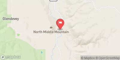


 Dowdy Drive 2, Larimer County
 Creedmore Lake Fishing Site
 Dowdy Lake
 Parvin Lake
 West Lake
 West Lake Day Use Area
 Continue with Snoflo Premium