Make an Announcement

Communicate warnings, disperse advice, and share.


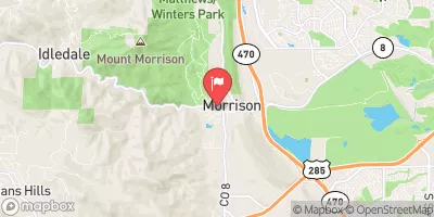
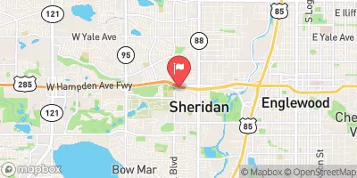
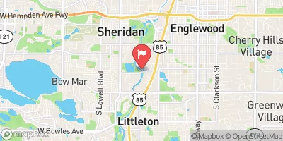
IDLEDALE TO MORRISON

Whitewater River Run


Colorado Bear Creek

Idledale To Morrison

Class IV+ TO V Easy

40 CFS

Too High
35°, Breezy. Snow Likely Then Chance Snow

Suggested river levels for paddling this section of the Bear Creek are between a bare minimum of 150cfs and a high of 800cfs. River conditions sourced from USGS 06711500, the Bear Creek At Mouth Remember only watercraft are permitted at Idledale to Morrison.

Status Too High
Class Level IV+ to V
Elevation 5,303 ft
Run Length 3.0 Mi
Streamflow Discharge 39.5 cfs
Gage Height 2.7 ft
Reporting Streamgage Bear Creek At Mouth
USGS 06711500

Nearby Snowpack and Water Data

Gauge Streamflow Stage
St. Vrain Creek Below Longmont
USGS 06725450
-999,999 cfs ft
Fourmile Creek At Orodell
USGS 06727500
2 cfs 4.5 ft
Coal Creek Near Plainview
USGS 06730300
-888 cfs 0.6 ft
Left Hand Creek At Hover Road Near Longmont
USGS 06724970
2 cfs 5.8 ft
Rock Creek Above Fort Carson Reservation
USGS 07105945
0 cfs 1.1 ft
Clear Creek Abv West Fork Clear Creek Nr Empire Co
USGS 06715000
11 cfs 3.5 ft
West Cr. Abv Shrewsbury Gulch Nr Westcreek Co
USGS 06701700
1 cfs 5.3 ft
Big Dry Creek At Westminster
USGS 06720820
1 cfs 1.5 ft
Cottonwood Ck At Union Blvd
USGS 07103987
2 cfs 10.8 ft
West Monument Creek At Air Force Academy
USGS 07103800
2 cfs 1.3 ft
Snotel Site Snowpack 24hr Change
Medano Pass
SNOTEL 914
22" -1"
Echo Lake
SNOTEL 936
29" 0"
Bear Lake
SNOTEL 322
68" -1"
Crow Creek
SNOTEL 1045
25" -2"
Long Draw Resv
SNOTEL 1123
63" -3"
fort collins
SNOTEL FORC2
1" None"
Sawtooth
SNOTEL 1251
71" -1"
Niwot
SNOTEL 663
43" -1"
High Lonesome
SNOTEL 1187
69" -2"
Copeland Lake
SNOTEL 412
18" -1"
Black Mountain
SNOTEL 1161
43" -1"
Deadman Hill
SNOTEL 438
64" -1"
Jackwhacker Gulch
SNOTEL 935
45" -1"
University Camp
SNOTEL 838
52" -1"
Willow Park
SNOTEL 870
75" -2"
South Colony
SNOTEL 773
70" -2"
Glen Cove
SNOTEL 1057
6" 1"
Hourglass Lake
SNOTEL 1122
44" 0"
Berthoud Summit
SNOTEL 335
66" -1"

Popular Destinations

Campground Campsites Reservations Toilets Showers Elevation
Bear Creek Lake Park 52 5,693 ft
Clear Creek RV Park 36 5,684 ft
Jackson Creek 9 8,179 ft
Osprey 13 6,217 ft
Wigwam 10 6,606 ft
Ouzel 13 6,285 ft
Platte River 10 6,333 ft
Kelsey 17 8,035 ft
Lone Rock 20 6,410 ft
Flat Rocks 19 8,245 ft
Standley Lake None 5,530 ft
Trail Creek None 7,844 ft
Buffalo 41 7,321 ft
Devils Head 21 8,856 ft
Indian Creek 11 7,562 ft
Boulder County Fairground None 4,974 ft
Chatfield State Park 193 5,494 ft
Ski Area Snowpack Air Temperature 5 Day Forecast
Echo Mountain Park 29" 21° 2.3"
River Run Streamflow Length Class
Main Section 55.3cfs 3.0 Mi IV+ to V
Golden Whitewater Park 3.92cfs 0.75 Mi II+
NSV 37.8cfs 13.0 Mi V+
Upper South Boulder Creek 5.0cfs None Mi V+
Idledale to Morrison 11.2cfs 3.0 Mi IV+ to V
Upper Clear Creek 60.7cfs 2.5 Mi IV- to IV+
SSV - Confluence to Picnic Grounds 37.8cfs 5.0 Mi V to V+
Lower Boulder Canyon 42.0cfs None Mi IV- to V-
October Hole 37.8cfs None Mi II
Tunnel 1 to Golden Whitewater Park 60.7cfs None Mi III- to III+
Upper South Boulder Creek 5.0cfs None Mi V+
Gnar Section 405.0cfs 1.0 Mi V+

Log Your Visit

When was your last visit to Idledale to Morrison?

Add a Photo

How was it? How were conditions?

Rate the paddle


Submit

Leave A Review

Idledale To Morrison

Submit

Upload an Image

Idledale To Morrison
Login

Need an Account?

Forgot Your Password?

Delete User Account

Welcome to Snoflo


Continue with a free account

Already Have an Account?


Snoflo Premium

Your first week's free. Cancel anytime

Have a Promo Code?


Already Have an Account?

Signup for Basic Access


Welcome to Snoflo


Continue with a free account

Add Snoflo Premium


Already Have an Account?


Please Verify Your Account

Favorite Limit Reached
Signup for a Free Account

Already Have an Account?