State Highway 6 To The Confluence With The Suwannee River River Run
Community Reviews
Been here? Share the conditions.
Reviews, ratings & photos are added in the free Snoflo iOS app — rate a spot, tag the conditions, and your visit is verified by location. Add or manage your reviews from the app.
State Highway 6 To The Confluence With The Suwannee River
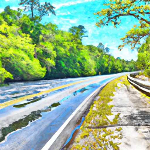
The river rapids and obstacles present in this section of the river are mostly small drops, gentle rapids, and occasional small boulders. The river terrain is mostly flat with some shallow riffles. The riverbanks are heavily forested, adding to the scenic beauty of the area.
Specific regulations to the area include a requirement for all boaters to have a valid Florida boating license. Additionally, all boats must have personal flotation devices for each person on board, and alcohol consumption is prohibited while on the river. It is also important to note that there are no designated take-out points on the Whitewater River Run, so paddlers must plan their trip accordingly.
In conclusion, the Whitewater River Run offers a gentle and scenic paddling experience for beginners and intermediate paddlers. With its Class I-II rating, small drops, and occasional rapids, the river is a great choice for those looking for a fun and easy day trip. Paddlers should be aware of specific regulations to the area and plan their trip accordingly.
Plan your run down to the hour
Same weather feed Snoflo's iOS app uses -- updated continuously from NOAA / yr.no. Watch the precipitation column on the meteogram; rain ahead of a run typically lifts flows 12-48 hours later depending on the basin.
Next 5 days, hour by hour
Temperature line with weather symbols on top, snow + rain accumulation as columns, humidity as a dotted line.
5-day forecast table
Every 3 hours, broken out across temperature, snow, rain, humidity, and wind. Each cell is colour-coded relative to the column min/max.
| Time | Condition | Temp (°F) | Snow (in) | Rain (in) | Humidity (%) | Wind (mps) | Wind dir |
|---|---|---|---|---|---|---|---|
| Loading detailed forecast… | |||||||
15-day temperature & precipitation
Daily temperatures, snow, and rain projected over the next two weeks -- the upstream story that drives next week's flows.
Regional streamflow levels
USGS streamgauges around State Highway 6 To The Confluence With The Suwannee River -- useful for spotting upstream pulses and gauging which tributary is contributing what.
| Streamgauge | Discharge | View |
|---|---|---|
| Withlacoochee River Nr Lee | 468 cfs | → |
| Withlacoochee River Near Pinetta | 144 cfs | → |
| Suwannee River At Ellaville | 1,630 cfs | → |
| Alapaha River Near Jennings Fla | 254 cfs | → |
| Suwannee River At Dowling Park | 1,830 cfs | → |
| Suwannee River At Suwannee Springs Fla | 247 cfs | → |
Plan a longer trip
The closest boat launches, other paddle runs, and campgrounds so a day on the water can grow into a full weekend.
Boat launches
- Withlacoochee River - Nw 47th Street
- Northeast River Park Road 1307, Lee
- Hamilton County Road 143 Public Boat Ramp
- County Road 141
- Suwannee River State Park Boat Ramp
- County Road 249, Jasper
Other river runs
- The Little River Springs At River Mile 81 To The Mouth Of The River At The Gulf Of Mexico
- Ichetucknee Headspring To The First Powerline Crossing Over Ichetucknee River
- The First Powerline Crossing The Ichetuckee River To The Confluence With The Santa Fe River, Down The Santa Fe River To The Suwannee River
- The Suwannee River Sill At River Mile 238 To The Little River Springs At River Mile 81
Campgrounds
Fishing spots
Whitewater safety
- Check the flow before you run
- Use the linked-gauge card and Regional Flow panel above. Class ratings change with flow -- a Class III at low water can become Class IV+ at high water.
- Know your skill ceiling
- Pick runs comfortably below your ceiling. Cold-water and big-water runs raise the consequences of any mistake.
- Wear the right gear
- Helmet, PFD, drysuit / wetsuit when water is below 60°F. Throw bag, knife, and whistle on your person, not in the boat.
- Scout, set safety, and run with a team
- Scout new rapids on foot, set safety with throw bags above the consequence pool, and run with at least one other competent paddler.
- Respect the river
- Strainers, undercuts, low-head dams, and wood can kill at any class rating. When in doubt, portage.
Set push alerts in the Snoflo app
Save State Highway 6 To The Confluence With The Suwannee River as a favorite, set a discharge threshold (e.g. "alert me when flow hits 600 cfs"), and the iOS app pushes the moment the linked gauge crosses.
About State Highway 6 To The Confluence With The Suwannee River
What's the optimal flow for State Highway 6 To The Confluence With The Suwannee River?
The optimal flow depends on the section and the craft. Check the Run Details panel for the linked gauge and current status.
How fresh is the cfs reading on this page?
The linked USGS streamgauge reports continuously (every 15 minutes); Snoflo refreshes throughout the day. Hover the streamflow sparkline to read individual datapoints.
What's the whitewater class?
See the Run Details panel for the class rating Snoflo tracks for this run. Class ratings change with flow -- a Class III at low water can become Class IV in high water.
Where do I put in / take out?
Tap Directions in the hero above to open driving directions to the put-in. For shuttle planning, check the Nearby Boat Launches panel and the river run operator's site.
Can I get alerts when flows hit the optimal range?
Yes -- alerts are managed in the Snoflo iOS app. Favorite this run, set a discharge threshold, and you'll get a push the moment the gauge crosses.
Other runs near here
Snoflo-tracked paddle runs within driving distance of State Highway 6 To The Confluence With The Suwannee River.