Bradwell Bay Wilderness (Northern Boundary) To Bradwell Bay Wilderness Boundary At Trice Bridge On Fr 329 River Run
Community Reviews
Been here? Share the conditions.
Reviews, ratings & photos are added in the free Snoflo iOS app — rate a spot, tag the conditions, and your visit is verified by location. Add or manage your reviews from the app.
Bradwell Bay Wilderness (Northern Boundary) To Bradwell Bay Wilderness Boundary At Trice Bridge On Fr 329
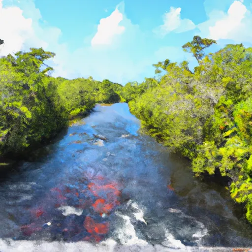
The class rating for the Whitewater River run is Class II-III, making it suitable for intermediate to experienced paddlers. The segment mileage for this run is approximately 5 miles from the Northern Boundary of Bradwell Bay Wilderness to Bradwell Bay Wilderness Boundary at Trice Bridge on Fr 329.
While the Whitewater River run is generally considered to be a safe and enjoyable experience, there are specific rapids and obstacles to be aware of, including the "Double Drop" and "Washing Machine" rapids. Paddlers should also be cautious of submerged logs and low-hanging branches.
As for regulations, it is important to note that Bradwell Bay Wilderness is a designated wilderness area, which means that motorized vehicles and equipment are prohibited. Paddlers must also adhere to Leave No Trace principles, including packing out all trash and avoiding disturbing wildlife.
Overall, the Whitewater River run in Bradwell Bay Wilderness offers an exciting and challenging experience for intermediate to experienced paddlers. With the proper equipment and knowledge of the area, paddlers can safely enjoy this beautiful and unique river.
Plan your run down to the hour
Same weather feed Snoflo's iOS app uses -- updated continuously from NOAA / yr.no. Watch the precipitation column on the meteogram; rain ahead of a run typically lifts flows 12-48 hours later depending on the basin.
Next 5 days, hour by hour
Temperature line with weather symbols on top, snow + rain accumulation as columns, humidity as a dotted line.
5-day forecast table
Every 3 hours, broken out across temperature, snow, rain, humidity, and wind. Each cell is colour-coded relative to the column min/max.
| Time | Condition | Temp (°F) | Snow (in) | Rain (in) | Humidity (%) | Wind (mps) | Wind dir |
|---|---|---|---|---|---|---|---|
| Loading detailed forecast… | |||||||
15-day temperature & precipitation
Daily temperatures, snow, and rain projected over the next two weeks -- the upstream story that drives next week's flows.
Regional streamflow levels
USGS streamgauges around Bradwell Bay Wilderness (Northern Boundary) To Bradwell Bay Wilderness Boundary At Trice Bridge On Fr 329 -- useful for spotting upstream pulses and gauging which tributary is contributing what.
| Streamgauge | Discharge | View |
|---|---|---|
| Sopchoppy River Nr Sopchoppy | 115 cfs | → |
| Lost Creek At Arran Fla | 1 cfs | → |
| Ochlockonee River Nr Smith Creek | 831 cfs | → |
| Wakulla River Near Crawfordville | 147 cfs | → |
| Ochlockonee River Nr Bloxham | 423 cfs | → |
| St. Marks River Near Newport | 503 cfs | → |
Plan a longer trip
The closest boat launches, other paddle runs, and campgrounds so a day on the water can grow into a full weekend.
Boat launches
- Myron B. Hodge Sopchoppy City Park
- Mack Landing
- Wood Lake Boat Ramp
- Hitchcock Lake Boat Ramp
- Tate's Hell State Forest - Log Cabin Camp Site #1 Primitive Boat Launch
- St. Marks National Wildlife Refuge - Otter Lake Boat Ramp
Other river runs
- Tirce Creek Bridge (Monkey Creek) To Forest Service Property Boundary In Sec 13
- Headwaters To Concrete Bridge (Burnt Bridge) On Fh 13 (Where River Enters Bradwell Ray Wilderness)
- Forest Service Property Bounday To St. Marks Wildlife Refuge Boundary
- 2 Miles Below Dam On Lake Talquin To Ochlockonee Bay
- Segment C--Mud Swamp/New River Wilderness Boundary To Mud Swamp/New River Wilderness (Southern) Boundary
Campgrounds
- Pope Still
- Otter Hunt Camp
- Pope Still Hunt Camp
- Bradwell Island Camp
- Bent Sapling Camp
- Myron B. Hodge City Park
Fishing spots
Whitewater safety
- Check the flow before you run
- Use the linked-gauge card and Regional Flow panel above. Class ratings change with flow -- a Class III at low water can become Class IV+ at high water.
- Know your skill ceiling
- Pick runs comfortably below your ceiling. Cold-water and big-water runs raise the consequences of any mistake.
- Wear the right gear
- Helmet, PFD, drysuit / wetsuit when water is below 60°F. Throw bag, knife, and whistle on your person, not in the boat.
- Scout, set safety, and run with a team
- Scout new rapids on foot, set safety with throw bags above the consequence pool, and run with at least one other competent paddler.
- Respect the river
- Strainers, undercuts, low-head dams, and wood can kill at any class rating. When in doubt, portage.
Set push alerts in the Snoflo app
Save Bradwell Bay Wilderness (Northern Boundary) To Bradwell Bay Wilderness Boundary At Trice Bridge On Fr 329 as a favorite, set a discharge threshold (e.g. "alert me when flow hits 600 cfs"), and the iOS app pushes the moment the linked gauge crosses.
About Bradwell Bay Wilderness (Northern Boundary) To Bradwell Bay Wilderness Boundary At Trice Bridge On Fr 329
What's the optimal flow for Bradwell Bay Wilderness (Northern Boundary) To Bradwell Bay Wilderness Boundary At Trice Bridge On Fr 329?
The optimal flow depends on the section and the craft. Check the Run Details panel for the linked gauge and current status.
How fresh is the cfs reading on this page?
The linked USGS streamgauge reports continuously (every 15 minutes); Snoflo refreshes throughout the day. Hover the streamflow sparkline to read individual datapoints.
What's the whitewater class?
See the Run Details panel for the class rating Snoflo tracks for this run. Class ratings change with flow -- a Class III at low water can become Class IV in high water.
Where do I put in / take out?
Tap Directions in the hero above to open driving directions to the put-in. For shuttle planning, check the Nearby Boat Launches panel and the river run operator's site.
Can I get alerts when flows hit the optimal range?
Yes -- alerts are managed in the Snoflo iOS app. Favorite this run, set a discharge threshold, and you'll get a push the moment the gauge crosses.
Other runs near here
Snoflo-tracked paddle runs within driving distance of Bradwell Bay Wilderness (Northern Boundary) To Bradwell Bay Wilderness Boundary At Trice Bridge On Fr 329.