Headwaters To Wade Creek River Run
Community Reviews
Been here? Share the conditions.
Reviews, ratings & photos are added in the free Snoflo iOS app — rate a spot, tag the conditions, and your visit is verified by location. Add or manage your reviews from the app.
Headwaters To Wade Creek
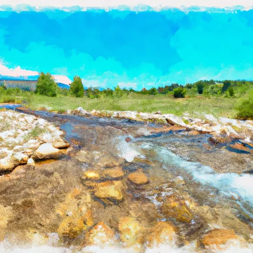
The segment mileage for this river run is approximately 12 miles, starting at the Headwaters and ending at Wade Creek. The river is characterized by steep gradients, narrow canyons, and technical rapids, making it a challenging yet rewarding experience.
The river rapids and obstacles to watch out for on this run include The Notch, Boulder Garden, and The Narrows. The Notch is a technical rapid where paddlers must navigate a steep drop and a tight chute. Boulder Garden is a long rapid characterized by large boulders and hydraulics. The Narrows is a narrow canyon section with swift currents and challenging rapids.
Specific regulations for this area include obtaining a permit from the Bureau of Land Management (BLM) and following Leave No Trace principles. The BLM limits group sizes to no more than 25 people and requires all participants to wear a personal flotation device (PFD) at all times. Additionally, fires are not allowed in this area.
In conclusion, the Whitewater River Run Headwaters to Wade Creek in Idaho offers a challenging and exhilarating experience for experienced paddlers. It is important to follow the specific regulations for this area and to check current streamflow levels before embarking on this adventure.
Plan your run down to the hour
Same weather feed Snoflo's iOS app uses -- updated continuously from NOAA / yr.no. Watch the precipitation column on the meteogram; rain ahead of a run typically lifts flows 12-48 hours later depending on the basin.
Next 5 days, hour by hour
Temperature line with weather symbols on top, snow + rain accumulation as columns, humidity as a dotted line.
5-day forecast table
Every 3 hours, broken out across temperature, snow, rain, humidity, and wind. Each cell is colour-coded relative to the column min/max.
| Time | Condition | Temp (°F) | Snow (in) | Rain (in) | Humidity (%) | Wind (mps) | Wind dir |
|---|---|---|---|---|---|---|---|
| Loading detailed forecast… | |||||||
15-day temperature & precipitation
Daily temperatures, snow, and rain projected over the next two weeks -- the upstream story that drives next week's flows.
Regional streamflow levels
USGS streamgauges around Headwaters To Wade Creek -- useful for spotting upstream pulses and gauging which tributary is contributing what.
| Streamgauge | Discharge | View |
|---|---|---|
| Lemhi River Nr Lemhi Id | 93 cfs | → |
| Pahsimeroi River At Ellis Id | 111 cfs | → |
| Lemhi River Below L5 Diversion Near Salmon | 26 cfs | → |
| Salmon River At Salmon Id | 1,110 cfs | → |
| Blackbird Creek Near Cobalt | 12 cfs | → |
| Napias Creek Below Arnett Creek Near Leesburg | 18 cfs | → |
Plan a longer trip
The closest boat launches, other paddle runs, and campgrounds so a day on the water can grow into a full weekend.
Other river runs
- Trailhead To Confluence With Hayden Creek
- Wade Creek To Nf Boundary
- Bear Valley Lake To Trailhead
- Cow Creek
- Colston To The Town Of Salmon
Whitewater safety
- Check the flow before you run
- Use the linked-gauge card and Regional Flow panel above. Class ratings change with flow -- a Class III at low water can become Class IV+ at high water.
- Know your skill ceiling
- Pick runs comfortably below your ceiling. Cold-water and big-water runs raise the consequences of any mistake.
- Wear the right gear
- Helmet, PFD, drysuit / wetsuit when water is below 60°F. Throw bag, knife, and whistle on your person, not in the boat.
- Scout, set safety, and run with a team
- Scout new rapids on foot, set safety with throw bags above the consequence pool, and run with at least one other competent paddler.
- Respect the river
- Strainers, undercuts, low-head dams, and wood can kill at any class rating. When in doubt, portage.
Set push alerts in the Snoflo app
Save Headwaters To Wade Creek as a favorite, set a discharge threshold (e.g. "alert me when flow hits 600 cfs"), and the iOS app pushes the moment the linked gauge crosses.
About Headwaters To Wade Creek
What's the optimal flow for Headwaters To Wade Creek?
The optimal flow depends on the section and the craft. Check the Run Details panel for the linked gauge and current status.
How fresh is the cfs reading on this page?
The linked USGS streamgauge reports continuously (every 15 minutes); Snoflo refreshes throughout the day. Hover the streamflow sparkline to read individual datapoints.
What's the whitewater class?
See the Run Details panel for the class rating Snoflo tracks for this run. Class ratings change with flow -- a Class III at low water can become Class IV in high water.
Where do I put in / take out?
Tap Directions in the hero above to open driving directions to the put-in. For shuttle planning, check the Nearby Boat Launches panel and the river run operator's site.
Can I get alerts when flows hit the optimal range?
Yes -- alerts are managed in the Snoflo iOS app. Favorite this run, set a discharge threshold, and you'll get a push the moment the gauge crosses.
Other runs near here
Snoflo-tracked paddle runs within driving distance of Headwaters To Wade Creek.