Gila Wilderness Boundary To Confluence With East Fork Gila River River Run
Community Reviews
Been here? Share the conditions.
Reviews, ratings & photos are added in the free Snoflo iOS app — rate a spot, tag the conditions, and your visit is verified by location. Add or manage your reviews from the app.
Gila Wilderness Boundary To Confluence With East Fork Gila River
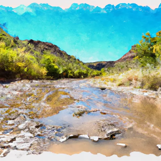
The segment mileage for this run is approximately 16 miles and includes exciting rapids such as the "Box," "The Chute," and "The Narrows." These rapids provide for a thrilling adventure and challenge for experienced paddlers. Other notable obstacles include log jams and strainers, especially during high water.
Specific regulations for this area include obtaining a permit to access the Gila Wilderness and adhering to Leave No Trace principles. The use of motorized vehicles and equipment is prohibited in this area, and camping is only allowed in designated campgrounds.
Sources for this information include the Bureau of Land Management and American Whitewater. It is important for individuals to verify current streamflow conditions and regulations before embarking on this adventure to ensure a safe and enjoyable experience.
Plan your run down to the hour
Same weather feed Snoflo's iOS app uses -- updated continuously from NOAA / yr.no. Watch the precipitation column on the meteogram; rain ahead of a run typically lifts flows 12-48 hours later depending on the basin.
Next 5 days, hour by hour
Temperature line with weather symbols on top, snow + rain accumulation as columns, humidity as a dotted line.
5-day forecast table
Every 3 hours, broken out across temperature, snow, rain, humidity, and wind. Each cell is colour-coded relative to the column min/max.
| Time | Condition | Temp (°F) | Snow (in) | Rain (in) | Humidity (%) | Wind (mps) | Wind dir |
|---|---|---|---|---|---|---|---|
| Loading detailed forecast… | |||||||
15-day temperature & precipitation
Daily temperatures, snow, and rain projected over the next two weeks -- the upstream story that drives next week's flows.
Regional streamflow levels
USGS streamgauges around Gila Wilderness Boundary To Confluence With East Fork Gila River -- useful for spotting upstream pulses and gauging which tributary is contributing what.
| Streamgauge | Discharge | View |
|---|---|---|
| Gila River Near Gila | 33 cfs | → |
| Mogollon Creek Near Cliff | 0 cfs | → |
| Mimbres River At Mimbres | 1,040 cfs | → |
| San Francisco River Near Glenwood | 74 cfs | → |
| Gila River Near Redrock | 14 cfs | → |
| San Francisco River Near Reserve | 3,350 cfs | → |
Plan a longer trip
The closest boat launches, other paddle runs, and campgrounds so a day on the water can grow into a full weekend.
Other river runs
- Aldo Leopold Wilderness Boundary To Gila Wilderness Boundary
- Gila Wilderness Boundary (Below Snow Lake) To Gila Wilderness Boundary (Sec 24, T12s, R14w)
- Wilderness Run
- Northern Boundary Nm To Eastern Boundary Gila Cliff Dwellings Nm
- Headwaters To Northern Boundary Gila Cliff Dwellings Nm
Whitewater safety
- Check the flow before you run
- Use the linked-gauge card and Regional Flow panel above. Class ratings change with flow -- a Class III at low water can become Class IV+ at high water.
- Know your skill ceiling
- Pick runs comfortably below your ceiling. Cold-water and big-water runs raise the consequences of any mistake.
- Wear the right gear
- Helmet, PFD, drysuit / wetsuit when water is below 60°F. Throw bag, knife, and whistle on your person, not in the boat.
- Scout, set safety, and run with a team
- Scout new rapids on foot, set safety with throw bags above the consequence pool, and run with at least one other competent paddler.
- Respect the river
- Strainers, undercuts, low-head dams, and wood can kill at any class rating. When in doubt, portage.
Set push alerts in the Snoflo app
Save Gila Wilderness Boundary To Confluence With East Fork Gila River as a favorite, set a discharge threshold (e.g. "alert me when flow hits 600 cfs"), and the iOS app pushes the moment the linked gauge crosses.
About Gila Wilderness Boundary To Confluence With East Fork Gila River
What's the optimal flow for Gila Wilderness Boundary To Confluence With East Fork Gila River?
The optimal flow depends on the section and the craft. Check the Run Details panel for the linked gauge and current status.
How fresh is the cfs reading on this page?
The linked USGS streamgauge reports continuously (every 15 minutes); Snoflo refreshes throughout the day. Hover the streamflow sparkline to read individual datapoints.
What's the whitewater class?
See the Run Details panel for the class rating Snoflo tracks for this run. Class ratings change with flow -- a Class III at low water can become Class IV in high water.
Where do I put in / take out?
Tap Directions in the hero above to open driving directions to the put-in. For shuttle planning, check the Nearby Boat Launches panel and the river run operator's site.
Can I get alerts when flows hit the optimal range?
Yes -- alerts are managed in the Snoflo iOS app. Favorite this run, set a discharge threshold, and you'll get a push the moment the gauge crosses.
Other runs near here
Snoflo-tracked paddle runs within driving distance of Gila Wilderness Boundary To Confluence With East Fork Gila River.