Rio Pueblo De Taos River Run
Community Reviews
Been here? Share the conditions.
Reviews, ratings & photos are added in the free Snoflo iOS app — rate a spot, tag the conditions, and your visit is verified by location. Add or manage your reviews from the app.
Rio Pueblo De Taos
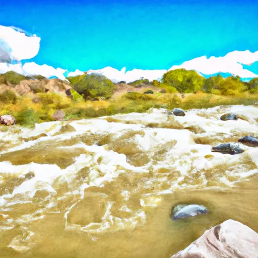
The specific river rapids/obstacles that paddlers will encounter during this river run include "Big Arsenic", "Little Arsenic", and "Pinball". These rapids are challenging, with large waves, turbulent water, and tight canyons that require precise maneuvering. Paddlers should also watch out for logjams, undercuts, and strainers that can be found throughout the river run.
Specific regulations to the area include permits that are required for commercial river outfitters. Private boaters are required to obtain a permit from the Bureau of Land Management, which is limited to a specific number of users per day. Additionally, there are restrictions on camping and fires along the river.
Overall, the Rio Pueblo De Taos is a beautiful and challenging river run that requires advanced skills and experience. Paddlers should be prepared for a remote and rugged environment, with limited access to resources and emergency services. It is important to check current river conditions and water levels before attempting this river run, as it can be dangerous during high water periods.
Plan your run down to the hour
Same weather feed Snoflo's iOS app uses -- updated continuously from NOAA / yr.no. Watch the precipitation column on the meteogram; rain ahead of a run typically lifts flows 12-48 hours later depending on the basin.
Next 5 days, hour by hour
Temperature line with weather symbols on top, snow + rain accumulation as columns, humidity as a dotted line.
5-day forecast table
Every 3 hours, broken out across temperature, snow, rain, humidity, and wind. Each cell is colour-coded relative to the column min/max.
| Time | Condition | Temp (°F) | Snow (in) | Rain (in) | Humidity (%) | Wind (mps) | Wind dir |
|---|---|---|---|---|---|---|---|
| Loading detailed forecast… | |||||||
15-day temperature & precipitation
Daily temperatures, snow, and rain projected over the next two weeks -- the upstream story that drives next week's flows.
Regional streamflow levels
USGS streamgauges around Rio Pueblo De Taos -- useful for spotting upstream pulses and gauging which tributary is contributing what.
| Streamgauge | Discharge | View |
|---|---|---|
| Rio Grande Blw Taos Junction Bridge Near Taos | 137 cfs | → |
| Rio Pueblo De Taos Below Los Cordovas | 11 cfs | → |
| Rio Grande Del Rancho Near Talpa | 0 cfs | → |
| Embudo Creek At Dixon | 1 cfs | → |
| Rio Pueblo Nr Penasco | 2 cfs | → |
| Rio Pueblo De Taos Near Taos | 3 cfs | → |
Plan a longer trip
The closest boat launches, other paddle runs, and campgrounds so a day on the water can grow into a full weekend.
Boat launches
- Taos Junction Bridge Taos County
- Taos Junction Bridge Boat Takeout
- Taos Junction Bridge Boat Launch
- Nm 570 Taos County
- Lone Juniper Boat Launch
- Lone Juniper Boat Takeout
Other river runs
Campgrounds
- Rio Pueblo Campground
- Orilla Verde Campground
- Taos Junction Campground
- Taos Junction
- Petaca
- Petaca Campground
Fishing spots
- Rio Chiquito Fishing
- Rito De La Olla Fishing
- Rio Fernando Fishing
- Rio Vallecitos Fishing
- Rio Trampas Fishing
- Rio Grande Fishing
Parks
Whitewater safety
- Check the flow before you run
- Use the linked-gauge card and Regional Flow panel above. Class ratings change with flow -- a Class III at low water can become Class IV+ at high water.
- Know your skill ceiling
- Pick runs comfortably below your ceiling. Cold-water and big-water runs raise the consequences of any mistake.
- Wear the right gear
- Helmet, PFD, drysuit / wetsuit when water is below 60°F. Throw bag, knife, and whistle on your person, not in the boat.
- Scout, set safety, and run with a team
- Scout new rapids on foot, set safety with throw bags above the consequence pool, and run with at least one other competent paddler.
- Respect the river
- Strainers, undercuts, low-head dams, and wood can kill at any class rating. When in doubt, portage.
Set push alerts in the Snoflo app
Save Rio Pueblo De Taos as a favorite, set a discharge threshold (e.g. "alert me when flow hits 600 cfs"), and the iOS app pushes the moment the linked gauge crosses.
About Rio Pueblo De Taos
What's the optimal flow for Rio Pueblo De Taos ?
The optimal flow depends on the section and the craft. Check the Run Details panel for the linked gauge and current status.
How fresh is the cfs reading on this page?
The linked USGS streamgauge reports continuously (every 15 minutes); Snoflo refreshes throughout the day. Hover the streamflow sparkline to read individual datapoints.
What's the whitewater class?
See the Run Details panel for the class rating Snoflo tracks for this run. Class ratings change with flow -- a Class III at low water can become Class IV in high water.
Where do I put in / take out?
Tap Directions in the hero above to open driving directions to the put-in. For shuttle planning, check the Nearby Boat Launches panel and the river run operator's site.
Can I get alerts when flows hit the optimal range?
Yes -- alerts are managed in the Snoflo iOS app. Favorite this run, set a discharge threshold, and you'll get a push the moment the gauge crosses.
Other runs near here
Snoflo-tracked paddle runs within driving distance of Rio Pueblo De Taos .