Russel Lake To Mt. Jefferson Wilderness Boundary River Run
Community Reviews
Been here? Share the conditions.
Reviews, ratings & photos are added in the free Snoflo iOS app — rate a spot, tag the conditions, and your visit is verified by location. Add or manage your reviews from the app.
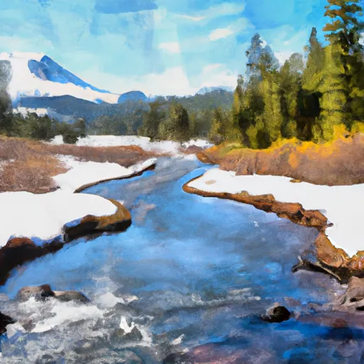
Russel Lake To Mt. Jefferson Wilderness Boundary
The segment mileage for this run is approximately 10 miles, taking around 4-5 hours to complete. Some specific rapids and obstacles include Boulder Drop, which requires tight maneuvering through a narrow passage with boulders; Pinball, which has multiple rocks and boulders that create a pinball effect for rafts and kayaks; and Staircase, which has a series of steep drops and ledges.
There are specific regulations to the area that visitors must adhere to, such as obtaining a wilderness permit and following Leave No Trace principles. It is also important to note that motorized vehicles are not allowed in the wilderness area. Overall, the Whitewater River Run is a challenging and exhilarating adventure for experienced paddlers.
Plan your run down to the hour
Same weather feed Snoflo's iOS app uses -- updated continuously from NOAA / yr.no. Watch the precipitation column on the meteogram; rain ahead of a run typically lifts flows 12-48 hours later depending on the basin.
Next 5 days, hour by hour
Temperature line with weather symbols on top, snow + rain accumulation as columns, humidity as a dotted line.
5-day forecast table
Every 3 hours, broken out across temperature, snow, rain, humidity, and wind. Each cell is colour-coded relative to the column min/max.
| Time | Condition | Temp (°F) | Snow (in) | Rain (in) | Humidity (%) | Wind (mps) | Wind dir |
|---|---|---|---|---|---|---|---|
| Loading detailed forecast… | |||||||
15-day temperature & precipitation
Daily temperatures, snow, and rain projected over the next two weeks -- the upstream story that drives next week's flows.
Regional streamflow levels
USGS streamgauges around Russel Lake To Mt. Jefferson Wilderness Boundary -- useful for spotting upstream pulses and gauging which tributary is contributing what.
| Streamgauge | Discharge | View |
|---|---|---|
| No Santiam R Blw Boulder Crk | 382 cfs | → |
| Shitike Cr | 29 cfs | → |
| Breitenbush R Abv French Cr Nr Detroit | 116 cfs | → |
| Blowout Creek Near Detroit | 6 cfs | → |
| North Santiam River At Niagara | 999 cfs | → |
| Metolius River Near Grandview | 1,230 cfs | → |
Plan a longer trip
The closest boat launches, other paddle runs, and campgrounds so a day on the water can grow into a full weekend.
Boat launches
- Peninsula Campground
- Ollalie Lake Resort
- Hoover Campground
- Detroit Lake Marina
- Elk Lake Campgound
- Kane's Marina
Other river runs
- Breitenbush Lake To Confluence With North Fork Breitenbush River
- Mt. Jefferson Wilderness Boundary To Confluence With Breitenbush River
- Highway 22 To Confluence With Rainbow Creek
- Confluence With North Fork Breitenbush River To Detroit Reservoir
- Headwaters To Mt Jefferson Wilderness Boundary
Campgrounds
- Breitenbush Lake Campground
- Horsehoe Lake Campground
- Breitenbush Campground
- Camp Ten (Olallie Lake) Campground
- Peninsula (Olallie Lake) Campground
- Cleator Bend Group Campground
Whitewater safety
- Check the flow before you run
- Use the linked-gauge card and Regional Flow panel above. Class ratings change with flow -- a Class III at low water can become Class IV+ at high water.
- Know your skill ceiling
- Pick runs comfortably below your ceiling. Cold-water and big-water runs raise the consequences of any mistake.
- Wear the right gear
- Helmet, PFD, drysuit / wetsuit when water is below 60°F. Throw bag, knife, and whistle on your person, not in the boat.
- Scout, set safety, and run with a team
- Scout new rapids on foot, set safety with throw bags above the consequence pool, and run with at least one other competent paddler.
- Respect the river
- Strainers, undercuts, low-head dams, and wood can kill at any class rating. When in doubt, portage.
Set push alerts in the Snoflo app
Save Russel Lake To Mt. Jefferson Wilderness Boundary as a favorite, set a discharge threshold (e.g. "alert me when flow hits 600 cfs"), and the iOS app pushes the moment the linked gauge crosses.
About Russel Lake To Mt. Jefferson Wilderness Boundary
What's the optimal flow for Russel Lake To Mt. Jefferson Wilderness Boundary?
The optimal flow depends on the section and the craft. Check the Run Details panel for the linked gauge and current status.
How fresh is the cfs reading on this page?
The linked USGS streamgauge reports continuously (every 15 minutes); Snoflo refreshes throughout the day. Hover the streamflow sparkline to read individual datapoints.
What's the whitewater class?
See the Run Details panel for the class rating Snoflo tracks for this run. Class ratings change with flow -- a Class III at low water can become Class IV in high water.
Where do I put in / take out?
Tap Directions in the hero above to open driving directions to the put-in. For shuttle planning, check the Nearby Boat Launches panel and the river run operator's site.
Can I get alerts when flows hit the optimal range?
Yes -- alerts are managed in the Snoflo iOS app. Favorite this run, set a discharge threshold, and you'll get a push the moment the gauge crosses.
Other runs near here
Snoflo-tracked paddle runs within driving distance of Russel Lake To Mt. Jefferson Wilderness Boundary.