Breitenbush Lake To Confluence With North Fork Breitenbush River River Run
Community Reviews
Been here? Share the conditions.
Reviews, ratings & photos are added in the free Snoflo iOS app — rate a spot, tag the conditions, and your visit is verified by location. Add or manage your reviews from the app.
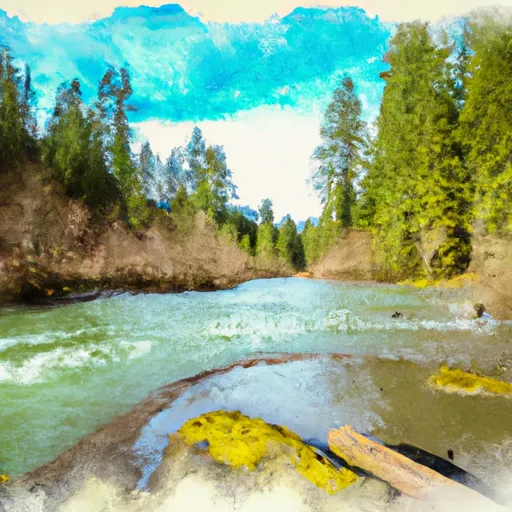
Breitenbush Lake To Confluence With North Fork Breitenbush River
This segment of the river is rated as Class III to IV, with notable rapids such as Horseshoe Falls, Pipeline, and Pinball. These rapids offer a challenging and exciting experience for intermediate to advanced paddlers. The total mileage for this run is approximately 7.5 miles, with an average gradient of 60 feet per mile.
While this section of the river is open to the public for recreational use, there are specific regulations that must be followed. Paddlers must wear appropriate safety gear, including a PFD and helmet. Camping is not allowed along the riverbank, and all trash must be packed out. In addition, the use of alcohol and drugs is strictly prohibited.
It is important for paddlers to be aware of the potential hazards of this run, including swift currents, submerged obstacles, and steep drop-offs. It is recommended that paddlers have prior experience with Class III rapids before attempting this run.
Plan your run down to the hour
Same weather feed Snoflo's iOS app uses -- updated continuously from NOAA / yr.no. Watch the precipitation column on the meteogram; rain ahead of a run typically lifts flows 12-48 hours later depending on the basin.
Next 5 days, hour by hour
Temperature line with weather symbols on top, snow + rain accumulation as columns, humidity as a dotted line.
5-day forecast table
Every 3 hours, broken out across temperature, snow, rain, humidity, and wind. Each cell is colour-coded relative to the column min/max.
| Time | Condition | Temp (°F) | Snow (in) | Rain (in) | Humidity (%) | Wind (mps) | Wind dir |
|---|---|---|---|---|---|---|---|
| Loading detailed forecast… | |||||||
15-day temperature & precipitation
Daily temperatures, snow, and rain projected over the next two weeks -- the upstream story that drives next week's flows.
Regional streamflow levels
USGS streamgauges around Breitenbush Lake To Confluence With North Fork Breitenbush River -- useful for spotting upstream pulses and gauging which tributary is contributing what.
| Streamgauge | Discharge | View |
|---|---|---|
| Shitike Cr | 32 cfs | → |
| No Santiam R Blw Boulder Crk | 430 cfs | → |
| Breitenbush R Abv French Cr Nr Detroit | 132 cfs | → |
| Blowout Creek Near Detroit | 8 cfs | → |
| Metolius River Near Grandview | 1,250 cfs | → |
| Oak Grove Fork Above Powerplant Intake | 263 cfs | → |
Plan a longer trip
The closest boat launches, other paddle runs, and campgrounds so a day on the water can grow into a full weekend.
Boat launches
- Peninsula Campground
- Ollalie Lake Resort
- Elk Lake Campgound
- Hoover Campground
- Detroit Lake Marina
- Kane's Marina
Other river runs
- Russel Lake To Mt. Jefferson Wilderness Boundary
- Mt. Jefferson Wilderness Boundary To Confluence With Breitenbush River
- Highway 22 To Confluence With Rainbow Creek
- Confluence With North Fork Breitenbush River To Detroit Reservoir
- Opal Lake To Confluence With Battle Axe Creek
Campgrounds
- Horsehoe Lake Campground
- Camp Ten (Olallie Lake) Campground
- Breitenbush Lake Campground
- Peninsula (Olallie Lake) Campground
- Peninsula Campground
- Paul Dennis (Olallie Lake) Campground
Whitewater safety
- Check the flow before you run
- Use the linked-gauge card and Regional Flow panel above. Class ratings change with flow -- a Class III at low water can become Class IV+ at high water.
- Know your skill ceiling
- Pick runs comfortably below your ceiling. Cold-water and big-water runs raise the consequences of any mistake.
- Wear the right gear
- Helmet, PFD, drysuit / wetsuit when water is below 60°F. Throw bag, knife, and whistle on your person, not in the boat.
- Scout, set safety, and run with a team
- Scout new rapids on foot, set safety with throw bags above the consequence pool, and run with at least one other competent paddler.
- Respect the river
- Strainers, undercuts, low-head dams, and wood can kill at any class rating. When in doubt, portage.
Set push alerts in the Snoflo app
Save Breitenbush Lake To Confluence With North Fork Breitenbush River as a favorite, set a discharge threshold (e.g. "alert me when flow hits 600 cfs"), and the iOS app pushes the moment the linked gauge crosses.
About Breitenbush Lake To Confluence With North Fork Breitenbush River
What's the optimal flow for Breitenbush Lake To Confluence With North Fork Breitenbush River?
The optimal flow depends on the section and the craft. Check the Run Details panel for the linked gauge and current status.
How fresh is the cfs reading on this page?
The linked USGS streamgauge reports continuously (every 15 minutes); Snoflo refreshes throughout the day. Hover the streamflow sparkline to read individual datapoints.
What's the whitewater class?
See the Run Details panel for the class rating Snoflo tracks for this run. Class ratings change with flow -- a Class III at low water can become Class IV in high water.
Where do I put in / take out?
Tap Directions in the hero above to open driving directions to the put-in. For shuttle planning, check the Nearby Boat Launches panel and the river run operator's site.
Can I get alerts when flows hit the optimal range?
Yes -- alerts are managed in the Snoflo iOS app. Favorite this run, set a discharge threshold, and you'll get a push the moment the gauge crosses.
Other runs near here
Snoflo-tracked paddle runs within driving distance of Breitenbush Lake To Confluence With North Fork Breitenbush River.