2026-02-19T10:00:00-08:00
* WHAT...For the Winter Weather Advisory below 1500 ft, wet snow expected. Additional snow accumulations of 1 to 3 inches. For the Winter Storm Warning above 1500 ft, heavy snow expected. Additional snow accumulations 3 to 6 inches for the passes north of I-5, and the Illinois Valley except up to 10 inches for the southern portions of the Illinois Valley. 1 to 2 ft in the Kalmiopsis Wilderness region. * WHERE...For the Winter Weather Advisory below 1500 ft, this includes Grants Pass, Wilderville, Merlin, Galice and Agness as well as portions of I-5 and Highway 199. For the Winter Storm Warning above 1500 ft, this includes Cave Junction, Obrien, Selma and Wolf Creek. This also includes portions of I-5 and Highway 199 and the Sexton Pass, Smith Hill and Stage Pass on I-5, Hayes Hill on Highway 199 and Bear Camp road in the Kalmiopsis Wilderness. * WHEN...Until 10 AM PST Thursday. * IMPACTS...Travel may be very difficult to impossible. The hazardous conditions could impact the evening and morning commutes. * ADDITIONAL DETAILS...Precipitation will be lighter and more showery tonight into Wednesday with mostly light accumulations. Another round of heavier snowfall is expected Wednesday night into Thursday. Visit weather.gov/mfr/winter for additional snow probabilities
Summary
The ideal streamflow range for this run is between 600 and 2,000 cubic feet per second (cfs). The class rating for this run is Class III-IV, with some sections reaching Class V during high water.
The segment mileage for this run is approximately 15.5 miles. Along the way, kayakers and rafters will encounter several notable rapids and obstacles, including Tight Squeeze, Boulder Garden, and Devil's Deadfall. These rapids are challenging and require significant skill and experience to navigate safely.
To ensure the safety of all visitors, there are several specific regulations in place for this section of the Whitewater River. For example, all kayakers and rafters must wear a personal flotation device (PFD) at all times while on the river. Additionally, groups must be limited to no more than 12 people, and all visitors must pack out their trash to help preserve the natural beauty of the area.
°F
°F
mph
Wind
%
Humidity
15-Day Weather Outlook
River Run Details
| Last Updated | 2026-02-07 |
| River Levels | 3550 cfs (3.86 ft) |
| Percent of Normal | 31% |
| Status | |
| Class Level | iii-iv |
| Elevation | ft |
| Streamflow Discharge | cfs |
| Gauge Height | ft |
| Reporting Streamgage | USGS 14372300 |
5-Day Hourly Forecast Detail
Nearby Streamflow Levels
 Rogue River Near Agness
|
3310cfs |
 West Fork Cow Creek Near Glendale
|
101cfs |
 Illinois River Near Kerby
|
662cfs |
 Applegate River Near Wilderville
|
345cfs |
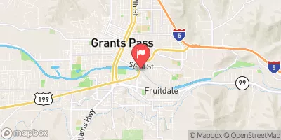 Rogue River At Grants Pass
|
1790cfs |
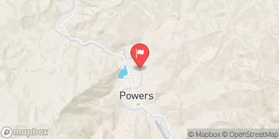 South Fork Coquille River At Powers
|
366cfs |
Area Campgrounds
| Location | Reservations | Toilets |
|---|---|---|
 Grassy Flats
|
||
 Grassy Flats Dispersed Campsites
|
||
 Bear Camp Campground
|
||
 Meyers Camp Dispersed Campsites
|
||
 Upper Black Bar (R8.20R)
|
||
 Big Windy (R8.10L)
|
River Runs
-
 Confluence With Chief Creek To Confluence With Breezy Creek
-
 Landslide (Se1/4 Of Sec 33, T35S, R10W) To Confluence With West Indigo Creek
-
 Confluence With Breezy Creek To Confluence With West Fork Indigo Creek
-
 West Indigo Lake (Sw1/4 Of Sec 26, T34S, R7W) To Confluence With East Fork Indigo
-
 Howard Creek Seg A
-
 Howard Creek Seg B

