Source To Mouth River Run
Community Reviews
Been here? Share the conditions.
Reviews, ratings & photos are added in the free Snoflo iOS app — rate a spot, tag the conditions, and your visit is verified by location. Add or manage your reviews from the app.
Source To Mouth
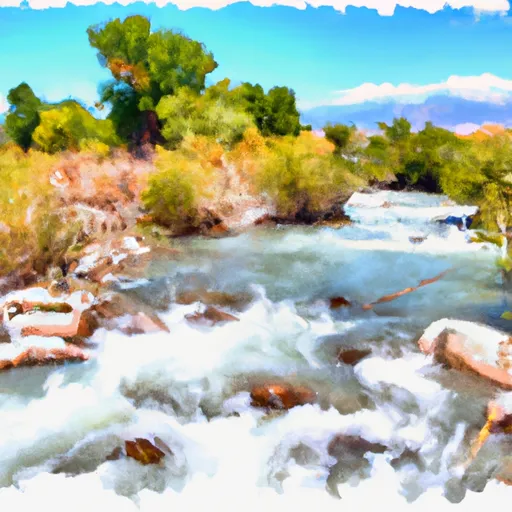
The river run covers a total distance of 46 miles, with various segments offering different levels of difficulty. The upper segment of the river, from the Source to Woodside Bridge, is a class II-III section that covers 21 miles. It features rapids such as Baptism, Lower Baptism, and Happy Ending. The middle section, from Woodside Bridge to Big Hollow Creek, spans 8 miles and is more challenging, with class III and IV rapids, including the infamous S-bend. The lower segment, from Big Hollow Creek to the Mouth, is a class II section that covers 17 miles, with rapids such as The Aquarium and Pick Your Poison.
The river run has specific regulations in place to ensure safety and minimize the impact on the environment. For instance, all boaters are required to wear Personal Flotation Devices (PFDs) at all times while on the river. Additionally, the river is designated as a Wild and Scenic River, which prohibits any form of development along the river corridor.
In conclusion, the Whitewater River Run is a thrilling adventure that offers a range of challenges for rafters and kayakers alike. It is important to follow the specific regulations in place to ensure safety and preserve the natural beauty of the area.
Plan your run down to the hour
Same weather feed Snoflo's iOS app uses -- updated continuously from NOAA / yr.no. Watch the precipitation column on the meteogram; rain ahead of a run typically lifts flows 12-48 hours later depending on the basin.
Next 5 days, hour by hour
Temperature line with weather symbols on top, snow + rain accumulation as columns, humidity as a dotted line.
5-day forecast table
Every 3 hours, broken out across temperature, snow, rain, humidity, and wind. Each cell is colour-coded relative to the column min/max.
| Time | Condition | Temp (°F) | Snow (in) | Rain (in) | Humidity (%) | Wind (mps) | Wind dir |
|---|---|---|---|---|---|---|---|
| Loading detailed forecast… | |||||||
15-day temperature & precipitation
Daily temperatures, snow, and rain projected over the next two weeks -- the upstream story that drives next week's flows.
Regional streamflow levels
USGS streamgauges around Source To Mouth -- useful for spotting upstream pulses and gauging which tributary is contributing what.
| Streamgauge | Discharge | View |
|---|---|---|
| Logan | 64 cfs | → |
| Logan River Above State Dam | 79 cfs | → |
| Blacksmith Fork Ab U.P.&L. Co | 52 cfs | → |
| Bear River At Idaho-Utah State Line | 931 cfs | → |
| Little Bear River At Paradise | 14 cfs | → |
| Big Creek Near Randolph | 3 cfs | → |
Plan a longer trip
The closest boat launches, other paddle runs, and campgrounds so a day on the water can grow into a full weekend.
Boat launches
Other river runs
Campgrounds
- Lewis M. Turner Campground
- Lodge Campground
- Tony Grove Lake
- Red Banks Campground
- Tony Grove Lake Campground
- Wood Camp Campground
Whitewater safety
- Check the flow before you run
- Use the linked-gauge card and Regional Flow panel above. Class ratings change with flow -- a Class III at low water can become Class IV+ at high water.
- Know your skill ceiling
- Pick runs comfortably below your ceiling. Cold-water and big-water runs raise the consequences of any mistake.
- Wear the right gear
- Helmet, PFD, drysuit / wetsuit when water is below 60°F. Throw bag, knife, and whistle on your person, not in the boat.
- Scout, set safety, and run with a team
- Scout new rapids on foot, set safety with throw bags above the consequence pool, and run with at least one other competent paddler.
- Respect the river
- Strainers, undercuts, low-head dams, and wood can kill at any class rating. When in doubt, portage.
Set push alerts in the Snoflo app
Save Source To Mouth as a favorite, set a discharge threshold (e.g. "alert me when flow hits 600 cfs"), and the iOS app pushes the moment the linked gauge crosses.
About Source To Mouth
What's the optimal flow for Source To Mouth?
The optimal flow depends on the section and the craft. Check the Run Details panel for the linked gauge and current status.
How fresh is the cfs reading on this page?
The linked USGS streamgauge reports continuously (every 15 minutes); Snoflo refreshes throughout the day. Hover the streamflow sparkline to read individual datapoints.
What's the whitewater class?
See the Run Details panel for the class rating Snoflo tracks for this run. Class ratings change with flow -- a Class III at low water can become Class IV in high water.
Where do I put in / take out?
Tap Directions in the hero above to open driving directions to the put-in. For shuttle planning, check the Nearby Boat Launches panel and the river run operator's site.
Can I get alerts when flows hit the optimal range?
Yes -- alerts are managed in the Snoflo iOS app. Favorite this run, set a discharge threshold, and you'll get a push the moment the gauge crosses.
Other runs near here
Snoflo-tracked paddle runs within driving distance of Source To Mouth.