Forest Land At Entrance Of Laurel Fork South Wilderness To Exit Laurel Fork North Wilderness River Run
Community Reviews
Been here? Share the conditions.
Reviews, ratings & photos are added in the free Snoflo iOS app — rate a spot, tag the conditions, and your visit is verified by location. Add or manage your reviews from the app.
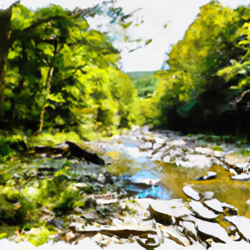
Forest Land At Entrance Of Laurel Fork South Wilderness To Exit Laurel Fork North Wilderness
There are several specific rapids and obstacles to look out for on this run, including the Big Splat, Sweets Falls, and Pillow Rock. These rapids can be quite challenging, especially during higher water levels, and require advanced kayaking or rafting skills. It is important to note that this section of the river is only open to experienced kayakers and rafters, and that all visitors must follow specific regulations to ensure safety and environmental protection.
Some of the specific regulations for the Whitewater River Run include obtaining a permit from the National Park Service, carrying proper safety equipment, and minimizing impacts on the surrounding wilderness area. Visitors are also required to follow Leave No Trace principles, including packing out all trash and minimizing campfire impacts. By following these regulations and being prepared for the challenging rapids and obstacles, visitors can safely enjoy the Whitewater River Run in West Virginia.
Plan your run down to the hour
Same weather feed Snoflo's iOS app uses -- updated continuously from NOAA / yr.no. Watch the precipitation column on the meteogram; rain ahead of a run typically lifts flows 12-48 hours later depending on the basin.
Next 5 days, hour by hour
Temperature line with weather symbols on top, snow + rain accumulation as columns, humidity as a dotted line.
5-day forecast table
Every 3 hours, broken out across temperature, snow, rain, humidity, and wind. Each cell is colour-coded relative to the column min/max.
| Time | Condition | Temp (°F) | Snow (in) | Rain (in) | Humidity (%) | Wind (mps) | Wind dir |
|---|---|---|---|---|---|---|---|
| Loading detailed forecast… | |||||||
15-day temperature & precipitation
Daily temperatures, snow, and rain projected over the next two weeks -- the upstream story that drives next week's flows.
Regional streamflow levels
USGS streamgauges around Forest Land At Entrance Of Laurel Fork South Wilderness To Exit Laurel Fork North Wilderness -- useful for spotting upstream pulses and gauging which tributary is contributing what.
| Streamgauge | Discharge | View |
|---|---|---|
| Shavers Fork Below Bowden | 136 cfs | → |
| Tygart Valley River Near Dailey | 78 cfs | → |
| Shavers Fork Nr Cheat Bridge | 37 cfs | → |
| Dry Fork At Hendricks | 213 cfs | → |
| South Branch Potomac River At Franklin | 34 cfs | → |
| Greenbrier River At Durbin | 58 cfs | → |
Plan a longer trip
The closest boat launches, other paddle runs, and campgrounds so a day on the water can grow into a full weekend.
Other river runs
- Forks To Frazier Creek
- Mcgee Run To .5 Mile Above Route 22
- Frazier Creek To .5 Mile Above Us 33
- Run North Of Judy Springs To Private Land
- Trussel Run To Run North Of Judy Springs
Campgrounds
- Casa Vitela
- Laurel Fork
- Laurel Fork Campground
- Gatewood Campground
- Spruce Knob Lake Campground
- Scenic Campground
Whitewater safety
- Check the flow before you run
- Use the linked-gauge card and Regional Flow panel above. Class ratings change with flow -- a Class III at low water can become Class IV+ at high water.
- Know your skill ceiling
- Pick runs comfortably below your ceiling. Cold-water and big-water runs raise the consequences of any mistake.
- Wear the right gear
- Helmet, PFD, drysuit / wetsuit when water is below 60°F. Throw bag, knife, and whistle on your person, not in the boat.
- Scout, set safety, and run with a team
- Scout new rapids on foot, set safety with throw bags above the consequence pool, and run with at least one other competent paddler.
- Respect the river
- Strainers, undercuts, low-head dams, and wood can kill at any class rating. When in doubt, portage.
Set push alerts in the Snoflo app
Save Forest Land At Entrance Of Laurel Fork South Wilderness To Exit Laurel Fork North Wilderness as a favorite, set a discharge threshold (e.g. "alert me when flow hits 600 cfs"), and the iOS app pushes the moment the linked gauge crosses.
About Forest Land At Entrance Of Laurel Fork South Wilderness To Exit Laurel Fork North Wilderness
What's the optimal flow for Forest Land At Entrance Of Laurel Fork South Wilderness To Exit Laurel Fork North Wilderness?
The optimal flow depends on the section and the craft. Check the Run Details panel for the linked gauge and current status.
How fresh is the cfs reading on this page?
The linked USGS streamgauge reports continuously (every 15 minutes); Snoflo refreshes throughout the day. Hover the streamflow sparkline to read individual datapoints.
What's the whitewater class?
See the Run Details panel for the class rating Snoflo tracks for this run. Class ratings change with flow -- a Class III at low water can become Class IV in high water.
Where do I put in / take out?
Tap Directions in the hero above to open driving directions to the put-in. For shuttle planning, check the Nearby Boat Launches panel and the river run operator's site.
Can I get alerts when flows hit the optimal range?
Yes -- alerts are managed in the Snoflo iOS app. Favorite this run, set a discharge threshold, and you'll get a push the moment the gauge crosses.
Other runs near here
Snoflo-tracked paddle runs within driving distance of Forest Land At Entrance Of Laurel Fork South Wilderness To Exit Laurel Fork North Wilderness.