Wilderness Boundary To Confluence With East Fork Beaver Creek River Run
Community Reviews
Been here? Share the conditions.
Reviews, ratings & photos are added in the free Snoflo iOS app — rate a spot, tag the conditions, and your visit is verified by location. Add or manage your reviews from the app.
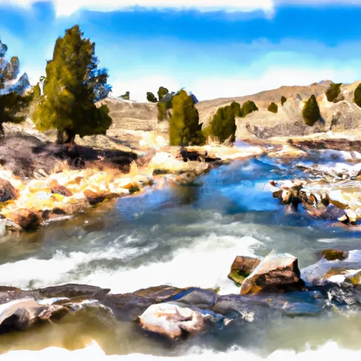
Wilderness Boundary To Confluence With East Fork Beaver Creek
The ideal streamflow range for this section of the river is between 500 and 1500 cfs. Below 500 cfs, the river may be too shallow and rocky, while above 1500 cfs, the rapids can become too challenging for less experienced paddlers.
Some notable rapids and obstacles on this section of the river include Boof Falls, Box Elder Rapids, and S-Turn Rapid. Boof Falls is a Class IV drop that requires precise navigation, while Box Elder Rapids is a technical rapid with numerous rocks and obstacles. S-Turn Rapid is a sweeping bend with multiple channels that require paddlers to carefully choose their path.
There are specific regulations to the area that visitors must adhere to. Permits are required for overnight camping in the wilderness area. All visitors are required to practice Leave No Trace principles and pack out all trash. Camping is only allowed in designated areas, and fires are not permitted.
In conclusion, the Whitewater River Run Wilderness Boundary to Confluence with East Fork Beaver Creek is a challenging and scenic river run located in Wyoming. Paddlers should be experienced and cautious, and adhere to all regulations to ensure the sustainability of the area for future generations.
Plan your run down to the hour
Same weather feed Snoflo's iOS app uses -- updated continuously from NOAA / yr.no. Watch the precipitation column on the meteogram; rain ahead of a run typically lifts flows 12-48 hours later depending on the basin.
Next 5 days, hour by hour
Temperature line with weather symbols on top, snow + rain accumulation as columns, humidity as a dotted line.
5-day forecast table
Every 3 hours, broken out across temperature, snow, rain, humidity, and wind. Each cell is colour-coded relative to the column min/max.
| Time | Condition | Temp (°F) | Snow (in) | Rain (in) | Humidity (%) | Wind (mps) | Wind dir |
|---|---|---|---|---|---|---|---|
| Loading detailed forecast… | |||||||
15-day temperature & precipitation
Daily temperatures, snow, and rain projected over the next two weeks -- the upstream story that drives next week's flows.
Regional streamflow levels
USGS streamgauges around Wilderness Boundary To Confluence With East Fork Beaver Creek -- useful for spotting upstream pulses and gauging which tributary is contributing what.
| Streamgauge | Discharge | View |
|---|---|---|
| East Fork Of Smiths Fork Near Robertson | 33 cfs | → |
| Blacks Fork Near Robertson | 92 cfs | → |
| Blacks Fork Near Millburne | 159 cfs | → |
| Uinta River Blw Powerplant Diversion Nr Neola | 191 cfs | → |
| Henrys Fork Near Manila | 35 cfs | → |
| Whiterocks River Near Whiterocks | 166 cfs | → |
Plan a longer trip
The closest boat launches, other paddle runs, and campgrounds so a day on the water can grow into a full weekend.
Whitewater safety
- Check the flow before you run
- Use the linked-gauge card and Regional Flow panel above. Class ratings change with flow -- a Class III at low water can become Class IV+ at high water.
- Know your skill ceiling
- Pick runs comfortably below your ceiling. Cold-water and big-water runs raise the consequences of any mistake.
- Wear the right gear
- Helmet, PFD, drysuit / wetsuit when water is below 60°F. Throw bag, knife, and whistle on your person, not in the boat.
- Scout, set safety, and run with a team
- Scout new rapids on foot, set safety with throw bags above the consequence pool, and run with at least one other competent paddler.
- Respect the river
- Strainers, undercuts, low-head dams, and wood can kill at any class rating. When in doubt, portage.
Set push alerts in the Snoflo app
Save Wilderness Boundary To Confluence With East Fork Beaver Creek as a favorite, set a discharge threshold (e.g. "alert me when flow hits 600 cfs"), and the iOS app pushes the moment the linked gauge crosses.
About Wilderness Boundary To Confluence With East Fork Beaver Creek
What's the optimal flow for Wilderness Boundary To Confluence With East Fork Beaver Creek?
The optimal flow depends on the section and the craft. Check the Run Details panel for the linked gauge and current status.
How fresh is the cfs reading on this page?
The linked USGS streamgauge reports continuously (every 15 minutes); Snoflo refreshes throughout the day. Hover the streamflow sparkline to read individual datapoints.
What's the whitewater class?
See the Run Details panel for the class rating Snoflo tracks for this run. Class ratings change with flow -- a Class III at low water can become Class IV in high water.
Where do I put in / take out?
Tap Directions in the hero above to open driving directions to the put-in. For shuttle planning, check the Nearby Boat Launches panel and the river run operator's site.
Can I get alerts when flows hit the optimal range?
Yes -- alerts are managed in the Snoflo iOS app. Favorite this run, set a discharge threshold, and you'll get a push the moment the gauge crosses.
Other runs near here
Snoflo-tracked paddle runs within driving distance of Wilderness Boundary To Confluence With East Fork Beaver Creek.