Magic Mountain #1 Dam

Magic Mountain #1
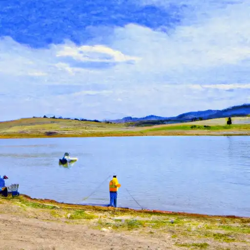
Magic Mountain #1 is a privately-owned dam located in Jefferson County, Colorado, near the city of Pleasant View. Built in 1958, this earth dam stands at a height of 51 feet and has a storage capacity of 189 acre-feet for purposes such as fire protection and stock or small fish pond management. Situated on Jackson Gulch, the dam plays a crucial role in regulating water flow and ensuring water availability in the area.
With a hydraulic height of 50 feet and a structural height of 56 feet, Magic Mountain #1 has a spillway width of 295 feet and a maximum discharge capacity of 5,372 cubic feet per second. Despite its high hazard potential, the dam is currently in satisfactory condition and undergoes regular inspections to ensure its safety and integrity. The dam has a moderate risk assessment rating and has had modifications done in 2003 to improve its hydraulic and structural components.
Managed by the Colorado Department of Water Resources, Magic Mountain #1 serves as a vital infrastructure for water resource management and environmental conservation in the region. Its strategic location on Jackson Gulch and its role in supporting various water-related activities make it a significant asset for climate and water resource enthusiasts looking to understand the crucial role dams play in maintaining water security and environmental sustainability.
Plan around the weather
Same NOAA / yr.no feed Snoflo's iOS app uses. Watch the precipitation column on the meteogram -- rain on the basin upstream typically lifts inflow 24-72 hours later.
Next 5 days, hour by hour
Temperature line with weather symbols on top, snow + rain accumulation as columns, humidity as a dotted line.
5-day forecast table
Every 3 hours, broken out across temperature, snow, rain, humidity, and wind. Each cell is colour-coded relative to the column min/max.
| Time | Condition | Temp (°F) | Snow (in) | Rain (in) | Humidity (%) | Wind (mps) | Wind dir |
|---|---|---|---|---|---|---|---|
| Loading detailed forecast… | |||||||
15-day temperature & precipitation
Daily temperatures, snow, and rain projected over the next two weeks.
Nearby streamflow gauges
USGS streamgauges around Magic Mountain #1 -- inflows here typically show up in storage 24-72 hours later.
| Streamgauge | Discharge | View |
|---|---|---|
| Clear Creek At Golden | 88 cfs | → |
| Bear Creek At Morrison | 4 cfs | → |
| Bear Creek Above Bear Creek Lake Near Morrison | 3 cfs | → |
| Bear Creek Above Evergreen | 6 cfs | → |
| Bear Creek At Mouth | 2 cfs | → |
| North Clear Creek Above Mouth Nr Blackhawk | 2 cfs | → |


About Magic Mountain #1
Where does the data for Magic Mountain #1 come from?
Structural and regulatory data come from the U.S. Army Corps of Engineers' National Inventory of Dams (NID). Weather forecast comes from NOAA / yr.no -- the same feed Snoflo's iOS app uses.
How often is the report updated?
NID structural data refreshes annually as the Corps publishes updated assessments. The weather forecast refreshes throughout the day.
What does the High hazard rating mean?
The Corps of Engineers' hazard potential classification grades probable consequences if the dam fails: High = probable loss of human life; Significant = no probable loss of human life but possible economic loss / environmental damage; Low = no probable loss of human life, only minor economic / environmental losses. See the Dam Data Reference card below for the full definitions.
What's "% of normal"?
The current storage value compared to the historical average storage on this calendar day. 100% = right on average; values above 100% mean above-normal storage (wet year); values below mean below-normal (dry year or drought).
Can I get alerts when storage crosses a threshold?
Yes -- alerts are managed in the Snoflo iOS app. Favorite this dam, set a threshold, and you'll get a push the moment conditions cross.
Dam data reference
Condition Assessment
- Satisfactory
- No existing or potential dam safety deficiencies are recognized. Acceptable performance is expected under all loading conditions (static, hydrologic, seismic) in accordance with the minimum applicable state or federal regulatory criteria or tolerable risk guidelines.
- Fair
- No existing dam safety deficiencies are recognized for normal operating conditions. Rare or extreme hydrologic and/or seismic events may result in a dam safety deficiency. Risk may be in the range to take further action.
- Poor
- A dam safety deficiency is recognized for normal operating conditions which may realistically occur. Remedial action is necessary. POOR may also be used when uncertainties exist as to critical analysis parameters which identify a potential dam safety deficiency.
- Unsatisfactory
- A dam safety deficiency is recognized that requires immediate or emergency remedial action for problem resolution.
- Not Rated
- The dam has not been inspected, is not under state or federal jurisdiction, or has been inspected but, for whatever reason, has not been rated.
Hazard Potential Classification
- High
- Dams assigned the high hazard potential classification are those where failure or mis-operation will probably cause loss of human life.
- Significant
- Dams assigned the significant hazard potential classification are those dams where failure or mis-operation results in no probable loss of human life but can cause economic loss, environmental damage, disruption of lifeline facilities, or impact other concerns. Significant hazard potential classification dams are often located in predominantly rural or agricultural areas but could be in areas with population and significant infrastructure.
- Low
- Dams assigned the low hazard potential classification are those where failure or mis-operation results in no probable loss of human life and low economic and/or environmental losses. Losses are principally limited to the owner's property.
- Undetermined
- Dams for which a downstream hazard potential has not been designated or is not provided.