Horsetooth Reservoir Reservoir Report
Last Updated: February 21, 2026
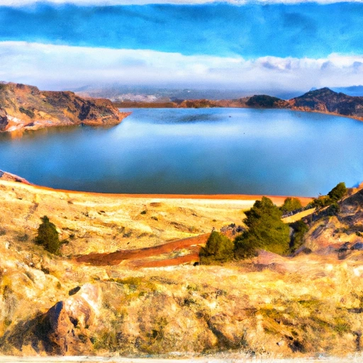
Horsetooth Reservoir is a popular recreational area in Colorado, located west of Fort Collins.
Summary
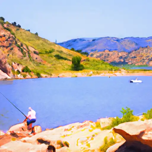
The reservoir was constructed in 1949 by the Bureau of Reclamation for irrigation purposes, and it has since become a significant source of water for the region. Horsetooth Reservoir is fed by several streams, including Spring Creek and the Cache la Poudre River, which provide the majority of the surface flow. Additionally, snowpack from the surrounding mountains contributes to the reservoir's water levels. The reservoir is used for various recreational activities, such as camping, boating, fishing, and hiking. The water is also used to irrigate agricultural land in the area, supporting the local farming industry.
°F
°F
mph
Wind
%
Humidity
15-Day Weather Outlook
Reservoir Details
| Storage 24hr Change | 0.33% |
| Percent of Normal | 130% |
| Minimum |
2,536.0 acre-ft
2001-10-06 |
| Maximum |
157,000.0 acre-ft
2004-04-09 |
| Average | 109,102 acre-ft |
| Dam_Height | 155 |
| Hydraulic_Height | 115 |
| Drainage_Area | 17 |
| Years_Modified | 2003 - Foundation, 2003 - Structural |
| Year_Completed | 1948 |
| Nid_Storage | 170370 |
| Structural_Height | 155 |
| Primary_Dam_Type | Earth |
| Foundations | Rock |
| Surface_Area | 2040 |
| River_Or_Stream | CACHE LA POUDRE TR |
| Dam_Length | 1840 |
| Hazard_Potential | High |
| Nid_Height | 155 |
Seasonal Comparison
Storage Levels
Storage Levels
Pool Elevation Levels
5-Day Hourly Forecast Detail
Nearby Streamflow Levels
Dam Data Reference
Condition Assessment
SatisfactoryNo existing or potential dam safety deficiencies are recognized. Acceptable performance is expected under all loading conditions (static, hydrologic, seismic) in accordance with the minimum applicable state or federal regulatory criteria or tolerable risk guidelines.
Fair
No existing dam safety deficiencies are recognized for normal operating conditions. Rare or extreme hydrologic and/or seismic events may result in a dam safety deficiency. Risk may be in the range to take further action. Note: Rare or extreme event is defined by the regulatory agency based on their minimum
Poor A dam safety deficiency is recognized for normal operating conditions which may realistically occur. Remedial action is necessary. POOR may also be used when uncertainties exist as to critical analysis parameters which identify a potential dam safety deficiency. Investigations and studies are necessary.
Unsatisfactory
A dam safety deficiency is recognized that requires immediate or emergency remedial action for problem resolution.
Not Rated
The dam has not been inspected, is not under state or federal jurisdiction, or has been inspected but, for whatever reason, has not been rated.
Not Available
Dams for which the condition assessment is restricted to approved government users.
Hazard Potential Classification
HighDams assigned the high hazard potential classification are those where failure or mis-operation will probably cause loss of human life.
Significant
Dams assigned the significant hazard potential classification are those dams where failure or mis-operation results in no probable loss of human life but can cause economic loss, environment damage, disruption of lifeline facilities, or impact other concerns. Significant hazard potential classification dams are often located in predominantly rural or agricultural areas but could be in areas with population and significant infrastructure.
Low
Dams assigned the low hazard potential classification are those where failure or mis-operation results in no probable loss of human life and low economic and/or environmental losses. Losses are principally limited to the owner's property.
Undetermined
Dams for which a downstream hazard potential has not been designated or is not provided.
Not Available
Dams for which the downstream hazard potential is restricted to approved government users.
Area Campgrounds
| Location | Reservations | Toilets |
|---|---|---|
 Inlet Bay - Horsetooth Reservoir
|
||
 South Bay - Horsetooth Reservoir
|
||
 Ansel Watrous Campground
|
||
 Ansel Watrous
|


 Horsetooth
 Horsetooth Reservoir
 boat ramp Larimer County
 Filter Plant
 Horsetooth Reservoir
 Ft. Collins City Park
 Sheldon Lake (City Park)
 North Shields Ponds
 Avery Pond